An Oldie Outdoors
About
No tough guy and no expert, just an ordinary oldie who likes the outdoors and randonnees pedestres.
Perversely, considering I hate heights and the cold, I’m fond of blundering up hills. Intermittently I leave unhilly Norfolk on unambitious adventures. Blogging about them, I reflect on my inability to choose reliable gear and muse on outdoor life. Nothing extreme or life-threatening. A slight emphasis on food.
Among other things, my blog documents three of my four completions of the Pennine Way, England’s oldest and best National Trail, and my adventures on the Scottish National Trail and the Hebridean Way. I’m grateful for any comments; thanks for your visit and best wishes, Andrew.
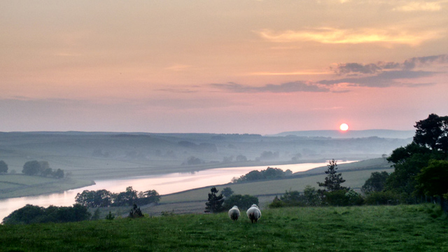
Sunrise over Blackton Reservoir from Clove Lodge, Pennine Way.
Trail Blog
Pennine Way Blog – South to North
Welcome to The Pleasant Pennine Way blog. The Perverse Pennine Way blog is also available. Either Way, I hope you’ll find these blogs useful if you’re planning a challenging but enjoyable walk along England’s oldest and best National Trail.
Click here to jump to the ‘pleasant’ itinerary, a conventional south to north nineteen day walk in late May and early June 2016. That’s pretty much the optimum time of year, although a week later would have been even better for wild flowers. This walk took in most of the standard stops and, although it had its moments, was ultimately achievable even for an oldie of moderate fitness. I based the plan on my first Pennine Way, walked back in April 1999 when I was young and blithe.
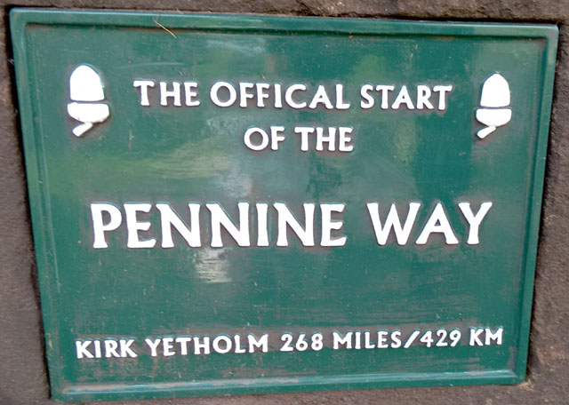
The Pennine Way, offically created before the miracle of autocorrect.
Despite longer, drier summer days, better gear and better knowledge (ha ha), I was more cautious this time, allowing nineteen days instead of 1999’s seventeen. I was older, I’d been troubled by foot and knee pain and between Gargrave and Steel Rigg I was to be accompanied. The latter was an excuse to book a few accommodations more luxurious than I’d have justified walking alone.
Complications of companionship also decreed ambitiously compressing the standard first five days into four. I wouldn’t recommend this for a first Pennine Way; many people fall by the Wayside within those early days as it is. Unless you’re already hill-fit, I’d start more slowly and speed up. I could barely speak on staggering into Gargrave.
When I did struggle (on days three, four and 18), this was caused by hurrying to reach particular places. Given the ample daylight and benign weather, I could have knocked a day or two off the walk overall by taking greater advantage of my tent to distribute the miles more evenly. I’d also suggest at least one complete, pack-off, rest day rather than a couple of short walking days, which don’t seem to have the same restorative effect. I’m assuming a tent. To me, a Pennine Way without camping is like the proverbially unpedalled pisciforme.
Many Pennine Way blogs are litanies of pain and misadventure, but this was a wonderful walk. I enjoyed it so much I did it again four months later. We didn’t get lost to any really troubling extent, but then I’d done the trail before. We didn’t fall into life-threatening bogs or freeze or have to be rescued, but then it was June. The days were light, dry-ish, cool and wonderfully long.
On the downside, the latter tempts you to do too much, hostels have to be booked and it’s virtually impossible to sleep on campsites noisy with families.
Guidebook references with page numbers are to Pennine Way – Official National Trail Guide by Damian Hall, Aurum Press (‘NTG’), although this walk was actually done using collapsible vintage copies of the previous two-volume NTG by Tony Hopkins*. References to Wainwright are to his Pennine Way Companion. Simon Armitage references are to Walking Home – Travels with a Troubadour on the Pennine Way, Faber, 2012. Grid references are OSGB, estimated by eye from the NTG maps or in some cases noted while on The Way from the free smartphone app OS Locate. In all cases they’re approximate and subject to error, as are any bearings.
Don’t rely on this blog for ‘live’ navigation on The Way. Things change, I make mistakes, I’m no expert. This blog is for entertainment, it describes the Pennine Way as it was in June 2016 and won’t be updated. This trail involves rough hillwalking often in challenging weather. Even for the suitably experienced and equipped, it can be hazardous.
*I’ve since been converted to the A to Z guides which are light and ideal – just the OS maps bound together with no extra weight of pointless persiflage.
Here’s the bare bones itinerary, with links to the blogs. Distances and elevations are estimated on Google Mapometer, rounded them to the nearest 1 km, 1 mile, 10 m and 10 feet. Hence they don’t convert consistently, like recipes. They’re just a rough indication for basic planning.
edale pennine way peak district derbyshire england tent campsite
Upper Booth
Pre-day: May 27th
Travel by train to Edale, arrive late afternoon.
Camped at Upper Booth farm campsite (booking essential).
Day 1: May 28th
bleaklow cairn peak district derbyshire pennine way hiking trekking hillwalking
Bleaklow
25 km, + 680 m, – 750 m. 16 miles, + 2240 ft, – 2460 ft.
Upper Booth to Crowden via Kinder Downfall and Bleaklow. Camped at Crowden campsite.
Day 2: May 29th
laddow rocks peak district derbyshire pennine way hike hillwalking wild camp rock climbing
Laddow Rocks
33 km, + 910 m, – 750 m. 21 miles, + 2980 ft, – 2460 ft.
Crowden to Light Hazzles Edge, via Black Hill and The White House Inn.
Wild camped at Light Hazzles.
Day 3: May 30th.
hebden bridge pennine way yorkshire moorland hike trek
King Common
29 km, + 670 m, – 830 m, 17 miles, + 2180 ft, – 2710 ft.
Light Hazzles to Ponden, via Stoodley Pike, May’s Shop and Top Withins.
Camped at Ponden Mill campsite.
Day 4: May 31st
yorkshire pennine way moorland hiking trekking trail long distance england
Ickornshaw Moor
28 km, + 730 m, – 840 m. 17 miles, + 2410 ft, – 2760 ft.
Ponden to Gargrave, via The Hare and Hounds at Lothersdale.
Bed and Beakfast at The Masons’ Arms, Gargrave (pre-booked).
Day 5: June 1st
yorkshire dales camping campsite pennine way england limestone karst tent
Malham Beck
11 km, + 210 m, – 120 m. 7 miles, + 680 ft, – 390 ft.
Gargrave to Malham, an easy recovery day.
Camped at Town Head Farm campsite on Malham Beck.
Day 6: June 2nd
limestone karst landscape yorkshire dales pennine way england
Malham
24 km, + 830 m, – 800 m. 15 miles, + 2710 ft, – 2610 ft.
Malham to Horton in Ribblesdale via Fountains Fell and Penyghent.
Bunkhouse at The Golden Lion (pre-booked).
Day 7: June 3rd
yorkshire dales horton ribblesdale pennine way england trail long distance walk
Cam High Road
22 km, + 450 m, – 450 m. 14 miles, +1480 ft, -1480 ft.
Horton to Hawes via the Cam High Road.
Bed and Breakfast at The Old Board Inn (pre-booked).
Day 8: June 4th
yorkshire wensleydales hawes pennine way england summit long distance trail
Great Shunner Fell
20 km, + 710 m, – 620 m. 13 miles, + 2320 ft, – 2050 ft.
Hawes to Keld, via Great Shunner Fell and Thwaite.
Camped at Swaledale Yurts (pre-booked).
Day 9: June 5th
yorkshire highest pub england dales bikers hiking real ale
Tan Hill
June 5th. Keld to Tan Hill.
7 km, + 280 m, – 80m. 4 miles, + 930 ft, – 270 ft.
Camped at Tan Hill Inn (no booking). Another easy recovery day.
Day 10: June 6th
county durham limestone karst england pennine way walkers hikers
God’s Bridge
16 km, +200 m, – 400 m. 10 miles, + 650 ft, – 1310 ft.
Tan Hill to Clove Lodge, via Sleightholme Moor and God’s Bridge.
Bunk Barn at Clove Lodge (pre-booked, check availability).
Day 11: June 7th
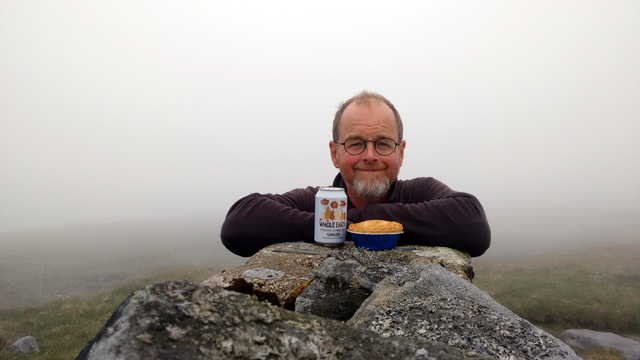
baldersdale-pennine-way-sunrise-blackton
Baldersdale
25 km, + 540 m, – 470 m. 16 miles, + 1750 ft, – 1550 ft.
Clove Lodge to Langdon Beck, via Middleton in Teesdale.
Hostel at Langdon Beck (YHA, pre-booked).
Day 12: June 8th
teesdale county durham england waterfall cow green pennine way
Cauldron Snout
20 km, + 380 m, – 580 m. 13 miles, + 1230 ft, – 1900 ft.
Langdon Beck to Dufton via Cauldron Snout and High Cup.
Hostel at Dufton (YHA, pre-booked).
Day 13: June 9th
cumbria summit pennines highest point pennine way cairn trig
Cross Fell
25 km, + 940 m, – 770 m. 15 miles, + 3080 ft, – 2520 ft.
Dufton to Garrigill, via Cross Fell.
Camped at Garrigill Village Hall (normally no need to book).
Day 14: June 10th
northumberland pennine way england burn long distance walk national trail
Gilderdale
20 km, + 260 m, – 400 m. 12 miles, + 850 ft, – 1300 ft.
Garrigill to Knarsdale, via Alston.
Camped at Stone Hall Farm campsite, Knarsdale (normally no need to book).
Day 15: June 11th
northumberland england pennine way roman fort picts border national trail
Hadrian’s Wall
28 km, + 620m, – 610 m.17 miles, + 2040 ft, – 2000 ft.
Knarsdale to Once Brewed, via Greenhead and Hadrian’s Wall.
Bed and Breakfast at Vallum Lodge (pre-booked).
Day 16: June 12th
northumberland kielder pennine way national trail england hike walk
Wark Forest
25 km, + 430 m, – 530 m. 15 miles, + 1420 ft, – 1750 ft.
Once Brewed to Bellingham, via Rapishaw Gap, Wark Forest and Horneystead.
Bunk Barn at Demesne Farm (pre-booked).
Day 17: June 13th
pennine way northumberland england long distance national trail moorland peat
Whitley Pike
25 km, + 580 m, – 470 m. 15 miles, + 1890 ft, – 1540 ft.
Bellingham to Byrness, via Whitley Pike and Redesdale Forest.
Bunkhouse at the Forest View Inn, Byrness (pre-booked).
Day 18: June 14th
northumberland kielder pennine way cheviot forest view byrness hillwalking trekking
Redesdale
33 km, + 1160 m, – 790 m. 20 miles, + 3800 ft, – 2600 ft.
Byrness to The Schil, via Windy Gyle and Auchope Cairn.
Wild camped on The Schil.
Day 19: June 15th
pennine way schil scotland borders cheviot camping hiking hillwalking coleman aravis tent trek trekking
The Schil
9 km, + 180 m, – 650 m. 5 miles, + 600 ft, – 2130 ft.
The Schil to Kirk Yetholm (high option).
Hostel at Kirk Yetholm (Friends of Nature, pre-booked).
Post-day: June 16th
river tweed england scotland border railway bridge
Berwick
Buses from Kirk Yetholm to Berwick on Tweed, via Kelso.
Hostel at Berwick (YHA, pre-booked). Train home on the 17th.
General Pennine Way Tips
As well as time of year, type of accommodation and a rough schedule, one of the most important decisions is choice of footwear. Our number one problem was sore feet. I was pretty much unblistered as my boots were worn in and I was proactive and pre-emptive with the Compeed. I ‘merely’ suffered unpleasant toe and metatarsal pain on descents, inexplicable instep bruising (only on my left foot) and eventually unattractive, itchy foot rot. My companion unfortunately did encounter the Wayfarers’ number one curse of blisters and, like so many, was unable to complete her planned walk because of them. We both wore mid-weight, upper-mid-price leather boots.
That decision was based on my 1999 experience walking The Way in suede, fabric and Goretex hybrid boots, Karrimor KSBs. I still recall those boots with loathing. They were comfortable, but they leaked like sieves from around day eight. Barely-thawed bog water constantly trickled into them, even with gaiters, Nikwax was no help and from Hawes northwards my feet were permanently soaked and freezing (I also acquired frostbitten ears – The Way in April can be quite hardcore if you’ve no idea what you’re doing). I thought leather boots would be better, but in fact this time my Goretex lined Scarpa Rangers behaved identically! From around day eight they too leaked, rendering their weight and bulk pointless.
After completing this Pennine Way I subsequently walked the entire trail a third time, in October 2016. I walked it nimbly and lightly, with no foot pain, rot or blisters. How? By finally heeding advice I’d heard often from wiser walkers. Ditch the heavy, soggy boots and walk in trail shoes. For three season fellwalking in the largely unpointy Pennines, for me personally it’s now that simple.
Guess what: my Goretex lined trail shoes leaked too, and from around day eight! It seems no Goretex footwear can remain waterproof for more than a week or so on the Pennine Way. But, being light and minimally structured, they dried quickly too.
One more thing on footwear – I routinely ditch all insoles, however fancy, and replace them with Sorbothane Double Strikes. In my opinion the three essentials of long distance walking are Sorbothane insoles, Compeed and trekking poles. These are all to do with saving your feet and knees, which will then drag the rest of you with them, along – The Pleasant Pennine Way…
PENNINE WAY BLOG 3 – DAYS 1 – 3.
The Purposeless Pennine Way, in which I set out purposefully and happily to complete my favourite trail, while disclaiming purpose and anticipating pain.
You may have seen the BBC programmes ‘celebrating’ the fiftieth anniversary of the Pennine Way. To me they were a travesty. An opportunity for some immortal ‘slow TV’ squandered in favour of a catalogue of breathless ‘adventures’. Most of these were nothing to do with walking the trail and communicated nothing authentic about the experience of doing so. Just more box ticking, more shopping for ready-made thrills, as if we don’t all need a break from stereotyped consumption.
The tone was set at the start of every episode, a bushy-tailed adventurer bragging his credentials – he’d been abroad (whoo!), he’d explored (double-whoo!), but now here he was slumming it on a mere path in boring old England, trying to work out why some fools in tweeds fifty years ago thought that walking 270 miles might be fun. His conclusion – it wasn’t enough fun. It was necessary instead to go rock climbing and white water kayaking. This made me cross.
The only bit I liked was when they showed an endearing soul who peacefully, harmlessly and all by himself walks The Way every year. An ordinary-looking chap with ordinary-looking gear, trudging along through what looked like Ribblesdale. The inevitable question: ‘So, why do you walk the Pennine Way every year?’
I jumped up from the sofa. ‘Mate!’, I cried, ‘No! Don’t justify! Don’t rationalise! Just shrug aimlessly! Say you do it just because of nothing, so there!’
I reckon he’d had his arm twisted by some vivacious production assistant, who from my own experience of TV work probably wasted three days of his life for thirty seconds’ screen time. He mumbled about his ‘fitness regime’. ‘I walk it every spring, then I’m fit for the rest of the year’. Not being unkind, he didn’t look like a fitness fanatic to me. Underwhelmed, the presenter bounded off to the car that would drive him to his next off-the-peg ‘adventure’.
I resolved immediately, then and there, that I would walk the Pennine Way again soon, simply, quietly and for no reason whatsoever. I looked online at cheap train tickets. Darn it, there was one available, very cheap. I bought it. And so, ladies, gentlemen and sheep, we present the Purposeless Pennine Way. OK, mostly sheep.
Day One – Edale to Kinder Low.
I leapt enthusiastically off the train at Edale. Well, alright, not exactly leapt. It was a quarter to three and so I started the way I meant to go on, with a nice cup of tea and a sit down in the excellent Coopers Café which, as you might hope given the location, is walker-friendly, filling your water bottle and selling takeaway cakes and sandwiches. You can camp here too, and they do breakfast.

Coopers Café, very nice too.
The sky was clear and sunny as I bounded up Jacob’s Ladder. Well, alright, not exactly bounded, but I was certainly buoyed upwards by excitement and glad anticipation.I also felt a remarkable sense of liberation and independence, not least I think because I was carrying no map and no guide book – I knew the way. Famous last words – a good job it was clear and sunny1. All the familiar landmarks of the Kinder massif were laid out before me, like balls on a giant pool table. It was wonderful.

The Pennine Way cairn on Kinder Low.
There was a chilly breeze on the top so I pitched my flysheet in tarp mode and in a dip that would normally have been a sopping quagmire but after this year’s remarkable drought was only slightly damp. I have never, ever seen these moors so dry, it was astonishing. If Wainwright had walked the Pennine Way in these exceptional conditions he’d have loved it a little more, perhaps.

Bone dry peat – unheard of!

Kinder Low wild camp. Sleeping up there is not officially encouraged so it’s especially vital to be discrete and leave absolutely no trace.
I had the entire summit to myself. The usual noisy aeroplanes glittered overhead in the low sun, the wind grew much colder; I had wear all my layers which was a bit of a worry on only the first evening. As I was finishing my sandwich and date slice (from Coopers) in the shelter of the tent, an unearthly sound suddenly drifted down to me, a kind of wailing and chanting; I’d never heard the like. I poked my head up out of my damp dip, it was coming from a group of people gathered around (and even upon) the triangulation point.
Kashmiri Muslims from Sheffield, they were singing praise songs to the Prophet on the summit, apparently this is quite the thing to do in Kashmir, albeit rather higher up. I went over to investigate, they were very friendly and invited me to join in. The kids wanted to tell me about their climbs of Ben Nevis and Snowdon; Dad preferred them to carry on chanting, the purpose of their ascents. It was God’s purpose that I should meet them up there, I was firmly informed. I apologised for my lack of Arabic and listened, intrigued, slightly embarrassed at my own lack of purpose but at the same time defiantly rather proud of it.
Sunset from Kinder Low – not a classic but good enough.
I did have an incidental agenda on this hike, if not an overriding purpose. Directly on the Pennine Way there are seven summits over two thousand feet. Kinder Low (2078), Bleaklow (2077), Fountains Fell (2192), Pen-y-Ghent (2277), Great Shunner Fell (2349), Cross Fell (2930) and Windy Gyle (2031). On three of these magnificent seven summits I had not yet camped out; Kinder Low was the first of those modestly extreme sleeps to purposefully be ticked off on this walk.
Knock, Great and Little Dun Fells are also over 2000′ but in my book they’re part of Cross Fell. Sleep on Great Dun and you’ll be irradiated by the radar station. I consider Cairn Hill and Auchope Cairn outliers of the actual Cheviot (2676), which is optional and who wants to sleep in a flat peat bog completely exposed to Scottish gales? Unless you’re actually in Scotland, of course, where that kind of fun is compulsory.
Day Two – Kinder Low to a plastic bag in some random midge-infested bog on Marsden Moor.
Yes, I still knew how to have fun, not least by getting out of bed at four am, after a rather parky night. Wandering around Kinder Low by moonlight, all alone, was also fun although perhaps not the kind of fun to tell the safety officer about.

Kinder Low triangulation point, four in the morning.
The sun rose as I ambled along to Kinder Downfall, one of my favourite places in the world for breakfast.

Breakfast at Kinder Downfall


To be honest, the downfall was more like the dryfall.
There was nobody about, and very little traffic on the A57 although what little there was I could clearly hear from Mill Hill through the still morning air.

Posing weirdly at Mill Hill cairn
Nobody on Bleaklow either, bar a solitary mountain rescuer running a few tens of miles to keep fit and a chap posing weirdly on the distant skyline. Don’t ask me, some kind of Tai Chi perhaps.

Unusually, all alone on Bleaklow

Pretty funky sky…
On Peaknaze Moor they were shooting and as I mistakenly took the peaty track away from Clough Edge, rather than the rocky track along the edge (a bad mistake in normal conditions but not too disastrous when it was all so dry), I nearly got mixed up in their bangy old business.

Tiny vintage waymarker on the trail above John Track Well, probably from 1965!
The whole experience was already so different in both character and detail from my last visit to Bleaklow that at John Track Well I suddenly felt a sense of purpose. The rivers were so low I could paddle; last time I’d nearly drowned leaping desperately across a foaming maelstrom. On this my fourth visit, the Pennine Way was already a changed place, showing me new things, exciting novel feelings.
Just uphill from the river I found a tiny vintage waymarker, crudely inscribed into a rock, partially hidden; I had to remove soil and moss to see it. This was the fourth time I’d walked past it but only now had I seen it, even though it had probably been there for fifty years. At the reservoir, brand new signs made finding the way down to the dam easier, not that I needed help now on my fourth attempt.
Perhaps my purpose was finally to walk The Way with the time and headspace to see change, rather than in a quotidian struggle merely to navigate the present. Walking the history, the heritage and the ongoing renewal of this remarkable trail rather than simply its distance, its obstacles. Not only looking, for the route, for the campsite, for the pub, but actually seeing.
Then I remembered I wasn’t supposed to have a purpose.

Well, exactly…

New signs, new directions, instructions, constant change.

Never thought I’d see Crowden Reservoir this low
Above Laddow Rocks I met a woman intrigued by my footwear. I can never understand why so many people think walking in the hills requires such different footwear from running in them. Dog walkers on Black Hill gave me the bad news that the snack van on the A635 had been absent for a while. Progress was so fast in the dry, sunny conditions I was up there by early afternoon; I’d thought about camping on the summit but was out of water, I stupidly forgot to top my bottle up from Crowden Great Brook and there’s nothing on the top of Black Hill but foetid swamps.

On Black Hill with my own personal wildlife guide. Not really, he was busy enumerating radio masts.

‘I see the trig point has sagged a bit more’ I said to the chap with binoculars. Surprisingly for a mast aficionado, he hadn’t noticed it wasn’t straight.
For this reason alone, I would have needed to continue but it was so pleasant and I had so much surplus energy I actually jogged most of the way down to Dean Clough. Where a dead sheep had recently been dragged from the stream. Oh well, at least it wasn’t still actually in the water.

Oh dear, I’m out of water. Still, so is the dead sheep.
At Wessenden Head a beautiful Short-eared Owl was quartering the rough meadows, I pointed it out to a young couple heading down to the reservoir and they kindly took an interest, the lad asking me ‘what does it eat?’ ‘Mostly voles’ I replied. Pause. ‘What’s voles?’ By the time I got down to the lodge I was tired and really wanted to camp somewhere, but the lower I descended the more midges appeared. I was so thirsty I eventually stopped at the bridge to brew some soup from river water. Clouds of midges latched onto me, they rapidly became maddening. I couldn’t bear to discard my irreplaceable soup, but it was still too hot to drink.
Throwing everything but the actual soup back in my pack, I slithered up one of the steepest little climbs on the entire Pennine Way with my two poles in my left hand and in my right hand a slopping titanium mug of Ainsley Harriott wild mushroom soup. The midges followed me, lured no doubt by Ainsley’s authentic mycological pheromones. Only at the Blakeley Clough tank was I left in sufficient peace to salvage the lukewarm dregs of Harriott’s fungal finest.

Finally enjoying my soup at the mysterious tank.
By now I was so tired I could have just flung myself into a swamp like Ophelia, my rucksack ‘pulling me from my melodious lay to muddy death’ (© W. Shakespeare). The moor was far too tussocky for the tent so I was forced to break out the bivy bag, brought with me for one of my three summit sleep-outs.
No photos exist of this camp, it was too awful. I lay in a random bog, midges descended once more but I had a piece of silk to cover my face; I fell asleep before sundown. In the morning I discovered that had I walked for another twenty minutes, I could have camped properly. At a pub.
Some will tell you the purpose of walking a trail is to have fun, or at least engender future fun after the event and perhaps also in others, through recollection. I expect we all know the three types of outdoor fun. Type One Fun is actually fun, and fun to remember. Type Two Fun is horrible at the time, but then becomes fun to remember. Type Three Fun is just horrible, and for ever.
Sometimes I fear I’m seeking out Type Two Fun for the sake of a tale to tell. Is my life really so dull that I must purposefully make it less enjoyable in order to make it more interesting? Then again, isn’t this the inevitable resort of any autobiographical writer? Ultimately, can Type One Fun ever be truly memorable? In which case, why do we allow ourselves to be constantly seduced into shopping for it?
Proust was big on this stuff. According to Alain de Botton he suggested “we become properly inquisitive only when distressed. We suffer, therefore we think”2. Wisdom acquired painfully through one’s own life is, according to Proust, far superior to that acquired painlessly from a teacher, including perhaps a professional Outdoor Activities Instructor with helmet, harness and risk assessment. Was acquiring a healthy dose of thought-provoking and memorable pain, solitary, unprofessional and free of charge, actually my Pennine Way purpose?
Day Three – Marsden Moor to May’s Shop.
It was no hardship to rise before the sun on Marsden Moor, because my appalling bivy bag was sopping wet inside with condensation. There must be something wrong with that thing, unless I’m just using it inside-out.

Sunrise over Marsden Moor
I squelched out of my plastic pouch like an unpleasantly mature pickle and ambled damply around the reservoirs in the dawn light. Their clear water was infinitely preferable for morning coffee to the Dean Clough sheep juice, which I happily discarded.

Would you believe that building is a pub at which I could have camped?

At Millstone Edge I thought someone had very kindly left a sack of muesli for passing hikers…

Drat, not muesli…
Blackstone Edge is one of my favourite Pennine Way locations; not only a lovely spot in itself, it means one has passed over and left behind the horrid M62. It also means the White House pub is near.

The horrid M62

Blackstone Edge in warm sunshine

The first time I’ve had any spare energy to inspect the Aiggin Stone – another example of walking the PW with a different kind of purpose

Ditto the Roman Road which is actually rather interesting
Both the Edge and the pub are also in Lancashire, hence it was necessary for me to wait an hour outside for the latter to open at midday so I could have black pudding for lunch in my ancestral county. Outside I met a fit looking man who said ‘I’ve always wanted to walk the Pennine Way but my wife won’t let me. She says I’m too old’.
‘Outrageous’, I replied, ‘how old are you?’ I thought he was about my age. ‘Seventy-eight’. ‘Ah. She may have a point. You could do it in sections…’ He seemed pleased with this idea and continued with the ten miles he was walking to Todmorden. Before lunch.
The pub was great as ever but I had to crack on as I knew with the steep climbs up from the Calder it would be a haul to get to May’s before she closed.

Looking back to the White House

Vintage reservoir architecture
On the way to Stoodley Pike I came upon a strange leather harness and some chains, lying on a rock by the trail. It looked like a waymarker for an S&M hiking club, or perhaps a bit of bondage-themed geocaching.

Cyril’s Seat, yet another favourite spot
At the pike a man with several misbehaving dogs enquired whether I’d seen their leads anywhere. ‘Ah…’

That Stoodley monstrosity
In Callis Wood I was nearly run over my a mountain biker descending at insane speed. By the canal, the alternative types who live there in vans and boats were already sipping wine and smoking whatever they smoke on garden chairs in the warm sunshine. I do sometimes wonder how and indeed for what purpose I’ve organised my own life so incompetently.
The Calder valley and its northern slopes have been completely taken over by Himalayan Balsam, it’s in every garden and all along the trail up the hill; I believe I may have predicted this in a blog two years ago #toldyouso.

The lovely ancient bridge at Hebble Hole had collapsed, and would you believe that according to a notice taped onto it the council has to apply, to itself, for listed building consent to repair it? A temporary scaffolding bridge was thankfully in place.The steps up from Colden Water had been very nicely repaired by the same council. It was a relief to reach May’s as I’d had a poor night. Her son asked if I had any washing to go in the machine, her daughter made me a mug of tea and sold me supper. It was like coming home, apart from the small sum of money changing hands and even that was painless as now – ta daaa – amazing news – May takes cards! Hence I spent a significant sum on essential stocks, for the purposeless privations lying ahead.
In the morning May gave me a free cake, for having already walked the Way three times, and we chatted about the BBC programmes. ‘That chap never walked the Pennine Way’, she laughed, ‘he just drove up here in a car. I said to him “you look exhausted” ’. She too isn’t walking very far these days, but she seems determined to keep running her small but miraculous retail empire, and purposefully to boot.
I should have asked her what the purpose of her shop is. Successful businesses surely always have objectives and mission statements, although I’m not completely convinced the latter have reached High Gate Farm Shop. It’s hard to imagine how something could purposelessly become so perfect, other than by evolving via natural selection over eons of course. Perhaps May’s is a kind of retail living fossil, slowly permineralising under its stone roof slabs, like an Archaeshopteryx. It’ll certainly be a missing link for the Pennine Way if May retires.
PENNINE WAY BLOG 3 – DAYS 4 – 6
Back to more typical Pennine Way conditions!
I’ve no idea why I decided once more to walk the Pennine Way. Reaction to the announcement was muted: ‘I hope you’re not going to start obsessing about rucksacks again’. Factually harsh – of all the men you’ll meet on a trail I am the least obsessive about gear; my rucksack was a lucky second-hand find on eBay. But fair in spirit, I suppose, from someone heading out into the rain to dig potatoes, by herself.
I was going to call this account The Pointless Pennine Way, but that seemed, although factually fair, harsh in spirit. ‘Point’ is more negative. “What’s the point of all this?” implies that there’s no point, whereas “what’s the purpose of all this?” very much implies that there is a purpose, though possibly hidden.
I had triggers: the TV programme and the cheap train. I had tactical targets: the three summits on which I’d not slept. I had a hankering for hills: living among the subtle topography of Norfolk I miss elevation. I had timing: I first walked the Pennine Way in 1999 a few weeks before I turned forty, I liked the temporal elegance of repeating it just before I turn sixty. We’ll see whether I again repeat it just before I turn eighty!

Cross Fell, April 1999. Photo by Ronald Turnbull.
Otherwise, I was determined not any impose expectations on this modest exploit. It would be just for fun, and whichever type of fun came along. The facts of the trail might be harsh – I’ve never yet walked the Pennine Way without almost blubbing at some point – but my spirit would be set fair and fancy-free. Clearly it would have outcomes on multiple levels but I felt that to identify and anticipate these in advance might constrain their potential. A useful excuse as I’m temperamentally averse to planning of any kind.
I decided to blunder up The Pennine Way as blindly as might be consistent with actual survival, making no itinerary and booking absolutely nothing, expecting only sore feet and sheep. As it turned out my feet were fine, so even that expectation was confounded. There were sheep.

World-class breakfast at May’s Shop
Day Four – May’s Shop to Pinhaw Beacon
They’d put the flags out for me on Clough Head Hill and as I was already feeling celebratory after a world-class breakfast of tea and sticky ginger parkin at May’s I tried to interpret them benignly as a gift. I graciously accepted their high-vis plastic intrusion into what’s otherwise, after a long interlude of farmland, a welcome return to some enjoyably bleak moors.

Strange plastic flags all along the trail, goodness knows why.
I was further cheered by recalling how in April 1999 I’d trudged through bitterly cold slush up here, my feet freezing in my leaky boots. That really was grim old-school fellwalking, this now was a dry, sunny morning stroll. The only fly in the ointment was that it was far too early for the Packhorse Inn to be open.
The Walshaw Dean reservoirs were extraordinarily low. ‘I’ve Seen ’em lower’, said a dog walker, ‘and this is when they drag out the stolen cars. And the bodies.’ It was very peaceful and with the rhythm of the easy walking I fell into a world of my own. I jumped out of my skin when a runner suddenly came charging down Lower Fold Hill. He then bagged a comedy double- double-take when on turning around and running back up, he hilariously made me jump again.

Ugly signage has returned to Top Withins, let’s hope it falls apart soon. At least it’s informative this time, not just ‘health and safety’.
Even Top Withins had only a handful of visitors, although I could see from the path ahead that there’d be at least a dozen people there by ten o’clock.

The very useful bad weather shelter at Top Withins was once more accessible.

…although it’s a bit draughty. One of those signs would fit this hole perfectly…
The lovely house at Upper Heights was for sale; if only I’d had £650,000, I could have bought it and re-opened the former much-loved campsite.
The vistas were broad, the air was still, the temperature benign; nothing happened to me at all, other than on the way up Old Bess Hill I picked up a revoltingly perfumed sweatshirt which I waved like a knight’s banner on my pole at a group of teenagers ahead. They all denied it belonged to them, although I suspect one of their number was secretly embarrassed at a terrible fragrance selection error in a cheap chemist. It’s probably still up there now, making sheep sneeze.

Old-school waymarking, with the new minimal marker post on the skyline (right).
The trend for minimalism and decluttering has reached Ickornshaw Moor where the motley cluster of sticks that used to decorate the rather subtle ‘summit’ has been simplified down to a single, slim pole. I should think this is much less visible in fog.
The newly-minimalised summit marker on Ickornshaw Moor
I was delighted for the first time ever to find one of the huts open and a denizen in residence; he told me all about them. The inherited rights exercised by the ‘freeholders’ who own these huts include rough Grouse shooting but by common agreement no birds had been taken this year as their productivity in the dry summer had been so poor.
Later in the pub I was told that no Ickornshaw Grouse are eaten locally as they’re much too valuable. For the price of one sustainable free-range wild Grouse harvested within sight of your house you can buy several bags of imported, frozen battery chicken, all the chips and a six-pack or three to wash it down.
At Low Stubbing I met more shooters in camouflage, carrying in lieu of a Grouse the largest wild mushroom I’d ever seen, “great for breakfast”. They confirmed a disturbing rumour my trail antennae had already picked up, that there was no food at the refurbished Hare and Hounds. On arrival I tried really hard not to argue with the new landlord about this. He was very friendly, his ale was excellent and more to the point I was dependent on him for the crisps and ‘spicy bar bits’ that were the only nutrition on sale.
It was baffling to me as a former owner of a rural hospitality business to see that they’d spent a fortune revamping the cosmetic appearance of the place to no visible commercial benefit while sabotaging a previously functional kitchen that could have been printing them money. When I acquired a run-down café on a country walking trail I sold chunky hand-cut sandwiches from day one even though the lights hung off the wall and the roof leaked, they were easy to make and I had bills to pay. The pub has since started doing food again, it sounds great and I wish them all success.

Camped on Pinhaw Beacon above the duck pools. These were noisily infested with foolish ducks that clearly hadn’t twigged their sinister purpose.
Distressed at Lothersdale’s formerly famous suet puds having been condemned to the dustbin of hospitality evolution, I trudged up Pinhaw Beacon in unusually low spirits. These were lifted by my discovery of an excellent camping nook near the summit, overlooking the duck pools.
I failed to realise that sleeping here would involve quacking ducks, both at dusk and before dawn. Lots of quacking ducks. Also midges – it was time to retreat into my allegedly midge-proof tent, albeit with confidence as it was sold to me as such by a Scotsman. If there’s a people on this planet that should know about midge-proofing it’s that noble race of mossie-fodder.
The lack of food at the pub meant I had to resort to Supernoodles, enhanced by more of Ainsley’s mushroom gloop and an extra packet of crisps that, due to unfamiliarity with his expensive computerised ’till’ (sorry, electronic point of sale system) the new landlord had been forced to give me as change.

Camp food at its finest.
Day Five – Pinhaw Beacon to Malham

Dawn from Pinhaw Beacon
I awoke feeling uncharacteristically gloomy. I was lonely and cold and could not for the life of me work out why I’d chosen to do this walk again when I could be at home with my loved one. I was pushing sixty and getting stiff in the mornings, my silly old eyes could hardly see in the poor light of a wild camping dawn. All in all, was long distance walking still really, sensibly, my thing?

A bit teasy on the Beacon.
Also dampening my spirits was the imminent walk through Cravendale, where the dairy farming is historically intensive and the ecology is commensurately tragic.

Intensively fertilised rye grass, shaved almost to bare soil at least twice a year. Where’s a Lapwing or Curlew to even hide, let alone nest, in this?

The haylage, which is seedless so unlike a traditional hay meadow provides zero bird food, is left after cutting to dry a little. It’s then raked up and baled in plastic by huge and terrifying machines. Yes, the system depends on plastic.
There’s nothing like a slap-up breakfast in The Dalesman at Gargrave to cheer me up, so I duly had one, even though I had to wait forty minutes for it to open at ten on a Sunday morning.
A sweet little old lady at the next table was visiting her son’s farm. Chatting, she told me she herself had recently starting growing ‘a few of those little carrots’. Envisioning her pottering around a cottage garden, Yorkie at her heels, I said “oh yes, farmers grow those in Norfolk”. “I grow some of mine down there”, she said, amiably, “this year in Norfolk I rented about six thousand acres”. I watched her totter across the road and lower herself with some difficulty into a racy Mercedes coupé.

The old PW sign outside The Dalesman
The walk from Gargrave to Malham is a doddle and along the river it’s even rather a treat in fine weather.

Pretty Airedale.

Aire Head, where the river springs mysteriously from the ground.

If you photographed all the vintage signs on the Pennine Way it would take you a year to walk it.

Approaching Malham
It was a fine Sunday afternoon so Malham was absolutely jam-packed, rammed and chock-a-block with people, the vast array of cars on the parking field gleaming in the sunshine for miles. After a restorative tea and curd cake at The Old Barn I walked through wave after wave of tourists returning from the cove to the campsite where, sentimentally, I pitched my tent in exactly the same place my partner and I had camped two years ago. Making exactly the same mistake of pitching by a damp, midgy river that I swore two years ago I wouldn’t make next time. There are drier, airier pitches at the top of the site.
The Lister Arms was so busy I tried the Buck Arms instead and ended up preferring it, less pretentious, less claustrophobic. I ordered a trio of sausages, imagining for some reason they would be wheeled in playing small musical instruments. All three were exceptionally delicious. The campsite was quiet, the shower was hot, my socks dried somewhat in the breeze. I felt a little happier.
I’m concerned at how a blog imposes purpose on every trail I walk. This time I very much wanted the trail to wag the blog, not the blog wag the trail. I was almost tempted to let the entire exploit sink unreported into the river of time, discarding my Facebook ‘virtual postcards’ to family and friends as if they were a sand mandala. What kind of boring, purposeless fool blogs about the same trail three times?
Munching my triyumyumyumvirate of sausages in the Buck Arms, I realised that this third-time-lucky repetition could perhaps serve my purpose as a ‘proper writer’. I’ve dutifully produced two practical Pennine Way blogs. Now, back on the same trail but with that job done, I was liberated from having to take accurate notes and free to think whatever crazy thoughts I chose. Also to invent crazy words.
How this might enable my trail writing to evolve I wasn’t sure, but at least this time my lame, clunky flights of fancy could crash and burn into the peat. I didn’t need to pick them out and polish them, because I might not even bother to write them down. Perhaps jettisoning the lifebelt of purpose would leave me floundering along the trail on a sinking ship of interesting whimsical introspection. A trail without a purpose is like a sausage trio con brio, like an armless buck, that kind of thing. Writing proper’s great.
Day Six – Malham to Horton in Ribblesdale
This day started nicely, I’d slept well, the weather was dry. At the top of the cove, though, there was a very noisy group of people, locked in endless complicated loud discussions that had nothing to do with their present location, and at seven in the morning. Ah well, at least I had a squashed sandwich from Gargrave Co-Op for breakfast.

Squashed sandwich brekkie above Malham Cove. Still dry at this point!

The incredible mammoth molars of the limestone pavement

I thought all the famous flowers at Malham Tarn would be long over but I’d failed to anticipate a gorgeous display of Grass of Parnassus.

Grass of Parnassus Parnassia palustris
It was clouding over, and as I rounded the back of the Field Centre it started to rain.

Clouding over, oo-er…
I was walking in t-shirt and shorts. As I ascended Fountains Fell I chose to simply pull my waterproofs on over these as the rain became steady. This was a mistake. By the top cairn, things were quite unpleasant.
I was dismayed. The plan had been to camp out on Pen-y-ghent, the next of my two unslept summits. I’d imagined a pleasant afternoon fossicking around up there, a little light exploring, a leisurely Supernoodle supper. Now I’d be up there by two in the afternoon and the rain was teeming down with no sign of stopping. What on earth would I do up there for sixteen hours in pouring rain?
penyghent-view-pennine-way-yorkshire
Views of Pen-y-ghent were not extensive…
No photos exist of this ascent of Pen-y-ghent. The rain hammered down, my phone would have been ruined in seconds. I clambered up the steep bit, which resembled a vertical stream, following a northern lad of asian heritage wearing football shorts and the kind of black anorak you see on market stalls, unzipped. “I think I might buy some waterproofs”, he said on the top, still with his hood down, “I quite like this hillwalking”. His enviably dark and thick hair was stiffened with one of those products young people spend fortunes on; each spikelet was crowned with a globule of water, he looked as if his head was covered in those little silver balls we used to put on fairy cakes as children.
A completely soaked couple of my own age (“we’ve got to that point when your waterproofs are useless but you’re past caring”) imparted terrible news. The Pen-y-Ghent Café seemed to be closed! No! Impossible! What about my pint of tea and my buttered Chorley cake? Ridiculous.
Perhaps with the shock of this news I suddenly felt very cold. I jogged down quite a lot of the big new stone steps and the interminable drove road. Even with this effort I failed to warm through. I realised, too late, I should have stopped and put on proper trousers and a warm top way back at Malham Tarn. Not only was I soaking wet, I’d acquired some bad chafing from the overtrousers rubbing my bare legs while jogging, a schoolboy error.
At Horton the café was indeed closed, I could hardly believe it. I made for the campsite which was itself in a slight crisis as Chris the proprietor had been hospitalised with heart trouble. I pitched the tent on soaking wet grass and lingered gratefully under a hot shower. Luckily the Golden Lion opens at three, so having warmed my muscles I could retreat there to warm my cockles. The young manager once camped wild on the west coast of Scotland for two months, he told me, living off the land. He had to call it off, he said, looking meaningfully at me, because his companion got hypothermia.
The food in here was charmingly old school, including a steak and ale pie that was actually a bowl of (very good) stew with a spurious free-floating puff pastry hat perched on top. I prefer a more formally constructed pie myself but I wasn’t about to moan, it was delicious.
penyghent-cafe-closure-sign
Pen-y-Ghent Café disaster!
A remarkable thing happened in the Golden Lion; an Irishman, who with impressive dedication to fashion was hiking with dungarees in his pack as evening wear, bought me a beer. This has never happened before, not on the Pennine Way I mean, obviously it’s often happened in Ireland. I feel bad about this because not only did I slope off to bed without buying him one back (I did warn him this was likely) but I’d criminally misled him on the price of the pub’s cosy bunkhouse, which he’d asked me about after also descending soaked and frozen from Pen-y-ghent.
I’d told him from memory it was twenty-something pounds, on hearing which he decided to camp, damply. Imagine my shame (and annoyance after also pitching a tent to economise) on finding it was only twelve pounds. The twenty-something I’d remembered paying on my previous visit had been for two people! I didn’t quite get round to confessing this during our entertaining conversation. Apologies, dale buddy, and thanks, I enjoyed the beer and your company. Not necessarily in order of importance.
One thing I routinely was asked in pubs was “why the Pennine Way again? Surely you should be ticking off some other trail from the list?” Because I’m a trail walker, not a trail collector. Because I’ve done one new trail already this year, so I get the rest of the year off for good behaviour. Because I like the Pennines.
There’s a ridiculous superabundance of trails and I’m in my sixtieth year, I’ll never do them all. To try and choose another purely on grounds of neophilia seems both invidious and hazardous. On what criteria? Not everything in life has to be novel, any more than it has to be purposeful.
There’s also a ridiculous superabundance of outdoor blogs. I write mine for fun, because I like writing. It also gives me back the gift of a vaguely coherent souvenir of my own unimpressive adventures. I’ve never been able to keep up a journal on paper, but I find blogging congenial and the feedback is nice (thank you). To quote Wainwright: “I wrote a book of my travels, not for others to see but to transport my thoughts to that blissful interlude of freedom”.
The blogs I least enjoy are the most blatantly purposeful; weekly cut-and-pastes of the generic second-hand ‘advice’ that wastes the first twenty pages of every trail guide. I’ve observed an inverse correlation between their number of listings*, ‘top ten blog’ awards and endorsements and the novelty and quality of the ‘advice’. I’m also suspicious of outdoor blogs by young female ‘adventurers’ who adventure in impractically tiny shorts and coincidentally have about forty thousand followers. For some reason you never encounter these fairytale creatures when you’re splodging through a bog in gathering dusk and a relentless hoolie and you could do with a bit of glamour to cheer you up.
Sitting in the Golden Lion contemplating the ontology of stew in a hat, I realised my suspicion of the overtly purposeful goes for trail walking as well as blogging. I was starting to understand how the motivations and rewards for both may be harder than I thought to disentangle. I was pleased to have emphasised my purposelessness to myself by abandoning one of my summit camping objectives, although obviously that TV presenter would have still camped on Pen-y-ghent in the rain. Obviously.
PENNINE WAY BLOG 3 – DAYS 7 TO 8
The Purposeless Pennine Way, in which while blithely enjoying my favourite hike in perfect weather, I meditate upon feeling weird, failing, annoying other people and disliking a book.
Something of a Philosophical Pennine Way. Practical Pennine Ways are also available, both south to north and north to south.
pennine way in yorkshire england hiking national trail
A trail gnome that seemed to have lost his fishing rod, at Ling Gill Bridge
We must be purposelessnessless, as Rowan Atkinson said in a comic monologue that seems highly relevant to the Pennine Way 1. To achieve a purpose is virtuous ‘work’, requiring ‘effort’. An absence of purpose on the other hand is a hallmark of vacuous laziness.
Strangely, I found once I’d embarked on the Pennine Way purposelessly, with neither objectives nor a plan, mentally I was working harder. I had very little idea from day to day what I was doing, let alone why. Each day I had to work it out, to reinvent it, as atheism imposes the intellectual effort of devising your own morality.
Rather than easing my mental Mercedes on cruise control along a mental motorway, I was a learner on a wobbly mental moped in a dark and narrow country lane. Was I proud of my lack of purpose, or embarrassed by it? Did I feel settled, at home, at peace with The Way and with myself or was I now even more of a guilty loner, a shifty outsider, a weirdo, for repeating the same trail?
yorkshire dales pennine way dismal hill
The two nearest hummocks in this picture are (seriously) called Rough Hill and Dismal Hill; just past them my mental moped got lost and had to retrace its wobble.
Was I happily and lazily liberated by my independence from maps, guides and itineraries, or more busily and anxiously concerned about my consequent dependence on the fortuitous reappearance of vaguely remembered landmarks, not to mention random food and shelter?
Walking entirely without a plan, it was necessary to give actual thought to where I might end up sleeping and eating. The Pennine Way isn’t an entirely trivial exploit; as I’d learned yet again on descending from Pen-y-ghent it’s quite possible while walking it to become tired, cold and wet.
Did I even want to walk the entire Pennine Way again? Protestant Work Ethic me wanted to chalk up another success. Liberated, alternative me wanted to fail, to digress, to snap my fingers at the impertinent tyranny of an official trail. Part of me wanted perversely to subvert my objectives.
I hope you’re not expecting answers to any of these questions. I always say that if walking the Pennine Way answers your questions, they must have been pretty daft questions.
Day Seven – Horton to Hawes
I was woken by some very loud Irish snoring from an adjacent tent; that will teach me to remember bunkhouse prices correctly. I was happy about this, though, as I didn’t want to miss my traditional Wensleydale sandwich at the Hawes Creamery so I needed to get going.
Everything was very wet and everywhere was very quiet, in fact I didn’t meet another human being for several hours, not until the Cam High Road where a young, long-haired lad was walking the Dales Way in the guise of a tinker with billy, socks, shirt and all manner of other gear hanging from the outside his pack to dry.
pennine way national walking trail yorkshire england
After a while, a splash of sunshine painted Ribblesdale with a brighter palette.
There were a few more wild flowers along this section; quite a bit of Sneezewort by the trail and then behind the sheep-proof fence at Ling Gill nature reserve in a hint of what the moors might have looked like before over-grazing, masses of Devil’s-bit Scabious with lots of Red Admirals feeding from it.
sneezewort on the pennine way
Sneezewort Achillea ptarmica
ling gill natinal nature reserve yorkshire
Ling Gill itself is hidden below the trail but the flowers and butterflies along its top edge were pretty, with lots of Devil’s-bit Scabious Succisa pratensis
On Birkwith Moor I carelessly managed to get lost, carrying straight on over Low Birkwith Moor towards the forestry instead of turning left immediately after the gate (point C on the National Trail Guide map, page 89). I was quite pleased though that I’d realised my error fairly quickly, from increasingly becoming aware that I didn’t remember these surroundings. I retraced my steps and a sneaky peep at the GPS told me I’d gone astray near the appropriately-named Dismal Hill.
pennine-way-dismal-hill-screenshot
Seriously, Rough Hill and Dismal Hill. Note the GPS arrow pointing in an embarrassing direction as I retrace my steps. Mapping copyright the OpenStreetMap contributors, from OsmAnd
pennine way yorkshire dismal hill gate
Take the left fork uphill after this gate, rather than the alluring path straight on.
At Cam End I suddenly encountered the answer to something I’d wondered about for years – why this section of the trail is so wide and is maintained to such a high standard. It’s used by enormous forestry trucks – keep your eyes peeled!
yorkshire forestry truck in pennines
So that’s why the trail is so well-maintained hereabouts.
whernside from the pennine way yorkshire
Looking over to Whernside from the path to Old Ing
At Kidhow Gate I was depressed to witness the employment-creating ritualised cruelty of driven shooting. Large, shiny expensive vehicles whizzed up and down the ugly tarmac road that’s been dumped onto a formerly picturesque moor. I could smell the diesel fumes and hear the engines, as well as the shots, from a mile away. Then, looking back over Snaizeholme I was cheered to recall an observation my Irish chum had made in the pub.
In the West of Ireland, he said, there are little houses everywhere, hardly anywhere feels actually remote. He’d been amazed, he said, by how in England with our much greater overall population density we could somehow still have kept wild, remote landscapes, and right in the centre of the nation.
It’s been subsequently explained to me that this has to do with the relative timings of enclosure acts, famines, clearances and other historical catastrophes and that all these hills and moors would indeed at one time have supported small, visible homesteads. Gazing nowadays on the North Pennines moors that we value for their bleak emptiness it’s certainly something to ponder.
yorkshire moors pennine way
The bleak emptiness of this landscape is both wonderful and baffling.
In the Wensleydale Creamery, a cheese factory, where they make cheese, a plain cheese sandwich is no longer on the café menu. I had to negotiate with a very busy young lady of East European heritage to obtain one, fortunately with her good-humoured collaboration. Our mutual subversion of the official repertoire was aided by a samizdat list of ‘simple sandwiches for awkward old people’ that she kept hidden under the till. Mine was delicious.
hawes creamery wensleydale cheese sandwich yorkshire
The now traditional Wensleydale sandwich.
Just uphill from Hawes I’d met a young Belgian Wayfarer, southbound. On my asking what had been his favourite bit so far, he recalled his traverse of The Cheviot and every detail sounded suddenly, happily familiar to me. For a moment I felt as if, like Simon Armitage, I was ‘walking home’, albeit in the other direction.
Another impressive experience had been his breakfast at the Hawes Hostel, where with the Golden Lion’s WiFi I’d booked my first night indoors on this walk in consideration of their large drying room and the soaking wetness of all my kit. That was annoying, as I was planning to leave Hawes too early to sample it.
I did enjoy once more the fabulous Cod Special in The Chippy which was as utterly perfect in its hot, fresh simplicity as ever and, again, faultlessly and kindly served by a young East European woman. It baffles me what will happen to our hospitality industry post-Brexit. Perfect too was the Timothy Taylor’s Landlord in The Old Board Inn, where I gave up my table and sat at the bar so a couple could eat. They were from Norfolk. As was the next couple along – five of us flatlanders, meeting randomly, in a pub in Hawes. As our talk was of familiar places, in an odd way I felt I’d already walked home.
hawes wensleydale yorkshire
A perfect sunny evening at Hawes
Walking The Way as familiar territory, knowing the way (except at Dismal Hill), I often found myself wondering whether I was now truly at home, in my own back yard. Whether as a veteran, already a member of the Free Half at The Border Club, I was to a greater or lesser extent part of a community.
Whenever I encountered another Wayfarer, I couldn’t help wondering whether in their eyes my prior experience promoted me to Trail Sage, or demoted me to the awkward squad. Often I deliberately kept quiet about it. Normally when you meet other walkers on the Pennine Way there’s a certain camaraderie as you’re all in the same bog of despond. The last thing you need to see is someone who mysteriously isn’t lost, swanking along without even a compass round his neck.
As I got further north this problem receded. As at Dismal Hill, my memories became a little vague in places and I started making the odd comforting mistake, acquiring the odd comforting anecdote, handy scraps of self-deprecating conversational currency. To feel at one with a community of travellers, perhaps you need yourself to be feeling a bit lost, a bit deracinated. The times I felt most at home on The Way were also those when I most felt a stranger to my fellows.
vintage ice cream van at Hawes yorkshire england
Day Eight – Hawes to Tan Hill
This was a great day, great views from Great Shunner, a great lunch, a great pub, a great supper. Oh, and a nice walk too. It started badly though when the hostel warden threw a spectacular sulk because I asked him if he’d reconsider his having turned on a loud radio in the lounge where I was sitting peacefully, all alone and in contented silence, at 6.45 am.
hawes-yorkshire-wensleydale-early-morning
A peaceful morning stroll through quiet Hawes
wensleydale yorkshire pennine way
Morning light on the way out of Hawes
To be fair, I may have spoken rather intemperately. Switching a radio on without asking first would be considered the height of rudeness in our house and would probably instigate the rapid movement of heavy objects through the air, not to mention bad language. I tend to forget other people like the radio, something he pointed out with surprising vehemence. ‘But there’s only me in here’, I recklessly retorted, ‘and it’s not for long, I’m going soon’. ‘GOOD!’ he snapped.
Rather than acquiesce with professional grace he insisted on further prolonging this embarrassing argument in a manner too tedious to transcribe. Honestly, where does the YHA find these people? I sloped off up Great Shunner Fell in a bad mood, luckily with a legendary mince and mushy pea pie in my pack to cheer me up. Also sunshine.
wensleydale yorkshire dales england
The view of Hawes improved the further I got from the hostel, but I’m sure this was just coincidence.
wensleydale yorkshire
Cheesy clouds down below in Wensleydale
Yes, there was sunshine on Great Shunner Fell! And – ta daaa – extensive views!
pennine way yorkshire england fells moors
On the way up – the sky looks promising!
The air was still and warm, I was alone, it was very quiet. Shame I didn’t have a portable radio to liven things up.
pennine way yorkshire england
Approaching the summit shelter
It was actually a pleasure to mooch about on the summit; the last two times I’d been here conditions had been foul.
great-shunner-fell-view
Extensive views, as promised.
Cloud inversion in the Vale of Eden

The clouds rose and swirled about as I watched. On the skyline right of centre, Cross Fell. I could clearly see the radar station on Great Dun Fell.

Northbound, the route off Great Shunner is easy to find even in poor visibility.
Even in poorer conditions I quite like Great Shunner Fell. Route-finding is easy and the ascent although long is not particularly arduous in either direction. At the top you always somehow feel as if you’ve got somewhere meaningful, even if you can’t see a thing. The vegetation is surprisingly colourful and there’s supposed to be Black Grouse up there although they’re darned elusive. In weather like this, it’s one of the great highlights of the trail.
On the way down I started to meet people. The lovely Kearton Country Hotel at Thwaite was quite busy, but not too busy to serve me a nice lunch of a fish finger butty and classic fruit cake with Swaledale cheese, as well as their famous ginger biscuits with the coffee.

The classic view back to Thwaite
In places above Thwaite the trail has been seriously undermined by rabbits. I won’t be surprised if it starts washing away soon at this rate.

Parts of the trail along here are basically a rabbit warren

Walking into Keld is always quite exciting, it feels magical.
For some reason Keld always has a slightly magical feel, it’s definitely a bit of a cosmic omphalos, snuggled in its bosky dell, its energies stirred by pixy picture-book waterfalls. I always expect my photos of Keld will turn out to have unexpected fairies lurking in their corners. To get them on a phone rather than on film I’d probably have to download a supernatural app.

The cosmic omphalos of Keld

You’d be a pretty wet fairy if you stood where I’m standing in winter…

Smart new signage, much appreciated.
It takes longer than you think to get up the hill from Keld to the wonderfully-named Arkengarthdale, but the first view of the pub is another magical Pennine way highlight. Especially so if you can’t actually see it due to freezing fog or blizzard, but today was a day of continuing extensive views.

Classic first view of the Tan Hill Inn.

Tan Hill was under new ownership and I was concerned by reports they planned to professionalise the place. Thus far they’d got the balance right, investing judiciously but leaving much of the pub’s character unchanged. There was even a typical Tan Hill moment when a couple moving rooms found their possessions had been hidden away by the cleaner and nobody knew where. The barman ineffectually tried to find them, becoming a little flustered. After an hour of this pantomime his young lady colleague offered to take over the search. She opened one cupboard and immediately reached down the lost items. My partner would have had something to say.
It was a lovely evening, the beer was great and my dinner was fantastic. As I was feeling mildly heroic for getting this far, I met a man who’d walked the Pennine Way in 1966, soon after it had opened and through its notorious but now only legendary bogs. In jeans and dubbined leather boots, carrying a canvas tent. I felt mildly silly.
He was pleased, he said, that the trail is now easier and more enjoyable walking, as it enables people to see more of the landscape and in different ways. In those days the Pennine Way was indeed an arduous struggle. He’d enjoy walking it again a lot more now, he felt, were he physically able.
This reminds me that I didn’t really enjoy Simon Armitage’s Pennine Way book2 when I first read it. It was given to me when I was preparing to walk The Way in 2016 and I suppose I’d hoped to glean from it simplistic information specifically about the trail and about the process of walking it. It seemed an unsatisfactory and in itself dissatisfied sort of book.
As with the BBC programmes, just walking the Pennine Way wasn’t interesting enough. To sex up the story it was necessary to bolt on the spurious ‘purpose’ of walking ‘home’, and the conceit of purposefully paying his way as a ‘troubadour’. The book ends with a mean-minded calculation that he has made a loss on the enterprise, as if any of us don’t walk the Pennine Way in permanent and profound debt, to the trail pixies, to Tom Stephenson, to Bill Gore, to road builders, train drivers, parents, teachers and the NHS, to slaves, kings and songwriters. Possibly also poets. My entire lifetime earnings would nowhere nearly fund all the gates, waymarkers and flagstones that have been installed and reinstalled on The Way in its fifty years of existence.
Armitage gets lost multiple times, even though for much of The Way he is not alone but in jolly, diverting and often professional company. He can’t even get it together to finish the damn trail! He uses baggage transfer. What a shambles.
Re-reading the book now I’m seeing it with different eyes. Relieved by my own serial completions from needing to learn about the Pennine Way and its walking per se, I’m able to absorb his trenchant observations of people and places, the verve and sheer competence of the writing with its consistent wry energy. The poetry of it, his rueful but defiant ultimate position that finding your way home is more important than finishing any arbitrary trail. I’m now engaging with the book on a much broader front rather than seeking in it a narrow, specific purpose. Now I’m over the practicalities it’s more fun and it’s teaching me more things. Not that I’m re-reading it purposefully, of course.
1 Many thanks to Lonewalker for kindly reminding me of this monologue via Twitter.
2 Armitage, Simon (2012), Walking Home – Travels with a Troubadour on the Pennine Way. London: Faber & Faber. I’ve a soft spot for the boy Armitage as when I owned a nature reserve he kindly gave me permission to reproduce a poem from this book on my signage. Cheers!
PENNINE WAY BLOG 3 – DAYS 9 – 11
The Purposeless Pennine Way, in which while strolling along on what most people would call a holiday I meditate upon work.
Something of a Philosophical Pennine Way. Practical Pennine Ways are also available, both south to north and north to south.
Day Nine, Tan Hill to Holwick
wild camp pub pennine way dawn yorkshire
Early doors at Tan Hill, my gear half packed, the inner tent drying in sunshine on the rocks, anticipating an excellent breakfast. It’s always all good here.
The ‘campers’ breakfast’ at the Tan Hill Inn was perfect, and great value for a very reasonable seven pounds – I fear it’s gone up since. The only downside for me was the unsolicited ‘breakfast news’ on a large TV dominating the room. I’d learnt my lesson at Hawes and said nothing, particularly as this time I wasn’t alone. Also, to be fair, I was glad of the weather forecast.
A table of upmarket oldies were section-hiking the Pennine Way together in annual small chunks. They became positively animated in their discussion of what always seems to me such bogus ‘news’, in the manner of people who were all at Oxford together fifty years ago and have been running bits of the world ever since. My world, our world. The manner of people who rather than set out over Sleightholme Moor on foot would shortly settle into an Audi and whizz off to Whitehall or the UN. When their conversation did revert to the trail it was firmly objective-focused. Just to overhear them felt like a Monday morning.
pennine way pub tan hill yorkshire
By the time I’d enjoyed my lavish breakfast the sky was blue over Tan Hill.
In some ways I too was approaching the Pennine Way as a job of work despite my avowed purposelessness, and I’ll be glad never to have the job of typing that again. I did try hard to visualise both the trail and its walking as pieces of conceptual art, which of course they are, but at the same time it’s a tough old hike (harder than the Cape Wrath Trail in my opinion) and to attain its completely arbitrary endpoint does require a certain stubborn focus.
It’s a profoundly physical experience; exercise quite unlike weekend football or evening squash, a relentless day after day physicality that otherwise only those doing hard labour for a living can truly know. It’s appallingly tactile; for days on end you’re in close touch with the elements, intimate with water, mud, sweat and seemingly infinite quantities of sheep poo, intimate with your gear and with every stitch of your tiny repertoire of clothing. Between undoubtedly wondrous highlights there’s quite a lot of connecting tissue. You see ugly things, even dead things, though hopefully not including other hikers. Not dead, I mean, I can’t promise not ugly.
It’s voluntary work, of course, and on a zero-contract contract other than with yourself. And it’s shamefully easy compared to the daily existence of those who lived high in these hills, as many did, in years gone by, scraping precarious livings, labouring harder than I can even imagine and only marginally staving off hunger.
Tan Hill reminds us of this heritage with maps on the breakfast room wall of the old Arkengarthdale mine workings. At what’s now a leisure destination for bikers, hikers and Instagram likers, people lay daily in darkness, filth and freezing water grubbing coal with pickaxes from a scrappy seam, braving dodgy shafts, collapsible tunnels and the terror of firedamp. The Pennine Way was a workplace then, alright, and Tan Hill’s coaltown rats had every right not to like Mondays.
pennine way lookingback to tan hill
Final view of Tan Hill. From now on it gets wilder.
Even in the driest summer the words ‘dry stroll’ and ‘Sleightholme Moor’ can’t be used in the same sentence. It was a moderately boggy stroll, but still very easy. I got to the green bridge unbelievably quickly, shaking off into the warm sunshine my memories of stepping through sheets of April ice to go up to my knees in peaty slush. I won’t be walking the Pennine Way in April again anytime soon.
gods-bridge-pennine-way
God’s Bridge
There wasn’t another soul about, not one, and there were no birds either other than Grouse; all the noisy waders I’d seen at Sleightholme Beck on my previous June visit had gone, I hope just seasonally. All was quiet, until from a good mile away I began to hear the intrusive roar and rumble of the traffic on the A66.
pennine way halfway trail marker
The famous ‘halfway, suckers’ trail marker at the A 66.
Which one is never entirely displeased to hear as it means, amazingly, that the halfway point on The Way has been reached. For some reason, northbound the first half always seems to take forever, the second half no time at all. I’m getting fitter by then, I suppose, and also I dare say the novelty is wearing off.
pennine-way-ravock-castle
Fit but jaded – ?
pennine way deep dale shelter
From this cairn just past Ravock Castle you can see the useful bad weather shelter at Deep Dale (arrowed). It would be great if a few more landowners were that kind to hikers.
At Race Yate I paid a courtesy call to the spot among unpromising reeds where I’d camped in surprising comfort in October 2016, despite pitching my tent in virtual darkness having carelessly run out of post-equinoctial daylight. I was pleased now in pre-equinoctial daylight to see it had been, by my standards, an almost competent choice of campsite.
pennine-way-race-yate
Walking the Pennine Way will soon be taking me a month if I have to re-visit everywhere I’ve camped.
For many Wayfarers, including me, this is one of the nicest and most relaxing sections of the trail. It’s wild but unchallenging, quiet but unisolated; you walk through beautiful and varied landscapes, you see lovely views. It’s a good long leg-stretcher but you’re still essentially on a pleasant country walk from a pub to a pie shop.
Sadly there was no sign of any bunk barn availability at Clove Lodge, which leaves accommodation for non-campers on this section problematic. (Update 2020, I believe the wonderful bunk barn is open again).
grassholme reservoir county durham uk
Grassholme Reservoir, where there was still a Portaloo in the car park. Due to its generous size I’ve found this very useful not just for its advertised function but as a brief respite under cover to sort myself out in bad weather.
Tan Hill to Middleton is easily achievable if you’re still in good shape, but if you’re footsore and fed-up by this point it can feel a bit ambitious. Bowes is an option, of course, but I was too preoccupied to consider it. Apart from a friendly chat with the kind proprietor of the little trail tuck shop by Collin Hill, I was on a mission. A pie mission.
pennine way tuck shop near middleton teesdale
The friendly little tuck shop near Collin Hill, where you can also fill your water bottle.
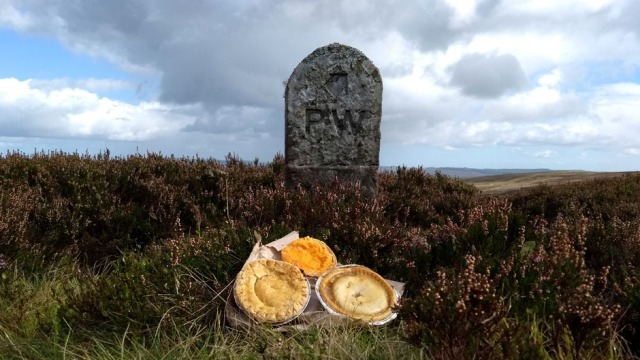
McFarlane’s, the legendary butcher and piesmith at Middleton on Teesdale, closes at five and thanks to my extravagant breakfast at Tan Hill I was cutting it fine. For the sake of one of their stunningly good pork and apple pies I literally ran quite a lot of the way down into the town. Lose calories to gain calories, I figured, as I staggered into the shop sweating profusely at four forty-five.
kirkcarrion teesdale england uk
As ever, Kirkcarrion broods over Middleton
‘Ha ha, we’re open til seven’, they said cheerily. Luckily for my small remaining safe margin of blood pressure this was a joke. I bought arguably a slightly reckless number of pies. Also a tremendous corned beef and potato slice, to eat immediately. It was then necessary to buy further provisions in the Co-op; Dufton is always a bit of a movable feast, there might be food, there might not be, then there’s Cross Fell to consider, and then who knows what there might be to eat at Garrigill?
All in all, you do need to do the shops at Middleton although tragically the lovely old Post Office and sweetie emporium where I traditionally posted home my surplus gear has closed. Luckily by my fourth Pennine Way I’d just about eliminated surplus gear, other than one redundant pair of warm socks, a hangover from memories of April. This time I walked the entire trail in skinny mesh-top running socks (Higher State ‘Freedom’s) which proved durable and dried very quickly.
Wary of wild camping in popular Teesdale, I was aiming for Low Way Farm at Holwick where you can camp legitimately for just a fiver. The weather looked ominous but locals were still out walking dogs. Helpfully, several told me I still had quite a way to go.
The site was unsigned and virtually invisible from The Way, I only just spotted a camper van behind a wall. By now it was absolutely teeming down with rain. A man who from the smell coming from his enviably watertight palace on wheels was boiling an entire steer on his camp stove, or perhaps heating a Desperate Dan-sized Cow Pie in his camp microwave, told me to ‘pitch oop, summun’ll coom’.
I pitched oop, on grass so wet if I’d rolled around on it naked I’d have been rendered quite hygienic, albeit hypothermic. Rain hammered on the flysheet. Then it stopped quite suddenly, the sun came out and with the light-headed relief that accompanies such ineffable transitions on a trail, I ate a McFarlane’s pork and cranberry pie. It was awesome.
Yet another life lesson from the Pennine Way: wise man doesn’t beetle about virtuously putting tent up in shower of rain like idiot cross between Bear Grylls and Doctor Foster. Wise man calmly waits for better weather, eating pie in toilet.
pork and cranberry pie mcfarlanes middleton
McFarlane’s finest. Apart from their pork and apple.
No one came so conscientiously I walked up the track to the farmhouse to pay, it seemed a long way after hiking from Tan Hill. There was nobody home, but the café kitchen door was open and on the bench were a dozen freshly-baked Victoria sponges, their aroma was overwhelming. I could have eaten an entire cake and nobody would have been any the wiser. Not about who did it anyway; counting cakes is normally a core skill for café proprietors.
As I was about to poke a fiver through the letterbox there crunched around the corner on the pristine leather driving seat of an upscale Range Rover what would in my childhood have been known as ‘The Farmer’s Wife’, now of course more correctly as Joint CEO, Low Way Agricamping and Catering Solutions LLP.
“Sorry”, she merrily explained, “I’ve just bought a new ram and couldn’t wait to try him out”. Suppressing an immature grin, I enquired whether by any chance she might now be driving her swish vehicle down the very long track back to the campsite. I tried to imply there might be more fivers down there for her to harvest but she had bigger cakes to ice. Bounding off energetically to her next agricatering assignment she cheerily apologised over her shoulder that taxi service wasn’t included.
I trudged back to the tent. Damp, claggy fog descended. Some Last of the Summer Wine types failed to light a stinky barbecue, filling my skimpy shelter with kerosene fumes. Bundled against the cold, one of them started to mangle a guitar and ‘sing’, like a drunk, busking Michelin man. The rain returned. Luckily I had scotch.
pennine-way-holwick-camping-scotch
My smoothie bottle was thankfully not so innocent…
Having run a rural business myself I’m always impressed with how much creativity, energy and focus it takes to generate what most would consider a reasonable income from a family farm. Even in a tourist area, trade is still seasonal and dismayingly unpredictable. Quite rightly, my fiver bought me only a few seconds of that enterprising woman’s valuable time; her farm isn’t a bucolic hobby but a busy workplace.
Scottish poet and essayist Kathleen Jamie wrote a perceptive critical review that encapsulates my own discomfort with books like The Wild Places1 by Robert MacFarlane, who sadly doesn’t bake delicious pies but is standard bearer for an outdoor writing genre which despite fluency and rich content I struggle to enjoy. Cheerfully admitting, as I do, to unfair prejudice, Jamie writes: “when a bright, healthy and highly educated young man jumps on the sleeper train and heads this way, with the declared intention of seeking ‘wild places’, my first reaction is to groan. It brings out in me a horrible mix of class, gender and ethnic tension. What’s that coming over the hill? A white, middle-class Englishman! A Lone Enraptured Male!”
I walk alone, I’m male and English and occasionally I even verge on enraptured. However I’m also mortified to think I’m strolling naively through places and structures bearing mute witness to other people’s historical and contemporary labours to scrape a tenuous living from unsympathetic terrain. Especially as a PhD pensioner with all the time in the world to walk, my financial independence traceable ultimately to my elite (and free) education. In her Love of Country2, one of my favourite books about the Hebrides, Madeleine Bunting writes “Elitism and the sublime have long been intertwined – the true experience of the latter has always required education and/or wealth”.
The Pennines are a cultural landscape and even their most remote moors are not ‘wild’. Apart from anything else if they were, as we know from pollen deposits, they’d be covered in scruffy, windblown trees. For better or worse people worked hard, and still do, to clear those trees, to build those picturesque walls and to dig those annoyingly hazardous mineshafts that someone else should jolly well do something about.
Jamie again: “Class comes in here. For a long time, the wild land was a working place, whether you were a hunter-gatherer, a crofter, a miner. But now it seems it is being claimed by the educated middle classes on spiritual quests. The land is empty and the saints come marching in”.
Day Ten – Holwick to High Cup
I woke into a wet world. I stuck my head out, cold condensation from the flysheet usefully rinsing what’s left of my so-called ‘hair’. Even with my ineptitude at judging weather I could see another deluge was imminent. I tore the tent down and scampered in relays with all my stuff into the small but sheltered pot washing bays that other than basic BYOP loos are the only facility at this very minimal campsite.
Just in time. I enjoyed hot cocoa and a Co-Op breakfast sandwich standing up, and indeed standing back from the splashing as lumps rather than drops of rain battered the tin roof. Then it stopped quite suddenly and off I went to my appointment with one of The Way’s highlights at High Cup, where I’ve long wanted to camp out.
pennine way teesdale high force
Compulsory boring High Force selfie.
It was September so despite looking pretty poorly from Phytophthora the females among the Juniper bushes were covered in aromatic berries, thousands of them.
Souvenir gifts for my loved one are always a problem when I travel; she’s if anything even more averse to pointless shopping than I am. From the very bush we’d sheltered under from heavy rain during our last visit here together I picked her a small bag of the tiny blue-black fruits, to perfume her G&Ts. It’s probably an SSSI, which might make berry-foraging illegal. Sorry.
teesdale-juniper-berries-pennine-way
Teesdale Juniper berries, very aromatic.
Pushing through the soaking bushes I encountered an interesting and friendly geologist researching, off his own bat, his forthcoming book on the geology of Teesdale. Subsequently at Cow Green an engaging and informative young woman from the North Pennines AONB was interested to hear this as she was herself up there chaperoning a Spanish film crew, making a film about geology.
It turns out the whole of the North Pennines is so interestingly geological it’s now an official UNESCO Global Geopark.
teesdale-memorial-bench-pennine-way
In the unlikely event anybody wants to install a bench in my memory, I’ll have one like this one near Langdon Beck please. Premature posthumous thanks.
I couldn’t believe there were no Dippers on the Tees. In 2018 we were all supposed to be trying to see 200 birds; not being much of a twitcher I’d been hoping for a Dipper here to get me past an amateurish 193. I eventually bagged one on the South Tyne north of Garrigill but the last time I’d passed Falcon Clints there were loads. This was worrying, as was the state of some of the boardwalks along here.
We must now add dodgy boardwalks to the dodgy rocks that are already on the Falcon Clints risk assessment
The river was so low after the dry summer that I was able to get unusually close to Cauldron Snout. This exploit did involve some terrifyingly slippery rocks but the resulting video got a few likes on Facebook. Sigh. I was supposed to be purposeless!
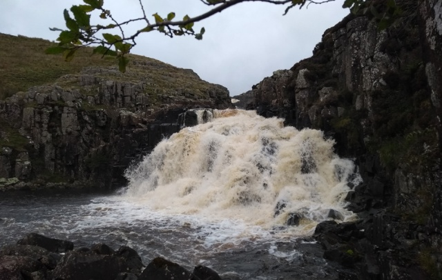
The so-called ‘scramble’ was a doddle as usual, even in the rain, and although the red flags were flying there were no whizzing shells to enliven the tedium of the shooting track up to Maize Beck.
pennine-way-cauldron-snout-scramble
The distinctly unexciting ‘scramble’. A good job too as I hate heights.
pennine-way-maize-beck-bridge
The all weather bridge at Maize Beck. A gamekeeper told me why it’s so high – the previous huge stepping stones had been simply knocked away by the force of a winter spate.
upper teesdale cumbria
The weather was looking a bit ominous…
north pennines aonb pennine way sign
Do not become so hypnotised by the boring track that you miss this vital sign off it to High Cup!
There’s plenty of flat ground at High Cup, enough in fact to hold the High Cup International Festival of Tentage with extended families of Bedu, Sami, Mongolians and Apaches frantically trying to hold down each other’s beit shaars, lavvus, gers and teepees in the raging hoolie.
Yes, my tent festival will for ever remain a fantasy, for into and up over High Cup the King of the Hoolies rageth, unpredictably but often persistently, all the way from his tempestuous domain over the wild Irish Sea.
The wind was definitely a bit mad and after the Hebridean Way I knew all about how little sleep I’d get if I pitched out in its full force. After some searching I found a sheltered nook but the ground was uneven and after struggling to orientate the tent optimally I found I was trying to push one peg, the last one of course, through a buried rock. Trying to overcome this by brute force I spectacularly sliced my thumb open on a titanium v-peg (these are dodgy things, actually, they can snap as well as cut you).
I was forced to unpeg the whole caboodle and shift it six inches, whence it was then necessary to staunch my copiously bleeding wound by pushing my hand into a pile of wet horse muck. I do love wild camping. Still, when the clouds deigned briefly to lift their grey lid off the Lake District the views were extensive and another small ambition had purposefully been realised.
high-cup-pennine-way-cumbria1high-cup-pennine-way-cumbria
Wild camping can be hard work alright, and it’s only one of the species of labour involved in hiking a trail ‘properly’. Not that I’d want to prescribe what your own ‘hiking properly’ might mean to you.
And then of course in a blog, a public journal, one can easily end up labouring too, as a Pennine Way proselytiser, a Pennine Way polisher. Hopefully this blog is a bit truer to my own personal experience, a reflection of my perverse enjoyment in celebrating the ordinary ugliness of an outdoor exploit, rather than striving stereotypically to rejoice in its sublime aspects.
Those more sublime aspects I try to share through the work of taking and posting photos. My writing may be slapdash hacking, but my photos are considered labour in both the taking and editing, even though I don’t lug a fancy camera around for results that would be indistinguishable at the 940 pixels resolution of my WordPress theme from these budget smartphone shots. As a photographer I’m always looking out for shafts of light, scraps of quirkiness. As you can see, the Pennine Way doesn’t always deliver them, but then it rarely delivers any expectations on a plate, let alone in a titanium mug of Supernoodles eaten by headtorch on a pile of wet horse poo in a hoolie.
Day Eleven – High Cup to Greg’s Hut
I awoke into a wet world. You’d tell me if this blog was getting predictable?
I’d slept angularly but soundly in my uneven but unwindy nook and the styptic properties of manure had prevented my sleeping bag from filling with blood. My purposeful purpose in sleeping at High Cup had been to experience sublime dawn views of the distant Lake District, ravishingly illuminated by golden morning sunshine.
Imagine my dismay upon emerging into the suspiciously damp outdoors to discover that the views were unextensive. Sorry, predictable.
high-cup-fog-pennine-way
High Cup is (altogether now…) famous for extensive views.
There was nothing for it but to pack up and walk on. In the wrong direction. Yes, so much for knowing the way. The fog was so confusing I ambled off south instead of west. I could have ended up on a long detour and possibly even into the Danger Area had I not rapidly realised that I was failing to descend to the rocky stream, as anticipated.
A sneaky peak at the GPS and I was set fair, but also sobered to realise that I’d forgotten one of the golden rules of wild camping off trail at altitude – you should always take a bearing from your tent back to the trail, and set your compass to it before you retire for the night.
pennine way cumbria in fog
Heading back down to The Way, as viewed extensively.
high-cup-horses-pennine-way
Horsezillas in the mist.
pennine-way-view-cumbria
On the way down the fog did lift a little, revealing vaguely extensive views over the Vale of Eden
pennine-way-honesty-box-cumbria
A healthy breakfast was procured from another friendly trail tuck shop at Bow Hall on the way down to Dufton. Thank you.
It was Sunday morning so I started to meet people, quite a lot of people actually, heading up to High Cup in all kinds of hiking attire from the alarmingly casual to the hilariously over-specified, and all hoping to savour the famously extensive views. Chortle.
Meanwhile I was heading into town, to find – ta daaaa – a café! The really good and friendly Post Box Pantry with tea, phone charging and a sumptuous Full English. Chortle with knobs on.
dufton-green-roof-cottage-cumbria
Perhaps the original green roof?
I was ahead of schedule, insofar as I had one. It felt thoroughly like a Sunday, which on a long distance trail amounted to an unusually accurate coincidence of feeling with reality. Why, I asked myself, did I not wander casually along to the lovely hostel which, as I’ve written elsewhere, all Pennine Wayfarers should support and book myself in for a well-deserved day off? This is why not…
dufton-yha-fully-booked
Welcome indeed to your private exclusive hostel, expletive deleted and friends…
Right, I thought, you dog in the manger bar stewards, I’ll show you, who needs to allegedly ruin your private party by sharing a tiny corner of your stuffy old hostel anyway? I’ll just jog the heck over Cross Fell in the healthy fresh air instead, see if I don’t. I stomped off to the highest point of the Pennines in high dudgeon. It started to rain.
knock old man cumbria on the pennine way
The steep climb up to Knock Old Man feels, after the distance you’ve already walked, like one of the hardest on the whole Pennine Way. Especially in pouring rain.
It rained more, and directly into my face as I was ascending a steep slope. Clouds descended, the trail ahead was largely invisible. Dun Fell Hush finally appeared, a reminder of terrifying labour that must surely have stripped away the lives of men as implacably as it did the soil.
Suddenly the clouds wafted clear of the radar station, revealing a conflict between this high-tech workplace and the labours of the farmer. One of his sheep had died hideously, it’s horns stuck in the fence. Having laboriously climbed up all that way just to have my elite sublime rapture compromised by the banality of common death, I undertook the further work of sharing a photo of this horror on Twitter (I won’t share it here). Someone remuneratively employed to manage a social media account earnt their wages by replying that it wasn’t their fault.
All this was starting to feel far too purposeful, so just for the heck of it I called out “brightening up!” to a couple of miserable-looking chaps picnicking out of the wind. My joke then felt a bit silly as that’s exactly what it did.
great dun fell pennine way
No seriously, guys, look – it’s brightening up…
I bounded up to Little Dun Fell where the views were not exactly extensive but at least coyly revealing themselves from under increasingly diaphanous clouds.view from little dun fell pennine way
Even Cross Fell tipped its cloudy hat as I approached.
cross-fell-from-pennine-way
Looking up to Cross Fell, the last of the clouds lifting.
It was wonderful to be up there again. I could even have allowed myself a sniff of the enraptured sublime, had I not been distracted by memories of the BBC programmes.
Another of the few bits I’d liked was footage of the dry stone wallers building the lovely new summit shelter, to mark the 50th anniversary of The Way. Such hard work, even just to get to their work, but they seemed to be enjoying it even when the bushy-tailed presenter, in one of television’s most pointless and annoying tropes, had to be allowed to pretend to add a stone himself.
I was disappointed to find the stones I’d myself added two years ago, my tiny cairn of fluorspar creatively adorning the dome, had all gone. Blown off by the Helm Wind perhaps, pinched, or virtuously removed by the increasingly active stone pile police. I personally see no harm in adding a tiny pile to a big one.
pennine-way-cross-fell-summitcross-fell-summit-pennine-way
The weather forecast wasn’t ideal for a summit camp, to say the least, so I slithered down to Greg’s Hut in which I decided to fulfil a long-held ambition of spending the night, even though I had no fuel for the stove so it wasn’t going to be warm. There was nobody else there so I figured this might be a chance to access the sublime by writing a poem, possibly on a theme of ecstatic shivering, or of elegant mortality among damp stones.
I was rescued from this virtuous work by the arrival of two chaps from Sheffield, then a brother and sister from Norfolk. As I live in Norfolk and prior to that lived in Sheffield, this was a bizarre coincidence. One thing I always dread in a bothy is the arrival of party animals with high-octane intoxicants and an all-night leisure agenda; from the empty vodka bottles littering Greg’s I’d say this is an occurrence not unheard of up there. Luckily we five were all tired Wayfarers, up for nothing more laborious than an evening of low-key, convivial sobriety and an early night.

Greg’s Hut, brought out of shadow with Photoshop, obviously, but the sunset is real 😉
Greg’s Hut is a remnant of the days when the whole of Cross fell was a workplace. Lead miners slept where hikers do now; there was a forge in the sitting room. 13,000 tons of ore were dug out of Cross Fell, all by hand, between 1811 and 1911. This shelter where now the leisured classes sleep for nothing was dearly bought with labour so hard it would seem to us superhuman, minimally paid and culminating if not in disabling injury, in a pitifully short, unhealthy and unpensioned retirement.
Much of the conversation that evening was about our jobs: welder, electrician, maths teacher and two of us retired but with former careers to account for. It was striking how we established our own and each others identities through our types of and relationships with employment, the next safest topic for English people after the weather, which was of course also discussed. Walking in one of the remotest places accessible to us within our small country, we’d brought not just our weather with us, but our workplaces.
I was tired, after all, I’d done a hard day’s work, all that walking and climbing not to mention all the searching for the sublime. Actively seeking and recording memorable images, striving for a respectable distance, constructing the day’s output for friends and family via Facebook. Mindfully using my body, as per Alexander technique (without which I wouldn’t be walking long distance trails). Cooking Supernoodles. Trying to remember what the heck I once did for a living. It was no wonder I needed an early night after all that work.
And tomorrow would bring the interminable tramp down the Corpse Road, hopefully without the hard labour of bearing a cadaver although in the event that was a close-run thing, given the volume of one of our number’s snoring.
north-pennines-panorama-cross-fell
As I’d been saved by human company from the hard labour of writing poetry in Greg’s Hut, the best I can now do, emphasising the Purposeless Pennine Way’s core values of repetition and of cementing memories, is to trot out once again the sonnet I knocked up last time I was there.
Kirkland Corpse Road
Winding like a post mortem scar
The corpse road, pale as rot, a thread
Spun lilac with fluorspar.
Nailed boots heavy as the lead
They are worn to win crush and tramp
Crystals. Shoes round necks for church.
What took her off were sleeping in the damp.
Rain knocks unanswered, bearers lurch,
A weight shifts as if still living.
No laughing matter, no fuss,
Grimly borne in hope of God forgiving
Sins and someone doing it for us.
Washings drip through a coffin crack.
A young and lively miner props the back.
1 MacFarlane, Robert, 2007, The Wild Places. London: Granta Books
2 Bunting, Madeleine, 2016, Love of Country, a Hebridean Journey. London: Granta Books.
PENNINE WAY BLOG 3 – DAYS 12 TO 14
The Purposeless Pennine Way, in which while trudging in enjoyable company, I duplicitously meditate on the downsides of companionship.
Something of a Philosophical Pennine Way. Practical Pennine Ways are also available, south to north and north to south.
Day Twelve – Greg’s Hut to Alston
mountain bothies association bothy cross fell greg’s hut
Waking up in Greg’s Hut, that green lump is my feet. In my sleeping bag, I mean, my feet hadn’t turned green. Not entirely. Shame nobody had anything to burn on that stove.
A light sleeper and a cold one, I’m unlikely to enjoy my best ever night in an unheated stone hut containing a snorer whose rhoncial reverberations had literally rattled our shared platform. On the upside, former occupants of our unpalatial shelter had kindly left not only porridge oats but, miraculously, golden syrup, so that was breakfast sorted. I was the first to leave, casting a concerned eye at the thick clouds swirling over and around a completely invisible Cross Fell and feeling sorry for the Norfolk siblings who, southbounders, would soon be heading for the summit. I’d given them my very best directions, so they’re probably still up there now.
I’m running out of expressions for ‘it started to rain really quite heavily, no, really, much heavier than normal in any sensible location’. But that’s what it now did. Absolutely hammered down. I slopped and sploshed down the Corpse Road, fossicking fluorspar and then finding to my dismay that presumably for the sake of the shooting the lower track had newly been ‘improved’ into something more like the Corpse Motorway, using incredible quantities of rolled stone.
kirkland garrigill corpse road pennine way
The Garrigill Corpse Motorway
The mist swirled around me, the rain battered onto and annoyingly through my tired waterproofs. It wasn’t altogether nice, but in happy compensation the southbounders had brought wonderful news – the pub at Garrigill had reopened! The thought of a pint and possibly even lunch was enough to reanimate even my cold, clammy corpse. Not only that, still smarting from the YHA’s sabotaging my Dufton Day Off and Dry-Out Decision, I’d exploited the surprisingly good phone signal at Greg’s to book a bed at Alston Hostel instead. This was going to be a nice short day, with a warm, dry end. Nonetheless, after the companionship of the hut I felt suddenly very alone.
When I’m not walking with my partner, a portable and congenial domesticity, my second best option to date has been to walk alone. Although I’ll chat superficially with anyone I’m shy of longer term interaction. Though I often feel painfully lonely on a trail it would be a big and difficult step for me to ask anyone to walk with me. As when any habitual outsider presses his nose to the bright window of others’ enjoyment, I’m intrigued, fascinated but also dismayed by the idea of a trail buddy. I’m afraid of my cognitive dissonance; others are rightly afraid of my Dad jokes and questionable hygiene.
At Greg’s it was entertaining to watch contrasting approaches to companionship, the Norfolk and the Sheffield, both of which, having lived in both places, I’m familiar with. The Norfolk siblings often walked apart; when the sister arrived she hadn’t seen her slower brother for several hours. Although affectionate and caring, they spoke to each other only on practical matters and were content to sit in calm silence, the natural mode of Norfolk natives – I should know, I live with one.
Sheffielders, in contrast, are in general among the most genuinely and generously conversational of the English, telling your their life story before they’ve known you ten minutes. Their expecting the same back can feel intrusive to more guarded folk. The Sheffield lads were inseparable, they often walked almost touching and kept up a continuous conversation, goodness knows what about, at a volume distracting to quieter walkers in their vicinity.
garrigill cumbria
First view of Garrigill from the Corpse Road, cloud starting to lift.
As someone lacking geocultural roots, a social chimera, I like a bit of both. My ideal trail buddy could deliver an hour’s meaningful conversation, then pause to examine wild flowers while I plodded on, contemplating the issues raised or other thoughts entirely. We might enjoy lunch together, then walk separately for the entire afternoon. When one fancied a shower and a hostel, it would be no problem if the other preferred to wild camp further up the trail.
In the old days this kind of loose buddydom would have been problematic, but now mobile phones make it entirely feasible. Nonetheless from watching more companionable walkers I fear many would find it unsatisfactory, even challenging.
I’m famous for abandoning companions I’ve tired of. I once impulsively clambered onto a random train pulling out of a Romanian border station in January, shouting to my bemused travelling buddy on the snowy platform below “I’m going to Vienna for a coffee, catch me up”. That was forty years ago, I haven’t seen him since.
garrigill post office pennine way
Garrigill Post Office looking a little bit League of Gentlemen, but at least still surviving.
It seemed a miracle to be back in the George and Dragon, so sadly abandoned on my last Pennine Way, especially as my anticipation had been heightened by having to wait forty minutes for it to open, at midday. Somehow the Sheffield lads turned up just as it opened, having also cunningly missed the worst of the rain.
There was a long story to tell but in brief it had been been rescued by a local chap who told me he’d somehow managed to buy the freehold, thank goodness. He had a lot of work to do but already his ale was excellent and his small menu of freshly-cooked food suited a hungry hiker. He’d also put back into service a few basic but good value BnB rooms.
While comically trying to discourage the fire from filling the room with smoke, he told me his parents had owned the pub when he was eighteen and employed him to run the bar. He’d been heartbroken when they had to sell it, and had told his then girlfriend ‘some day I’ll own this pub’. Girlfriends had come and gone, but now he owned his pub. I swear as he told me this tale his eyes moistened, although it may have just been the smoke. (Update 2020: Sadly I’ve heard that despite this chap’s efforts the pub is now closed again).
Full of improbable but excellent chicken goujons and homemade chips, not to mention ale, I strolled off down the pretty South Tyne.
south-tyne-river-pennine-way
The pretty South Tyne, as advertised.
river-south-tyne-pennine-way
Despite the heavy showers the river was amazingly low
cross-fell-from-pennine-way
A last distant view of Cross Fell, as you approach Alston. It always seems most unlikely that you were actually up there not so many hours ago.
pennine-way-into-alston
Approaching Alston. The hostel is directly on the trail just past here.
Some hikers call this warm, friendly Alston Hostel expensive at £28 for BnB but not me. The bunks are comfy and the breakfast excellent; they thoughtfully try to put Wayfarers in quiet dorms and they have a proper drying room unlike a BnB that would cost you twice that. I refuse also to claim my YHA discount at this independent hostel, why wouldn’t I buy these kind, hard-working people a pint? I’d rather put £3 towards feeding the Red Squirrels, several of which I saw from the sitting room.
My roomie was a recently retired financial analyst, and if they don’t know good value who does? A summit bagger, he was hunting for a retirement home within easy reach of Scotland and The Lakes. I didn’t dare ask his budget, but with a house in Milton Keynes under offer he could probably have bought half of Alston.
Having washed everything I could while retaining enough dry fabric for a respectable visit to the Spar shop, I scampered there to buy for a lavish supper of reduced items, to be cooked back in the cosy hostel’s excellent kitchen.
By the drying room I was pleasantly surprised to see a familiar grinning face. Stepping off the train at Edale, ten long days previously, I’d encountered a determined- and well organised-looking young woman in hiking gear. Yes, she intended to walk the Pennine Way. Yes, the whole thing. Yes, by herself. Yes, camping (any more daft questions?) Her first night would be off trail but then her intended timescale would require her to overtake me. Every so often during the first week I found myself looking back, wondering where she might have got to.
You meet a lot of people trying to walk the Pennine Way, many of them overburdened and underprepared; many fail. By the time I got to Teesdale I’d started ruefully to suspect that she too might have fallen by the Wayside. That would have been disappointing, both for her sake and because from our five minutes’ conversation I’d for some reason convinced myself this was someone who would succeed. Hence I was disproportionately pleased to see JR walk into Alston Hostel, vindicating my judgement. Also because in our previous brief encounter I’d instantly warmed to her. We spent a happy hour reminiscing about our own very individual Pennine Ways, so far.
Talking with JR, I started to wonder, very tentatively, whether here might be a trail buddy I could tolerate, whether it might even be pleasant to walk a while with a young person who was not only understated, self-contained and interesting but could casually throw rather impressive asanas while chatting. To be on the safe side, I avoided the possible complications of companionship by getting up early and setting out alone the next morning.
Day Thirteen – Alston to Greenhead
Leaving Alston I passed one of the freakiest locations on the entire Pennine Way, a very strange wood full of fowls and small crosses, presumably graves. I couldn’t believe I’d never noticed this before, but I was repeatedly finding that as I now (mostly) knew my way up the trail and so didn’t have my nose buried in a map all the time, I was seeing completely new things at every turn. The Way was repaying repetition by giving me new gifts, although I wasn’t quite sure how I felt about this particular one.
alston-chicken-graveyard-pennine-way
Freaky, Beaky, Cockaleekie…
This happened again at Gilderdale Burn. I’ve been rude in a previous blog about the apparent nonexistence of ‘Isaac’s Tea Trail’, but here on the bridge was a sign I’d never noticed before. To be fair, the bridge had been refurbished since my last visit and one of the screws on the sign was suspiciously new.isaacs-tea-trail-pennine-way
Again, I’ve been rude about the uninspiring signage at Whitley Castle (Epiacum) but goodness me, here, unless I’ve just never noticed them, were smart new signs full of interest. I actually stood and read them, and then, would you believe, I was even seduced for the first time into entering the fort itself. Not least because the sign cunningly mentioned that I could get directly back onto the Pennine Way at the far end without retracing my steps.
epiacum-whitley-castle-pennine-way
Inside the fort a row of bright plastic bollards compromised my ability to ‘imagine I was a legionnaire’ which made me a bit cross. In this unreasonable frame of mind I enquired of two ladies who seemed to have something to do with them what they might be all about. A Victorian stone wall was being removed, the senior lady patiently explained, as it had been preventing visitors gaining a proper view and an holistic impression of the Roman site.
‘What does the Victorian Wall Preservation Society make of that?’ I enquired provocatively. Rather than getting defensive she smiled and engaged with me in the same mischievous vein. We ended up having an amiable discussion about rucksacks. The farmer was in a good mood too, I should think, since as the owner of the thousands of Victorian stones being removed he’d be turning a pretty penny flogging them to garden centres.
whitley castle pennine way
Plasticated Epiacum
At Slaggyford there was still no Pennine Way sign at the vital turn-off, but drinking water was still kindly provided at Yew Tree Chapel. The former hot drinks sign on the house opposite had disappeared.
slaggyford-signs-pennine-wayslaggyford-drinking-water-pennine-way
pennine way knar burn
Pixie bridge over Knar Burn, viaduct hidden behind.
slaggyford-waymarker-pennine-way
Vintage waymarker just after Slaggyford
At Kirkhaugh the pretty little house I’d seen for sale two years ago and longed to own was finally occupied. Next to it a chap was standing in an alarmingly small stone pen, in close contact with three beautiful Swaledale rams. Their magnificent coiled horns were worryingly level with important parts of his anatomy. He explained he was grooming them for a show. “They look pretty calm about it”. “Just you wait til I pull a burr out of a fleece!” He told me the house had been for sale for nine years but had finally been bought by people from Dorset.
butter pie pennine way
My lunch was a Butter Pie, a delicacy I’d only previously seen in a chippie in Liverpool. Traditionally a Catholic Friday food, I was told via Facebook.
Above Knarsdale the Trail Pixies had provided another nice new ladder stile, the amount of refurbishment ongoing on this trail was very heartening. Further on past Burnstones there was a rather less useful ladder stile!
knarsdale-ladder-stile-pennine-wayabandoned-ladder-stile-pennine-way
At Greenriggs the Trail Pixies had tamed the legendary swamp with flagstones! I could hardly believe it.
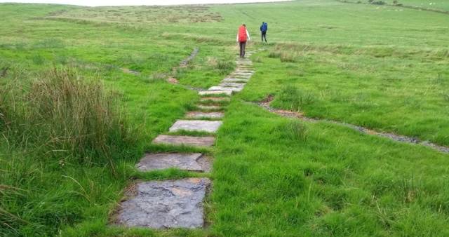
As demonstrated by two men from Sheffield, the Greenriggs swamp has been tamed!
I felt a bit sad, another piece of conversational currency had gone for ever. Another small thrill diminished. Tell kids how bad the old Pennine Way was, they think you’re fibbing. Etc, etc, etc. Talking of conversation, at this point the Sheffield lads, late starters but fast walkers, caught me up. I was pleased to have a bit of company for a while although, duplicitously, I did at the same time find myself missing peace and quiet.
If the purpose of hiking in our wildest, emptiest places for a long, long time is to experience peace and space, why do so many who seek this experience then compromise it with vocalisation, often more or less continuous? Many ‘outdoor people’ must actually in their hearts abhor peace and space. Making great efforts to access it, they then fill it with words, and not even purposeful words.
I’m always up for an original observation, a considered opinion, a correction of my map-reading, delivered empathetically and sotto voce. So often on trails though what I hear is continual, intrusive verbalising for its own sake. Sometimes I literally hide behind rocks to avoid it. I’m a communication enthusiast – obviously, I write a blog – yet to me an excessive flow of words often obstructs other communication.
One of the most distinctive outcomes, purposes if you like, of walking and wild camping a very long trail in the hills alone is a sharpening of the animal senses that are attenuated by habitual lack of use. You re-learn to read the weather, to identify people at distance from their body language, to parse and predict aches and pains, to tell the rustle of heather in darkness from a goat eating your guy-rope. You learn to recognise when a fellow walker is reaching for something deep within their soul, not longing to hear about the film you saw last month. It takes peace, space and subtle stimulation for this enriched instinctual world slowly to unfold.
Wild, remote places, despite the absence of conventional distractions, are rich sensory environments. They’re especially rich in sound but also in the lack of it, in the so rarely encountered auditory negative space that can frame and highlight new constructs and connections in our minds.
Ethnomusicologist Steven Feld uses the term acoustemology to denote a union of acoustics and epistemology, an investigation of “the primacy of sound as a modality of knowing and being in the world”. “Soundscapes”, he writes, “no less than landscapes, are not just physical exteriors, spatially surrounding or apart from human activity. Soundscapes are perceived and interpreted by human actors who attend to them as a way of making their place in and through the world.”
Long distance hilll walking has a distinctive, subtle acoustemology all its own. By importing our domestic soundscape onto a trail, or, even worse, importing somebody else’s soundscape via the dreaded headphones, we surely fail in the purpose of properly making our place in and through it.1 Not that we have a purpose.
pennine way hartleyburn common
Heading up Hartleyburn Common where after the dry summer the trail was much more distinct than I’ve ever seen it.
pennine way hartleyburn common waymarker
The important marker post has been replaced with a much higher-visibility model.
Black Hill was still reassuringly boggy, and with reassuring suddenness the weather turned foul up there. The Sheffield lads took the first obvious track down to the A69 rather than the official long detour. Typically, they got to Greenhead ages before me.
gap shields pennine way
The Trail Pixies have even rebuilt the Gap Shields causeway and replaced the fallen fingerpost. Good work, Trail Pixies!
It was ten past four when I reached the tea room, desperate for tea. They closed at four. Fortunately I looked sufficiently wet and pathetic for them to sympathetically sell me some tea anyway, and several cakes. When I ran a café I hated it when folk came in after closing time. Little did I know there was no need to buy tea at all! Once I’d accessed the hostel after putting my tent up on its small lawn I found there was free tea to be had inside it.
In fact camping at Greenhead Hostel is great value as you get to use not only the hostel’s showers but the huge common room and kitchen too. And, if you’re very lucky, and manage to look really pathetic, a nice lady fellow-hosteller will give you cherry pie and custard. Thank you!
The adjacent pub was quite convivial with me, the Sheffield Lads, the Cherry Pie Lady, the Antipodean Lesbians, the Mancunian Baggage Transferers (staying in pub luxury of course) and several other Wayfarers, although not JR who’d enigmatically vanished again. At Greenhead you only need to get into your tent to go to sleep, which was a good job too as it was pouring down yet again.
Many hikers proclaim that their purpose in walking is to acquire new companions. They seem to randomly pal up on trails or in the pubs along them then stay buddies for life, walking (and talking) together year after year. They even walk in groups, or hook up via Hiking Singles. Terrifying.
Wainwright famously claimed that no man ever sat on a summit and plotted murder but he’d obviously never climbed a hill with The Ramblers. Whenever I’ve walked in a group I’ve so rapidly tired of the blather and waffle that by lunchtime murder has been more on my mind than future friendship. A sly trip with a trekking pole on a steep descent, a subtle elbow over a cliff. It’s best not to pursue this line of thought when wild camping alone in the hills, especially if you’ve seen the film Sightseers. Actually, did I tell you about that film I saw, it was awesome…
It’s not just noise that can be problematic. A very long walk uniquely allows you to settle into your own natural rhythm, to let your body set its own pace, to sleep, wake and eat when it chooses. After a week of so of this, while you’re focusing on your breath, on the wind, the click of your poles, suddenly almost without noticing you can slip into a soul-nourishing meditation. For someone like me who can’t be bothered to meditate intentionally this is a startling experience; having to adapt to someone else’s rhythm tends to sabotage it.
Day Fourteen, Greenhead to Bellingham.
It had poured with rain all night; luckily my Trekkertent Stealth tent although prone to condensation is impeccably waterproof.
tipalt-burn-greenhead-pennine-way.jpg
The Tipalt Burn was a roiling torrent.
The rain had stopped now though and the day looked set pretty fair. By the time I reached Walltown Crags the sun was on its way out.
walltown crags hadrians wall
Quite a few Wayfarers sneakily camp here at Walltown Crags, where there’s lots of flat space and a useful loo. Camper vans are allowed to overnight, so why not?
walltown-crags-hadrians-wall-northumberland
More tent-friendly space at Walltown Crags
As I climbed higher the weather improved further and eventually it blossomed into a classic Hadrian’s Wall day. Finally after several visits I was able to take a few half-decent holiday snaps…
hadrians-wall-pennine-way1hadrians-wall-pennine-way2
hadrians-wall-pennine-way3hadrians-wall-pennine-way4hadrians-wall-pennine-way5hadrians-wall-pennine-way6
hadrians-wall-trig-point
The highest point along the wall, with the proper North beckoning…
I got to Rapishaw Gap sooner than I expected in the benign conditions and stopped for lunch. Somehow the Sheffield lads, who’d left much later, appeared below me by some mysterious route. They stopped for lunch too.
pennine-way-rapishaw-gap-northumberland
Rapishaw Gap, with the Pennine Way finally heading away from the funky old wall. It’s all North from here…
Out of nowhere JR appeared above me, it was getting positively sociable up here. Kindly she joined me for lunch; I had a sandwich and cake from Greenhead, she had raw mange-tout peas and tomatoes. Perhaps cowed into unaccustomed sociality by the intimidating view of the Real North ahead, all four of us then set off together on a brief experiment in group hiking.
This didn’t work out. Different paces, different rhythms, different needs for conversation, or the lack of it. Amicably, what Gwyneth Paltrow might call conscious ungrouping occurred. I examined wild flowers. JR vapourised spookily into the trees. The Sheffielders forged ahead at their habitual high speed; the last JR and I saw of them they were heading off over the wrong hill in the wrong direction. Somehow they still got to Bellingham before us.
pennine-way-wark-forest-sheepfold
At the mysterious sheepfold in Wark Forest, during our brief experiment in sociable hiking.
For the next hour or so JR and I swapped places and paces, greeting each other politely. After a while I realised she was quite footsore and I resolved to maintain at least visual contact into Bellingham. She didn’t need me to, it just seemed friendly. We ended up walking together, more or less, and she was delightful company despite my leading her to where I’d forded a then very low Houxty Burn in June 2016. It was now completely impassable, we had to walk a dogleg to the bridge which I should have aimed directly for in the first place.
pennine-way-wark-forest
Wark Forest. The bit without forest, obviously.
I like to think my ecology background gives me added value as a Trail Buddy, so I cheerily misidentified several plants and on seeing a large bird with grey wings, black-tipped, disappearing up a burn I exclaimed excitedly “oh wow, a Hen Harrier!” Pause. “It’s a Heron” said JR. “Oh. Er, yeah, so it is.”
We stopped for tea at the Horneystead pit stop, where I regaled JR with my theory of purposelessness. “Ah well,” she said, “at least you’ve HAD an interesting life”. At Linacres we realised we wouldn’t get to Bellingham until after dark and so had better book the campsite. I couldn’t work out how to make a phone call on my phone, something I never use it for. “You’re as bad as my Mum”, said JR, not unkindly.
pennine-way-shitlington-northumberland
Another of my favourite Pennine way houses
Approaching Bellingham it was pitch dark. I was pleased to realise I might actually be useful as I knew the way along the unlit riverside path to the campsite. I’d failed to appreciate that JR is of the next generation; she has unlimited mobile data and a total command of Google Maps, an app that routinely baffles me. Give the woman a smartphone, she can navigate the souks of Ouagadougou in a sandstorm. I tagged along, feeling old and redundant.
In the Cheviot Hotel, which does great food until late, thank goodness, I met an Outdoor Activities Instructor, strawberry blonde, compact and tidily built, I got the feeling all five feet nothing of her could wrestle me to the ground in an instant if I upset her. The latter was a bit of a worry because I’m afraid I get a bit snippy when I meet an OAI, despite their indisputably great work with urban youth, etc. I dislike my Outdoors being packaged and sold and I’m particularly resistant to off-the-peg, commercialised ‘Fun’.
‘Fun’ was the issue; having walked the Pennine Way from Kirk Yetholm she was so far most unimpressed. It wasn’t exciting, it wasn’t adventurous. It was just going for a walk, a waste of her valuable time.
pennine-way-shitlington-mast-northumberland
Glowering atmospherics like these at Shitlington mast are run of the mill to an Outdoor Activities Instructor.
Selling the Pennine Way isn’t my job but I did offer a few aspects of my own satisfactory experience of walking it multiple times. She seemed unconvinced. The multiple times bit seemed particularly to surprise her. She strode off to her tent, leaving me drinking yet again with the ever-friendly Sheffielders, who I fear despite my multiple wayfaring credentials found me a bit nesh.
The next morning I was packing up my tent when the Outdoor Activities Instructor informed me, purposefully, that she was abandoning the unenjoyable and insufficiently thrilling Pennine Way in favour of ‘Fun’. Justification followed, unsolicited, in terms of belated compensation for suboptimal life experiences to date. “I’m due some Me-Time. I’m buying a cheap plane ticket to somewhere warm”. In other words, I thought, yet more shopping for temporary happiness. Again it isn’t my job to police other people’s choices so I confined my comments to “you’ll get sunburn”. “I NEVER get sunburn”.
JR stuck her head out of her tent, so I told her of this development. Immediately, emphatically and with her trademark grin she exclaimed “the Pennine Way isn’t SUPPOSED to be fun!” And that’s why in my head I’ll always be JR’s Trail Buddy, a cheap commitment as she doesn’t want or need one, and more to the point it’s overwhelmingly unlikely I’ll ever see my young friend again. That’s the fun of the Pennine Way for you.
1 Feld, Steven 2003. A Rainforest Acoustemology. In Bull, Michael & Back, L. (eds) The Auditory Culture Reader. Oxford: Berg pp. 223 – 239.
PENNINE WAY BLOG 3 – DAYS 15 – 17
The Purposeless Pennine Way, in which I wonder whether after four Pennine Ways I’m finally a Wayfarer.
Something of a Philosophical Pennine Way. Practical Pennine Ways are also available, both south to north and north to south.
Day Fifteen, Bellingham to Byrness.
bellingham-town-hall-northumberland
The good folk of Bellingham are working hard to keep the place attractive and vibrant.
It was a lovely morning at Bellingham and I felt in no hurry. For some reason I’d managed to edit from my Pennine Way memories the stiff climbs and the tiring bogs between Whitley Pike and Rookengate and the long hard road through Kielder. I lazed about eating multiple breakfasts in warm sunshine on the slightly erroneous basis this would be an easy day.
cheviot hotel bellingham northumberland
A top Bellingham tip especially on Tuesday when the Chinese is closed is that the Cheviot Hotel does takeaway hot food until surprisingly late in the evening, and they’re quite happy if you take it away only as far as their outside tables, to which you can also take your pint.
bellingham norhtumberland petrol station camping shop
Another top tip is that the petrol station near the campsite sells gas cylinders. You may need a new one by this point on the Pennine Way, not least to boil bog water on The Cheviot.
Bellingham still had a traditional bakers that sold as well as hot drinks and pies a few Northumberland specialities, notably Sly Cake. This seems to be a thick sandwich of vine fruits between shortcrust pastry, like a giant Chorley Cake in a tray, perfect hikers’ grub. They also sold, or at least displayed, scary-looking ‘Pink Biscuits’ which for some reason I’ve never tried.
bellingham traditaional bakers northumberland cakes
Sly Cake. which is delicious. Scary ‘Pink Biscuits’ below, also strangely chimerical gingerbread men.
Wainwright was famously rude about the Pennine Way north of Hadrian’s Wall, considering it a spurious bolt-on. Personally I look forward to it. For one thing you’re in the Proper North at last. “I can’t understand how anyone from Yorkshire can say they’re ‘from the North’ “, said a Bellingham lady to me as I drank my coffee in the sunshine.
For another it’s a time of confident, excited anticipation. The massive dead weight of rucksack you dragged up Jacob’s Ladder has somehow evaporated into not exactly fairy wings but at least more of a hanky on a stick. The Compeed has fallen off your blisters, revealing miraculously tough skin underneath. If you’ve got this far without catastrophe or capitulation you’ll almost certainly go on to complete England’s most legendary hiking trail.
The Way is wilder and more isolated now, you’ve left the daywalkers behind at The Wall and henceforth will encounter rather few people. Apart from the odd baggage transfer softie, those you do meet will be gnarly backpackers whom you can now look in the eye as an equal. The trail may lack spectacular summits and picturesque ruins but it’s nonetheless profoundly interesting in its ecology, history and psychogeography.
Along Hadrian’s Wall I’m very much traversing a linear feature, progressing along a continuous sequential narrative, like a paragraph of prose. Further north, the relative remoteness imposes on a social creature with a strong survival instinct a strong sense of attaining milestones. You’re ticking off the changes of terrain and direction, shopping opportunities and other points of inflection often with relief and an increasing sense of achievement. The numbered waypoints on the guidebook maps become more meaningful in a featureless landscape, amplifying this feeling of stepping from stone to stone rather than flowing with the stream. The forests and the moors, anonymous and uniform, can feel more like gaps in the information. You walk them as if they’re negative space, patches of blank screen to be scrolled over between a series of discrete images.
[ … screen left intentionally blank …]
pennine-way-sign-northumberland
Everyone else had disappeared, I felt independent, happy and confident. At Hareshaw there’s another of my all time favourite Pennine Way houses and surely one of the most desirable small residences in Northumberland. It’s sheltered from north and west, compact and manageable and fully open to the sunny, sloping south with extraordinary views.
hareshaw northumberland
Another favourite Pennine Way house.
hareshaw-farmhouse-view-northumberland
The view to the south from their windows!
Passing Callerhues Crag I spotted in the distance ahead of me a solitary hiker. It was JR; as she’d left much earlier than me, this meant she was again walking slowly. As I approached it became clear she was working hard to maintain progress on her dodgy foot. It was like watching a tragic wildlife film in which a Cheetah cub has a thorn in its paw. Cue David Attenborough voice: ‘The young female is injured but she must keep going. She must reach her den by nightfall. She looks up, checking the sky for vultures. Her only hope of food is to find prey older and weaker than herself. She stops. Her finely-tuned senses have detected an elderly, fat Warthog, not far behind her’.pennine-way-northumberland
A yoga teacher, JR has an enviable working relationship with her own body. When I caught her up it was clear she knew what she was doing. I left her to it; my walking ahead would at least save her from wondering where the trail was. That was if I didn’t get hopelessly lost, as I’d done at this very point in June 2016. Luckily for my debatable status as Trail Sage, the path was much clearer this time and the visibility was perfect.
pennine-way-lough-shaw-northumberland
In places the trail was much clearer than it had been last time I walked this way.
pennine-way-lough-shaw-northumberland1
In others it was very boggy, like the legendary Pennine Way of old.
pennine-way-black-sike-northumberland
It’s important to find this bridge over Black Sike, at the foot of Whitley Pike
Just as I was looking forward to enjoying one of my stash of pies in the sunshine on Whitley Pike, clouds suddenly obscured the sun. It started to rain, a cold, stinging rain and most unpleasant. I mooched about searching for shelter, as I was hungry. There was none, but then as suddenly as it came the rain departed and the sun appeared again. Just one of those showery old Pennine Way days.
pies on whitley pike northumberland
I conducted an informal Facebook poll as to which of my Northumbrian pies I should eat on Whitley Pike: mince and pea, steak and kidney or macaroni. The majority vote was ‘eat all of them’.
JR reappeared; good news as it meant she was walking more freely. Eyeing my pies, she observed “I did notice your pack had grown by about a foot”. She’d been managing her wear and tear issues partly, she explained, by every so often walking backwards to free up musculature, also to gain a different perspective and take more interesting photographs. What I can’t grasp is how she doesn’t just trip over. I suppose I should have expected this from someone who routinely stands on her head, a stunt I never try not just because I’m uncoordinated but due to a residual childhood fear my brain will fall out of my ears.
Past Padon Hill, another happy campsite of mine in 2016, there’s a steep little pull up to Brownrigg Head that’s followed by a notorious but enjoyable boggy section. (Update 2020, I hear a terrible rumour this has now been flagstoned!)
pennine way bogs behind me
Bogs behind…
pennine way bogs at brownrigg head
Bogs ahead…
pennine way bogs
Bogs afoot…
Previously was always followed by a dramatic plunge into the darkness of a dense forest. I always look forward to this sudden and striking transition from open, airy ground to a shady kingdom of trolls. It’s one of my mental milestones, a point of inflection along the Way that I’ve always found memorable. Now I was taken aback to see that the forest had entirely disappeared!
penine way forest felling
The vast, dark forest that was previously a memorable bit of drama had been felled!
I was stumped (ha ha). I sat on a stump and contemplated this remarkable and moving sight for some while. JR caught me up again and seemed very affected by the ravaged landscape. She’s subsequently looked into the matter and found it’s to be replanted with more ecologically favourable trees.
northumberland trees blown over
Unprotected by the former forest, exposed trees had blown over, their root plates ripping up huge carpets of moss. It was as if they’d tripped over their own rugs.
We were joined by three Australians and a Scot, walking The Way with baggage transfer and luxury indoor accommodation. This must be a very much more punctuated, discontinuous approach to trailwalking than backpacking. They were swapping diurnally between two quite separate modes of existence, experiencing the trail as a cast in stone, point to point itinerary. For them everything was plotted out, all pre-booked, from meal to meal, bed to bed. Hot meal to warm, dry bed.
A book that’s influenced my trailwalking is Lines: A Brief History by the social anthropologist Tim Ingold. One of his themes is the difference between wayfaring and transport. He starts his discussion from Paul Klee’s famous distinction between a ‘line that goes out for a walk’ and a line that is ‘more like a series of appointments’.
“The Wayfarer”, writes Ingold, ” is continually on the move. More strictly, he is his movement”. The Wayfarer and the Way are one and the same. The Wayfarer is sustained “both perceptually and materially, through an active engagement with the country that opens up along his path”. For the Wayfarer life happens while travelling. Transport, on the other hand, is destination-oriented.
“The wayfarer has no final destination, for wherever he is, and so long as life goes on, there is somewhere further he can go. For the transported traveller and his baggage, by contrast, every destination is a terminus, every port a point of re-entry into a world from which he has been temporarily exiled while in transit”.1
Walking is not necessarily a hallmark of wayfaring, Ingold observes, noting that Australian aboriginal people drive vehicles gesturally as ‘organs of wayfaring’ whereas a marching army is a form of transport. I may have been underestimating the three Aussies.
Since discovering Ingold’s book I’ve tried quite hard to avoid marching, along a trail or indeed anywhere, but it’s quite hard to avoid falling into a marching mindset along the forest roads through Kielder.
pennine-way-kielder-forest-northumberland
Kielder forest road, JR distantly ahead, also first views of an alluringly sunny Cheviot.
Stopping to look at plants helps. I found some Crocosmia among what I think are the ruins of an old house, judging by the other garden species growing among them.
pennine-way-crocosmia-kielder-northumberland
JR wondered about one of the mysterious Pennine Way diversions that are signposted off the forest road. It looked a bit overgrown. ‘Oh, they’re fine’, I said, recalling a pleasant detour along one of them on my previous southbounder.
We ended up pushing through soaking wet shoulder-high bracken, then we were faced with crossing a steep-sided and deep ditch that was quite unsuited to a woman with a bad foot. One of my better bits of trail sagery.
As we were gingerly slithering into this ditch I was startled by a large creature bounding across it in a single leap, just to my right. I honestly thought it was a deer, but no. Suddenly before us on the trail was a tall and rather beautiful boy with shorts, trainers, a tiny pack and enviable curly blond hair. It was as if Apollo had materialised on the Pennine Way. I looked behind him for hounds, a retinue of diaphanously-clad nymphs and hopefully Bacchus bringing up the rear with refreshments. I know, I know, in Kielder Forest.
“Out for a hike?” I enquired after regaining my composure. Yes, from Edale. This was his day nine. Day NINE from Edale. Out of curiosity I tried to keep up with this athletic apparition. He slowed to half his normal speed to humour me and on hearing I was a trail veteran asked advice on where to camp. We settled on Chew Green, although I felt the distance might be ambitious. “Oh, I’ll be there in a hour”, he said, riffling the pages of the trail guide with one hand and consulting the map while still striding along as fast as I could possibly manage. If I try that I fall over my own feet and my trail guide flies into a swamp.
Matching his pace up the hill wore me out and I was forced to bid him farewell, leaning on my sticks as he loped off over the horizon. “You don’t need to wait” called JR but when she caught up I explained that, exhausted, I’d had no choice. “Well”, she snorted, “he’s only about twenty-two. He’s just a baby”. I grinned at this as JR is all of twenty-nine, half my age. In the forces babies of that boy’s background are in charge of expensive planes and tanks and can order others to their deaths. But, as usual, her observation made perfect sense.
I’d forgotten how many milestones, how many destinations, I’d passed between twenty-two and twenty-nine. Every year in my twenties brought detectable changes in my personality and knowledge, and most of them brought points of inflection in my mode of living. Between fifty-two and fifty-nine I fear I’ve changed very little. In fact I often feel as if in my fifties I’ve learnt nothing and forgotten much. Even though this is partly by design and from my policy of considered purposelessness, it’s disconcerting to think back at my historical rate of island-hopping across former decades, bobbing on life’s turbulent waters past jobs, homes, activities, journeys and relationships.
Of course Continuous Personal Development is very much the fashion even for us oldies, especially if you’d like to spend a bit of money on doing it, thank you very much, here’s your Diploma in Creative Writing, oh, and your credit card receipt. One must develop, one must invest in learning, shop for adventures, crash, burn, grow, then treat one’s many friends to an uplifting alternative pre-paid package funeral in a novel location with a vegan feast and edgy entertainment (shame one will miss it).
It’s precisely to evade the drudgery of transportation between ‘milestones’, ‘events’ and ‘achievements’ that I’ve grown to love repeatedly wayfaring the same old trail; to amble through the same old woods and hills, in the same old quiet way, living in the moment and in the movement. But that didn’t stop me suddenly feeling a bit pathetic. Not least because, among the bracken thickets of our ill-considered detour, I’d copped a sudden chest pain.
JR accompanied me down to Byrness, which was good of her as despite my nonchalant start and the ample daylight this is quite a hard day for an oldie. The chest pain and trying to keep up with the young lad had drained me. All in all, I didn’t feel too bright, so much so that for only the second time on the entire Way I took a wrong turning which JR kindly corrected.
Unexpectedly at the Border Forest caravan park there were friendly new signs on the fence saying ‘Pennine Way walkers may camp here for £8’. We looked at each other. ‘Yes!’ Typically, the Sheffielders, unseen all day, were already pitched there in good order and preparing for a mile’s walk each way to Forest View to sample Colin’s ale. I’m ashamed to say I declined their kind invitation.
JR sensibly camped next to the ladies’ showers but I’d dumped my pack near the entrance so I had to walk back. Down there at the bottom of the site I found a little campers’ kitchen with a microwave, power for charging phones and worktops at which you can cook a meal standing up. I messaged JR with this happy news. She replied “I’ve just walked here from Bellingham, why would I possibly want to stand up?”
bordr forest caravan park byrness northumberland
In the campers’ kitchen, illuminated by the midge zapper.
Day Sixteen – Byrness to Windy Gyle
The next day started amusingly when one of the Sheffield lads tried to dry his underpants in the campers’ kitchen microwave.
pennine-way-underpants-kielder-forest.jpg
I really don’t recommend microwaving your underpants…
The sun was sneaking around and down into the trees as I walked through Byrness. The climb up to the Cosmic Portal (the little tumbledown gate onto The Cheviot massif) was steep as always but pleasantly dry.pennine-way-byrness-redesdale-forest
Young soldiers were running along the Pennine Way with full packs and weapons, I kept having to step off the path in a hurry. Their sleeves were rolled up and their brawny bare arms glowed red as carrots in the bitter wind. Just ahead of me one slipped on a flagstone and fell heavily with a sickening thump. Rather than lying in the swamp whimpering for the helicopter, as I would have done, he somehow rolled over on his pack, still holding his weapon, rolled back upright and carried on running. Very impressive.
pennine way cheviot northumberland soldiers running
Some of the soldiers looked happier than others. An instructor is ‘encouraging’ this poor lad from behind.
A Warrant Officer was running with a dumpy short-legged hound on a lead. ‘Remind me not to book your dog-walking service’ I said as they passed me. ‘A ten miler’s nothing for ‘im, ‘e loves it!’ Then suddenly after all this activity the hills were eerily quiet again. I was glad of the Sheffield lads’ intermittent friendly company along this section.
cheviot northumberland windy gyle
Windy Gyle in the distance
cheviot hut pennine way
Pennine Way cocoa at the Yearning Saddle hut
So far this time the Pennine Way had failed to present me with a gift, normally I acquire some random useless item that’s been lost along the trail. At Yearning Saddle one of the Sheffielders spotted inside the hut a snug Musto woolly hat and kindly presented it to me. He was insufficiently nesh to require a woolly hat, he explained. Thanks.
pennine-way-cheviot-lamb-hill
Archetypal Cheviot scenery above Yearning Saddle
If I was feeling a bit unengaged with the journey at this point it was partly because this section of The Cheviot just isn’t very engaging, unless the weather is beautiful, which it wasn’t. Showers blew across, some of them cold. Clouds fell and rose, views came and went. The Roman fort at Chew Green is nothing much to write home to Rome about, especially in mist and cold rain. Even though I’m supposed to be living in the movement rather than for the destination, along here I always rather look forward to reaching the huts. I like sheds.
I was also strongly aware this particular Cheviot traverse would be punctuated by a destination, dominated by a fixed point objective. It was my avowed ambition to sleep out on Windy Gyle. Having wimped out of Penyghent, I wasn’t going to miss this one.
What on Earth was the purpose of sleeping out on a summit? Ostensibly to see the view, to acquire information, novel data. But according to Tim Ingold knowledge built up by acquiring observations from a series of stationary loci is not a wayfarer’s knowledge but that of a surveyor or cartographer. He calls this an occupant’s knowledge, rather than an inhabitant’s.
At this point I was focused on occupying a summit rather than inhabiting the trail. In the weather conditions I was also distracted by uncertainty as to by what means of shelter I might render this forthcoming occupation survivable, let alone enjoyable. Thus do our forward purposes and their hypothetical means of attainment distract us from our immediate ongoing lives.
cheviot northumberland lamb hill
Back at Lamb Hill, a very unsuccessful campsite in 2016.
The wind was really picking up now but the forecast showed just two spells of rain, one at teatime, one in the night. This was a relief as there was nowhere on Windy Gyle’s exposed summit to pitch the tent other than right out in the teeth of the gale.
Over many years the top of Russell’s Cairn has been adapted into a hikers’ wind shelter. By far the best option would be to hunker down into this in my bivy bag, pitching a tent on a cairn of stones being obviously unfeasible. I subtly improved the shelter, blocking gaps through which the hoolie had until then been howling with stones picked from what would become my sleeping hollow. After a bit of work it was surprisingly snug, and a good job too as the wind kept strengthening. Ha ha, Windy Gyle, who knew?
windy gyle wind shelter bivy pennine way
Trying to get the hang of this bivy bagging nonsense in my Neolithic wind shelter.
Dark deeds were done on this hill in days of yore and the name of the cairn itself commemorates an egregious murder (see historical explanation). Its structure is allegedly Neolithic, hence undoubtedly infested with stone age wraiths and ghoulies. As I was planning to spend a very dark night alone on top of the cairn it was lucky I’m an atheist and don’t believe in the afterlife. Any ghoulie that says ‘boo’ to me has to go straight to ghoulie gaol and not pass ghoulie Go.
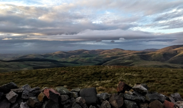
The view from my bed, which I suppose is why we do these mad things.
Just as I was finally getting my rocks in a row, a familiar grinning face popped over the edge of my bouldery boudoir. “Welcome to the Windy Gyle Hilton”, I told JR, “sorry the coffee shop is closed”. “I thought I’d better call in and check your air conditioning”. The teatime rain had arrived but she held a plastic bag over her head while telling me her day’s news. I felt very alone when she sensibly departed in the gathering dusk to find a less extreme campsite further down.
windy-gyle-cheviot-woman-hiker
My occasional trail buddy JR calling in to the Windy Gyle Hilton. Soaking wet, freezing cold, in pain, but still grinning.
I hunkered down out of the gale, it started to get dark. Then the daylight was suddenly resurrected at the last minute, treating me to a brief sun et blowière over Scotland.
windy-gyle-view-pennine-way
The last minute light show over Scotland. I took this photo while lying in bed, had I stood up I’d have been blown over.
windy-gyle-bivy-sleep-out
Settling down for the night, complete with my new hat.
It wasn’t that nice up there, if I’m honest, but out of the wind at least it wasn’t cold. So much so in fact that after an hour I had to untangle the whole caboodle in pitch darkness and remove an entire layer of clothing. It rained heavily in the night. A warm, wet, sheltered bivy brings only one outcome – I awoke at dawn in a claggy plastic bag full of condensation.
Day Seventeen – Windy Gyle to Kirk Yetholm
From my remote rocky eyrie on Windy Gyle, the dawn over The Actual Cheviot looked unpromising.
cheviot-dawn-pennine-way-northumberland
Dawn over The Actual Cheviot. Nothing to see here…
To be fair, I wasn’t looking my best myself…
cheviot hill bivy sleep out northumberland
An early awakening on Windy Gyle
I scuttled off, past the trig point at King’s Seat and up to Cairn Hill junction where I once more contemplated diverting up to The Actual Cheviot. Was this not an important milestone that must purposefully be attained?
Nah…
poor view from windy gyle pennine way
Goodbye to the Windy Gyle Hilton and its extensive morning views.
cheviot detour on pennine way northumberland
To The Actual Cheviot? Thanks, but no thanks…
pennine way cheviot northumberland
Auchope Cairn is (altogether now…) famous for extensive views.
I was pleased to attain a further milestone, the friendly little refuge hut that may actually have saved my life in a blizzard back in 1999.
pennine-way-auchope-rescue-hut
More hut cocoa at Auchope
One of the army instructors had told me how once in a similar blizzard he’d had to hole up in here with twenty young soldiers. Twenty of them, standing up like vertical sardines, all night. In that vein, I was pleased to see the Order of the Day had been posted…auchope-hut-cheviot-sign
With excellent timing a diabolical squall passed over, shaking and drenching the hut. I made more cocoa, later discovering that poor JR had been trudging down to KY in the teeth of the weather. It was my good fortune that it began to clear as I reached the top of The Schil.
pennine way schil views of scotland
Glimpses of Scotland from the Schil.
The Pennine Way’s high option into Kirk Yetholm presents you with one more punishing climb, but it’s worth it for the valedictory views.
pennine-way-high-kirk-yetholm
The last proper climb on the Pennine Way. Hard work at this point, but strangely exhilarating.
Then it’s more views all the way down to the legendary metropolis. Well, unless you’re walking down just an hour earlier when JR tells me she could see absolutely nothing.pennine-way-view-kirk-yetholm
So there we all were in the Border Hotel, all five of us, finishing the Pennine Way. Five?! Where did they all come from? Me and JR, an elusive Dutch couple and the hitherto unsuspected Melton Mowbray Mitch, Midlands Man of Mystery. The Mancunian baggage transferers and the luxury Aussies were on their way down too. This must be costing the pub a fortune in free halves but they’re much appreciated. I didn’t mention I was on my third. The Nag’s Head at Edale doesn’t seem to have joined in the party, so southbounders are at a disadvantage.
The Sheffielders were there too, having slept in the hut. One of them had fallen out with JR, his intrusive questioning crossing her comfort line. I was dismayed for my young friend. This should have been a time of celebration for her after achieving so much and for the last few days through considerable discomfort. She and I put the world to rights over our beers until the barlady had the presence of mind to call “there’s the bus”. JR had literally to run for it, on her bad foot. One companion spoilt her party, another nearly made her miss her ride home. Trail buddies, huh?pennine-way-border-hotel
I felt strangely at home.
Obviously the Border Hotel is not my ‘home’ and on this occasion it wasn’t even my destination. But as a man with no geographical roots other than a vague second-hand generic Englishness it’s an ephemeral joy for me to feel ‘at home’ anywhere. Moreover my real purpose on this Pennine Way had been largely attained. I had in fact felt ‘at home’ along almost all of this familiar trail, even though I was patently at no point along it in any way ‘a local’. Unlike Armitage I couldn’t bolt onto my Pennine Way the spurious objective of ‘walking home’, yet it felt as if I’d been walking my home.
According to Tim Ingold wayfarers are not locals but inhabitants. He writes: “wayfaring is neither placeless nor place-bound but place-making”. Wayfarers are “not failed or reluctant occupants but successful inhabitants”. In other words, The Way is made by The Wayfarer.
“Wayfaring, I believe, is the most fundamental mode by which living beings, both human and non-human, inhabit the earth”, writes Ingold. “For the wayfarer the world as such has no surface. Of course he encounters surfaces […]. And woven into their very texture and thence into the country itself are the lines of growth and movement of its inhabitants”.
The purpose of my wayfaring had been simply to grow and move, to inhabit the texture of my country.
My Pennine Way had not been a purposeful purchase or a tick off an adventurer’s list, but an authentic Way of Life. As long as we have breath to breathe and a Way to fare along, growth and movement can continue.
Hang on, what do you mean the Border Hotel wasn’t your destination?

See that round plaque by my right ear?
The Purposeless Pennine Way, September 2018.
1 Ingold, Tim, 2007. Lines: A Brief History. Oxford: Routledge.
PENNINE WAY – AN ENTERTAINING EXTENSION
Kirk Yetholm to Berwick, via Kelso and the River Tweed.
…in which I recall a Balsamic Border, the Cambusnethan Pippin, the Sticky Haggis Bandit, the Most Dangerous Place in England, the Tweed Dolphins and a welcome Barber’s Chair.
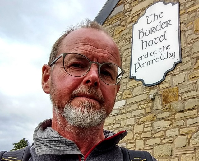
Pennine Way blogs are so often tales of pain and misadventure, you may be surprised to hear anyone might casually stroll onwards into Scotland after completing England’s premier long distance trail. In fact, if you walk The Way at the right pace for you and with sensible lightweight gear, by the time you get to Hadrian’s Wall you should be fitter than you’ve ever felt in your life. I’m no tough guy, but even in April 1999 when I’d no idea what I was doing and hence had a huge pack, feet rotting in ‘waterproof’ boots and frostbitten ears, I remember bounding into KY like a spring lamb and feeling I could have walked further.
What stopped me then was having to get back to the office. Only through pleading and unpaid overtime had I scored an extra three days’ leave over a standard two week vacation. In September 2018, retired, I had no such constraints. Good-oh.

I missed out on this vital selfie when I walked the SNT. Don’t think I’ll get away with sticking this one on that blog though – if I was just starting out I wouldn’t look so wild and fluffy. Perhaps.
When in May 2017 I set out to walk the Scottish National Trail my train was late and I missed the bus from Kelso to KY. Now I was back, with a chance to fill in this section. While lying in a plastic bag on the benighted, rain-lashed and gale-wracked summit of Windy Gyle, I’d randomly booked myself into an hotel in Kelso, on the tenuous grounds it allegedly had a sauna. For some reason this had appealed to me in the circumstances.
It then seemed a reasonable, if somewhat vague, plan to walk down the Tweed from Kelso to Berwick. I’d no idea whether this was actually possible, which added to the allure. Many things in my life have felt as if they ought to have been possible.
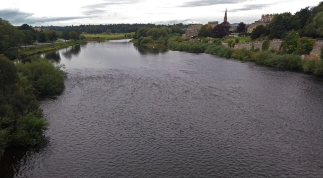
As it turned out, the SNT route from KY to the A698 at Crailing is a lovely walk, interesting, not too strenuous and with extensive views. No, really. It took me about seven hours at a very gentle pace with a long stop. Navigation is easy as you can download the directions and GPX points from Walkhighlands and you’re following the St Cuthbert’s Way which is popular and waymarked.
From Crailing you can then simply get a bus to Kelso. Ahem. That’s if you bother to work out the distance, research the bus times and, having correlated those data, get up early enough. The buses are not frequent. Having failed to do those things I ended up walking to Kelso, which took another couple of hours or so. This did feel like hard work but might have been more interesting had I chosen a different route option – see below.
Everyone in Kelso then told me there’s no path along the Tweed between there and Coldstream and that to try and freelance it at the height of the fishing season would make me extremely unpopular. Consequently I caught the bus to Coldstream from where on the English side there is a legitimate riverside path running twenty miles all the way to Berwick. The terrain is completely flat so if you got an early bus this could be done in a day, but I had two days to kill so that’s how long I took.
path from coldstream to berwick on tweed
Riverside footpath sign at Coldstream Bridge
Day One: Kirk Yetholm to Kelso
But first I needed to find somewhere to stay at KY, and when I realised I’d doubled my total accommodation spend for my entire Pennine Way by booking the following night’s hotel I figured this had better be camping. I’ve always been intrigued by Kirk Yetholm’s mysterious twin, Town Yetholm, and as the SNT passes that way I finally had an excuse to investigate.
It turns out Pennine Wayfarers can camp at a small caravan site with showers close to the village centre. There’s an excellent village shop with long opening hours and another very good pub. In fact, although I’d never have a bad word to say about the Border Hotel with their lovely staff and generous free halves, (whisper…) the food at the Plough Hotel round the corner was less pretentious and better value. Their Mac’n’Cheese was superb.
shop yetholm scotland
The really excellent village shop at Town Yetholm
You can walk the bus route past the eponymous Kirk and along the road, but the SNT takes you instead over the pixie bridge by the hostel and across the fields, which unless it’s soaking underfoot is obviously nicer.
scottish borders yetholm
Pixie bridge by Kirk Yetholm hostel.
scottish-national-trail-kirk-yetholm
This unadventurous path between Kirk and Town Yetholm is seriously the start of the Scottish National Trail to Cape Wrath. It does get a bit more Scottish.
Next morning I ambled off, along what after the rigours of the Pennine Way looked like a very easy country walk.
scottish national trail
It takes a while to gain any height, but when you do the views back over The Cheviot are quite something.
snt-views-back-kirk-yetholm1
The visibility wasn’t perfect but it was still strangely moving to look down and back at the Yetholms nestled in their cosy valley. Away to the right I could see the Schil, The Actual Cheviot and Windy Gyle; a whole different perspective on the Pennine Way.
Eventually you gain a bit of height on Crookedshaws Hill, Wideopen Hill and Grubbit Law which as well as being evocatively named form, I should think, one of the nicest short ridge walks in the Borders. Wideopen Hill provides, as the name suggests, genuinely extensive views. In fact this whole area is very scenic, although quite intensively farmed.
wideopen-hill-scottish-national-trail
The light wasn’t great, unfortunately.
kale-water-scottish-national-trail
Kale Water
The path descends to the pretty Kale Water, which I fancied might be something I could bottle and sell to Waitrose until I came across a friendly woman from New Zealand washing dog muck off her boots in it. As I’d met no one else all the way from KY, I made the most of a chance to chat but in fact this was just the first of a dozen international encounters. To my surprise the St Cuthbert’s Way turned out to be really quite busy, although people who walk it typically get up later than I do.
satellite-treevee-dish-aerial-scotland
The Scots love their satellite treevee.
scottish national trail morebattle borders
The views from Wideopen Hill would have been even more extensive two hours later!
Walking down into Morebattle the sun came out; looking back to Wideopen Hill I realised if I’d got up later I’d have had better views. Ah well. In compensation, Morebattle was an unexpected cornucopia of refreshment, not only is there a shop and a pub that does coffee and meals, even the church has been rebranded as the ‘St Cuthbert’s Coffee Stop’.
morebattle-church-coffee-shop-scotland
The St Cuthbert’s Coffee Stop. I can imagine a seventh century ascetic would have been pretty glad of a cappuccino.
This was a very sociable and indeed educational place. Somehow I ended up discussing naval gunnery with a retired Commander, then a lady Churchwarden kindly gave me a juicy and delicious Cambusnethan Pippin, one of the nicest apples I’ve ever eaten. I’d never heard of this beautiful eighteenth century variety, also known as the Scotch Redstreak, and had no idea there was such a rich and now once again thriving horticultural heritage in the Borders. English people think apples come from Kent or Herefordshire but it seems the Clyde Valley also has their ideal microclimate.
Morebattle shop didn’t sell pies or other portable savouries in order not to compete with the butcher a few doors down. This is all very well except when the butcher is away on holiday. I plodded on pieless. Nothing that ate hips, haws or crab apples would have gone hungry as the hedges everywhere were weighed down with autumn fruit.
scottish-national-trail-autumn-colours
The quantity of fruit in the hedgerows was astonishing.
Topping up my vitamin C with blackberries I bumped into a shepherdess in the bushes, which could have been fun in a fairy tale but in unromantic real life we just chatted about the weather and gin, a modern shepherdesses primary interests, it seems. I knew she was a shepherdess not because she was wearing a smock, carrying a crook and accompanied by winsome lambs, but because she told me so. She was wearing jeans and a fleece like the rest of us and carrying a Lidl bag which she was stuffing with industrial quantities of sloes, for the gin.
Cessford Castle, stronghold of the Kerrs, has a short but delightfully obscure Wikipedia entry featuring the words barmekin, escalade and fortalice. It also quotes the Earl of Surrey as observing in 1523 that “it might never have been taken had the assailed been able to go on defending”. Stating the obvious, one might think. Anyway, this is a striking ruin which, for hikers of a slightly disrespectful bent, would make an excellent leave-no-trace campsite. I mention this because back in 2017 had I set off along the SNT in the early afternoon as per plan I’d have needed to camp at more or less this point.
cessford-castle-scottish-national-trail
Cessford castle – most picturesque.
It was Saturday afternoon so the trail got busier and busier although everyone else seemed to be going the other way, towards Lindisfarne rather than Melrose. I suppose a bleak, wind-swept island in the North Sea has to be a more logical destination than a rather chi-chi little town with public transport, paninis and coffee shops.
scottish-national-trail-ferny-forest
Nice woods. Well, plantations.
In September these Borders woods are very rich in fungi, many edible. In my under-pied condition I began to wish that as I had a stove and a pan I also had some butter and a smidge of garlic.
scottish-national-trail-edible-mushrooms
Please don’t eat wild fungi unless you’re 100% sure they won’t kill you; some of them will.
Never mind, I thought, I’ll soon be getting the bus into Kelso, pie capital of the Borders.
scottish-national-trail-teviotdale-borders
Descending into Teviotdale, Peniel Heugh on the skyline.
I was really jolted to come upon, very suddenly, the exact spot at which I’d nervously ventured onto the Scottish National Trail, a year and a half previously. I’d never hiked alone in Scotland before then and I’d arrived at this unprepossessing portal jangling with anticipation and, frankly, fear. My stepping onto a 470 mile trail at this very point had been, I now discovered, etched into my memory, and I carry very few place-specific memories (which is why I took to writing trail blogs – this is my scrapbook).
Now the vividly recalled portal beckoned me with a strange magnetism. It was as if, having hiked all the way from Edale, this defined, continuous pair of trails had become my only home, my duty. To turn my back now on their reassuring linear jurisdiction seemed an arbitrary and foolish dereliction. Back to England – what was I thinking of? Cape Wrath in late October – hmmm – sounds great. I could so easily just carry on…
crailing scottish national trail
The unprepossessing portal, through which on my very own feet I’d previously set out upon this very trail, all the way to Cape Wrath. I found it strangely hard to turn away.
I remembered my lack of provisions and snapped out of it. I turned away from the portal and walked, more smartly and determinedly than I’d walked all day, up the road to Crailing.
Here I discovered that had I not spent so much time chatting to New Zealanders, shepherdesses, naval officers, churchwardens, girls’ hiking weekenders, shop ladies, serious beardy pilgrims in sandals, German castle buffs, random Americans and, to my surprise, once again the speedy Sheffielders who were by pure chance crossing my route, I’d just have caught the blessed bus. The next one was in two hours, more or less the same time it would take to walk to Kelso. Oh well, you’re either a walker or you’re not…
road-to-kelso-scotland
The first section of the A698 towards Kelso isn’t too bad to walk along as there’s a wide grass verge. Subsequently it gets a bit scarier.
The advantage of having chatted to so many people was I’d learnt there is a bridge across the Teviot at Kalemouth, after which allegedly I could then walk along an old railway line into Kelso. The issue was how to get there from the bus stop at Crailing. The shortest way is along the A698. A much nicer way would be to continue on the SNT along Dere Street to Jedfoot then switch onto the Borders Abbeys Way and follow that all the way into Kelso, but I reckon this would be at least 6 km longer than walking up the road from Crailing, quite a lot further on top of hiking all the way from KY.
A shorter alternative is to leave the SNT at the portal as I did and then at Crailing cross the A698 and from the west end of the village find the B6400 to Nisbet Bridge over the Teviot. Here again you could pick up the Borders Abbeys Way to Kelso. Lacking a proper OS map I wasn’t confident about this option, so I’m afraid I just walked up the road. A possible advantage of this otherwise unpleasant choice is that the Teviot Smokery at Kirkbank has a café. Sadly I arrived there at 3.35 and the ‘chef’ goes home at 3.30. Apparently you have to be a ‘chef’ these days to make a smoked salmon sandwich, or any other kind of simple sandwich, for a hungry hiker.
teviot-smokery-water-gardens-scotland
A view of the water gardens from the otherwise useless after 3.30 Teviot Smokery.
After crossing the Teviot at Kalemouth you encounter an annoying sign which suggests you could indeed have walked there up a route nicer than the A698. At this point you realise that this Borders Abbeys Way leaflet would be very useful. You might think St Cuthbert would equip his Coffee Stop at Morebattle with a few copies of it.
ormiston-borders-abbey-way-link
Slightly annoying sign on far side of Kalemouth Bridge. Ah well.
Anyway, you’re there now, so walk round the bend and then after the Old Ormiston station (now a private house) climb up onto the old railway (below).
old-ormiston-railway-line-path
I had no idea what that white ‘W’ waymarker meant. It means the Borders Abbeys Way.
The Borders Abbeys Way only follows this railway embankment for about a kilometre, then you encounter a confusing sign offering two routes to Roxburgh.
roxburgh-route-choice-signpost
Randomly, I plumped for the Old Railway option. I now think Borders Abbeys Way via Riverside would have been nicer and more interesting.
If you choose ‘via Old Railway’, as I did, you end up on an easy but boring walk all the way into Kelso. At Roxburgh a counter-intuitive change of direction takes you across the viaduct (below) but this is the only highlight and the subsequent dull and completely flat trail follows a long curve into a rather unfrequented part of town. With hindsight, I think the Borders Abbeys Way ‘via Riverside’ past Roxburgh Castle would be the more interesting and enjoyable of these two options.
kelso-via-roxburgh-viaduct-signpost
Counter-intuitive change of direction at Roxburgh
roxburgh-viaduct
Crossing Roxburgh Viaduct. Yellow arrow shows the perhaps nicer Borders Abbeys Way below, along the River Teviot.
It only remained for me to saunter into Kelso, tireder and later than I’d expected, and to check into the friendly but pricey Cross Keys Hotel, my end of trail treat. Here I found the sauna promised on bookingdotcom was a fib. Guests can access a sauna, but it’s in an affiliated fitness centre several blocks away. What?!
As in order to be able respectably to visit any place of refreshment in Kelso it was necessary for me on arrival immediately to wash my filthy trousers, that would have entailed scuttling through the streets in my shorts, to cries of ‘Andrew where’s your troosers?’ I didn’t bother. Instead I set to drying my trousers with a tiny hairdryer and generally reducing my smart little room to wet and grubby chaos.
hotel-before
Hiker’s hotel room – before.
hotel-after
Hiker’s hotel room – after.
It was a warm evening, which was lucky as the hairdryer was pretty useless and due to my overspending on the hotel it was necessary to eat Chinese takeaway on a bench in the square for my supper. I then went of course to Rutherford’s Micropub, where I did a general knowledge crossword in the company of a random drunk whose job was loudly to shout out completely unrelated answers to any clue. Me: “OK, how about ‘wife of Theseus’, five letters”. Random drunk: “Aaaarrgggh, mmhhggmm, a nautical one! Uueeuurrghhh, midshipman!” I dare say that’s how life’s long distance trail ends, among random company answering the wrong questions.
Day Two: Coldstream to Norham
Having ascertained from various Borderers in various states of intoxication that the existence of a footpath along the Tweed was mired in doubt and obscurity, not to mention actual mire, my first task the next morning was to buy an OS Map. On Sunday morning. For most of my life this would have been a fool’s errand, especially in Scotland, but nowadays Kelso is a hotbed of seven-day shopping; a friendly stationers didn’t just have the odd dusty map in a quiet corner, they were an official OS outlet with an impressive state-of-the-art cartographic offering.
kelso abbey in the scottish borders
Pretty gardens of Kelso Abbey
One thing that is very limiting on a Sunday is the buses. Monday to Saturday there’s a bus as early as 07.55, which makes walking the twenty miles from Coldstream to Berwick in a single day a doddle. On Sundays though the first bus seems to be at a much more leisurely 11.05. This suited me as I’d opted for the Cross Keys’ lavish buffet breakfast which I’d figured would feed me for the entire day.
Me and hotels don’t really mix, though. Dump me on a benighted summit in a plastic bag and I’m a lean, mean survival machine, put me in a respectable hotel and I turn into Paddington Bear. Having already reduced my room to a muddy shambles I managed to spill honey all over the breakfast table. Trying to wipe this up with the napkin merely produced a lichenesque encrustation of papery fluff everywhere. Trying to pick this off the table I spilt my coffee. I then got a dirty look from the waitress for pinching all the haggis, no laughing matter as she was six foot three in her hiking boots, with military-looking tattoos. I sneaked back out into the wilds, fearing I was now blacklisted throughout the Borders as the Sticky Haggis Bandit.
A man on the bus advised me to check out the plaque on Coldstream Bridge, recording where Burns famously scampered back into Scotland after two minutes in England then, rather than repairing to the Besom Inn for a restorative fizzy beer like any sensible Scot, insisted on kneeling and extemporising patriotic doggerel.
river tweed border england scotland
Looking East towards Berwick from Coldstream Bridge. This is some other plaque, not the one about Burns.
At this I’m afraid I just thought ‘what a poseur’. Burns, I meant, not the man on the bus. Mind you, who knows? He did have a guitar and a quite unnecessarily funky dog. The man on the bus, I mean, not Burns.
burns-plaque-coldstream-bridge-scotland
This is the Burns plaque, featuring ‘poetry’ of his usual quality.
england border river tweed coldstream bridge
Being English I had absolutely no intention of declaiming patriotic verse at this point. I just took a selfie.
coldstream bridge river tweed scotland england
Coldstream Bridge from the riverside path. Well, actually from one of the numerous salmon fishing paths that repeatedly lure you off the main footpath.
Considering that a walk along the romantic and historic border between two ancient kingdoms and along one of Britain’s mightiest rivers has a certain allure and could surely be marketed as a visitor attraction, one might expect to find an obvious and well-marked path all the way to Berwick. There may have been one at some point but as with so many English footpaths in a time of austerity, recent maintenance has been minimal. Also, to be fair, the banks of the Tweed are pretty variable in character and in fact intermittently vertiginous, necessitating detours. They’re also punctuated by salmon beats where people pay up to £275 + VAT per person per day to fish! Hence I suppose access for hikers may not be a priority for landowners. All in all, though you might think navigating along the bank of a blooming enormous river would have been straightforward I was actually very glad I had a map at several points.
river-tweed-path-northumberland
Some sections of the path are quite straightforward
river-tweed-bank-path-northumberland
Having survived the Pennine Way it’s a surprise to find that a stroll along a riverbank at sea level can be more hazardous than anything along that legendary upland trail. This vegetation disguises a vertical drop into a deep and powerful river. If you slipped on the wet grass while walking alone and wearing a heavy backpack, you could easily drown. I unclipped my waist and sternum straps along several sections like this, especially where they were overgrown with slippery Himalayan Balsam.
Approaching the River Till there’s an atmospheric ruined chapel which makes a nice spot for lunch if you don’t mind creeping across a bit of somebody’s field.
saint-cuthberts-chapel-northumberland
Pretty much all the old chapels in these parts seem to be called St Cuthbert’s and this one is no exception.
river-till-viaduct-northumberland
To get across the River Till you have to head up onto the impressive old viaduct. It’s astonishing how much civil engineering is now just standing around virtually unused up here. St Cuthbert’s Chapel is just left of centre, in the ploughed field. Confusingly, the invisible Tweed, split around an island at this point, is behind it, flowing off to the right. See what I mean about being glad of a map?
One blunders onward, occasionally confused, past Twizel, Kippie Island, Groat Haugh, Bendibus Island and Upsettlington. I’m not making any of these places up. Nor am I making up the virtually impenetrable Himalayan Balsam that blocks the path along several sections, filling the air with its cloying, nauseating scent. So unsettling was the sickening odour I kept thinking there was a branch of Lush hidden behind the trees.
himalayan-balsam-reiver-tweed-northumberland
This is, seriously, the path. A week or two later as well as the foul smell you’d have explosive seeds in your every crinkle and orifice; not always a pleasant experience.
It’s not just the blooms that stink, the crushed foliage is even worse. This becomes relevant because it’s also extremely slippery. Several times I ended up on my knees which was not only quite alarming given the proximity of a powerful river, it meant the terrible smell of the plant was ground into my long-suffering trousers.
tweed-bank-path-to-berwick
That darkness below me is water. Very slippery when crushed, the Himalayan Balsam again disguises a vertical drop into the deep river.
Finding myself involuntarily emulating Burns by kneeling at the Scottish border, I thought I’d better declaim some doggerel.
I blundered through the Balsam, along the mighty Tweed.
I blundered through the Balsam with its bonkers popping seed.
It filled the air with perfume foul
Its every bloom a lurid cowl.
I blundered through the Balsam, that loathsome stinking weed.
Burns, eat your heart out.
Despite the bad smell and the even worse poetry this was an easy walk. It was still early afternoon when I strolled into picturesque Norham which has an inviting looking pub, a useful public convenience and both a sensible village shop and a posh deli, on the right as you pass through towards the castle. Having an extra day to kill I’d planned to overnight here, so was pleased to find it’s also an extraordinarily friendly place, belying its historical claim to be ‘The Most Dangerous Place in England’. When I read the pointlessly destructive and wasteful history of border towns like this I despair even more that so many people at this point seem to want to roll back our hard won erosion of international frontiers.
border castle in scotland england northumberland
Norham Castle, spectacular location of many a desperate and bloody struggle in the bad old days when this was The Most Dangerous Place in England.
Assiduous research taking all of five minutes had told me I could camp at the Plantation Inn. Dutifully I entered the postcode into Google Maps and it took me over a load of boring fields to a random bus shelter on the A698 in the middle of nowhere. I phoned the pub and found it was miles in the other direction and a long way from the river, so I trudged back to Norham and went for a consolatory pint in the Mason’s Arms. I figured I’d try to blag an informal campsite somewhere in the village or, if all else failed, cross the Ladykirk & Norham Bridge into Scotland and wild camp legally back in that civilised nation.
norham-church-northumberland
Norham’s Norman church is worth a look with its massive graveyard and interesting Anglo-Saxon carvings.
I rapidly twigged that the Mason’s is a strong candidate for Friendliest Pub in England and also does brilliant and good value food. For some reason I became strangely reluctant to leave its vicinity. Everyone in there put their heads together to think of a possible campsite and phone calls were kindly made, to no avail. Meanwhile strong and surprisingly unanimous hints were dropped that a BnB a few doors away might be a good bet. I looked online, there was a vacancy at £45.
An infallible test of whether a BnB owner is a kindly generous soul is when you appear on their doorstep brandishing your phone and saying ‘Hello, erm, ha ha, I see online you have a vacancy, I was wondering whether if I turned up in person we could split the commission? >hopeful grin<‘. The lovely Sheila laughed merrily, ‘£42.50 then, which room would you like?’ ‘Whichever’s easiest for you, sorry about my smelly trousers’. ‘I think my dogs and children spread most of that Balsam!’
Abbotsford BnB is absolutely lovely, the room was twice as big and twice as nice as the one I’d paid twice as much for the previous night and the breakfast was amazing. Sheila’s home-made preserves are legendary and you even get delicious Chain Bridge Honey. Supper in the Mason’s was delicious too; all in all, after a discouraging start my stay at Norham was a great success.
masons-arms-pub-norham-northumberland
A quite moment in the very friendly Mason’s Arms, fishing rods on the ceiling.
Day Three: Norham to Berwick upon Tweed
This is a pretty short walk so I lingered over my superb breakfast and wandered around the church and castle, both well worth a visit. The path is then straightforward, though again intermittently balsamic, as far as the Horncliffemill Burn where there’s a bit of confusing climbing up and down around Horncliffe village.
tweed-bank-path-northumberland
Slightly confusing climbing up and down around Horncliffe.
Also the map runs out. Oh dear. Luckily this last bit down the river to Berwick is easy to navigate, although not necessarily simple to walk as some of the path is pretty derelict.
union chain bridge river tweed northumberland scotland
The Union Chain Bridge, an international icon of civil engineering history, the oldest surviving iron suspension bridge in Europe and the first designed for vehicles. Now closed to vehicles, as it’s somewhat disintegrating.
The Union Chain Bridge is a remarkable and historic thing, built by the famous Samuel Brown whose company for a hundred years made all the chains used by the Royal Navy. It’s in a sad state at present, but there’s an appeal ongoing to get it fixed up in time for its bicentenary in 2020.
wild-flower-meadow-northumberland
The friendly owner of a cottage here was very proud of his wild flower meadow. I didn’t like to ask how exactly Cosmos counts as ‘wild’ in Northumberland.
Downstream towards Berwick, quite suddenly you realise that the river has imperceptibly become tidal, and hence the vegetation has changed.
riverbank-path-tweed
Looking back along the mighty Tweed, shortly before it becomes obviously tidal.
tidal river tweed near berwick
A little further down, the river has become tidal.
Even more suddenly, after crossing what looks like just another field and pushing through a hedge you suddenly find yourself having to cross the A1! Not the busiest section of the entire A1, I grant you, but still a shock to the system. The path on the far side isn’t obvious either, you need to spot a stile a little way to the south.
berwick-on-tweed-northumberland-A1
After nearly three weeks of peace and quiet I have to cross the actual A1!
berwick-A1-stile
The not very obvious stile on the far side of the A1.
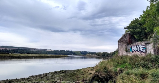
The riverbank starts to get a little urban in places.
Even more suddenly, after blundering up what you think is just another rise along the endlessly rising and falling riverbank, out of nowhere appears the enormous railway bridge standing incongruously above a field of barley. You’re actually in Berwick upon Tweed, journey’s end.
berwick-tweed-railway-bridgerail-bridge-at-berwick-tweed
And, on walking into town, you realise that one of the best things about this route is that it dumps you literally on the doorstep of The Barrels, at the far end of the old road bridge.
berwick-old-road-bridge
See that white van? The Barrels pub is just there, on that corner.
It was early afternoon so after a refreshing pint and booking into the hostel I had plenty of time to see the sights of Berwick, which are many and very interesting. I ended up all the way out on the end of the harbour breakwater, at the foot of the lighthouse, waving my little old feet that had carried me all the way from Edale over the grey and grumpy North Sea.
berwick-harbour-path
Walking out to the pier to look for Dolphins.
berwick-harbour-north-sea
As far north-east as this walk is going to get. I don’t mind wet feet but I draw the line at the North Sea.
I was very lucky to encounter on the end of the pier Lisa from Berwick Dolphin Watch who was not only friendly and informative but more to the point equipped with binoculars. After a long wait in an increasing cold wind we spotted half a dozen individuals feeding on the incoming tide, a little disappointing as the resident pod now has over fifty animals, but still, real live Dolphins! Not what you expect as the climax of the Pennine Way.
Between you and me, though, I was secretly disappointed the famous Tweed Dolphins weren’t actually woolly and checkered. They were just kind of grey and shiny, like regular Dolphins.
berwick-harbour-light
Berwick harbour in poor but interesting light
berwick-harbour-beach
Berwick beach. Yes, it has a beach!
And after all that, having walked about three hundred miles, you may be wondering why, when I patently have no hair worth barbering, I’d been looking forward to sitting in a barber’s chair…barrels-berwick-barbers-chair
This is why. Cheers!
Scottish National Trail – Overview
With just two minor snags, I more or less completed the Scottish National Trail. I found it fairly straightforward, though obviously it’s a long old hike and I was helped by the most walker-friendly Scottish spring weather in living memory.
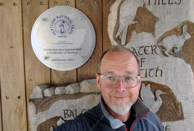
The SNT is nowhere waymarked, these plaques are the only evidence of its existence. I haven’t quite mastered the art of the selfie, what a silly expression!
This trail is surprisingly manageable and almost overwhelmingly interesting. In fact I’m still slightly reeling from all I saw, how much I learnt and how it’s broadened my horizons. The first part of this post outlines the basic practicalities of hiking from Kirk Yetholm to Cape Wrath, a total of around 470 miles. The second half is a summary of my itinerary, which you can jump to by clicking here.
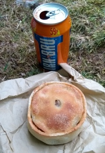
Adapting to local resources…
The Scottish National Trail was originally mashed up from sections of other trails by Cameron McNeish. His coffee table book Scotland End to End narrates his pathfinding walk along it, in his usual colourful, enthusiastic style.
This book isn’t a trail guide but a souvenir, readable and entertaining with great photographs, although it could do with a few more of the latter and their print quality isn’t great. I hope McNeish gets a chance to tidy the book a little for a second edition, it reads as if it was finished in a slight hurry and the ‘directions’ are a bit redundant as you’d never carry such a bulky tome in your rucksack. You’ll want the book as a keepsake once you’ve walked the trail, but it isn’t your primary source of information for planning.
More practical and in fact the sine qua non enabling resource for the Scottish National Trail is the Walk Highlands website, which provides not only mapping resources but comprehensive directions and downloadable GPX files. For each day I made a laminate of their directions (heavily edited) augmented with notes, stripmaps and detail maps from their website of tricky looking bits. The Walkhighlands route differs in a couple of places from the route in McNeish’s book but their directions worked perfectly for me, a Scottish hiking newbie.
Laminates are heavy so I posted a bunch of them ahead and threw each day’s sheet away as I went, which was slightly heartbreaking after the work I put into them. As I moved onto the Cape Wrath Trail, for which I had a guidebook, my laminates became sparser with 3-4 days on each sheet.
The GPX files were 100% reliable and quickly became my default navigation resource. I used them in the free mapping app OsmAnd, paying about two quid for the contour lines plugin which was invaluable. Lazily, I ended up not bothering with paper maps at all, which I know is not really the done thing in such remote country.
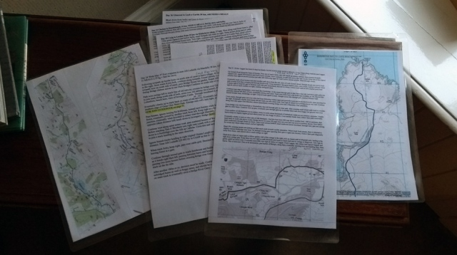
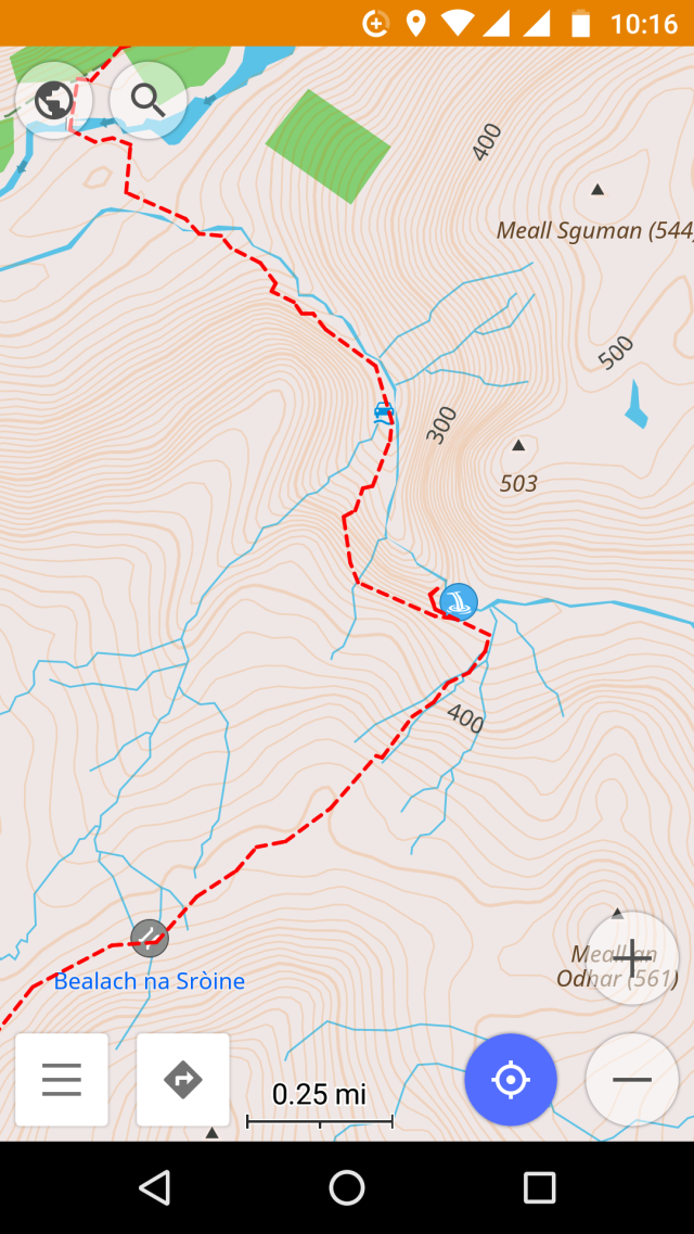
Phone screenshot showing GPX waypoints from Walk Highlands imported into OsmAnd. This is the Falls of Glomach, where I was particularly glad of being shown the way. I found OsmAnd completely reliable, it needs no phone signal and is virtually free, the contour lines plugin cost £2.09, I think. Set it to store its maps on your SD card before you download them, they’re huge files.
In my defence, the Scottish National Trail is not Munro-bagging but a very long scenic walk through glens, over the odd bealach, along forestry trails, canals and rivers. There are only two summits, one at the start and one at the end.
After my phone battery issues in Wales I’d invested in a new Moto G5 phone which gave me three days’ battery life in airplane mode with Android Battery Saver. This was also my camera as well as my phone and Internet and I carried a spare battery. Why people carry separate GPS’s and cameras when a smartphone does the lot is beyond me.
I must admit, though, there were days when my phone got worryingly wet. My ‘waterproof’ case leaked after a week and I ended up using sandwich bags as usual. Another time I’d consider a more water resistant phone, although the advantage of the Moto G5 is that it’s dual SIM, so pretty much anywhere other than Cape Wrath and Bynack Lodge you’ve a chance of signal on one side of a hill or the other.
Obviously I carried a compass and whistle and in the most remote sections I had Plan B’s (acquired from OS maps in Norwich library) noted on my laminates. I’d have liked to carry OS maps for context and flexibility, but the expense and logistics of acquiring all the maps for the 470 mile trail were prohibitive.
I posted ahead a copy of Iain Harper’s Cicerone Guide Walking the Cape Wrath Trail, mainly for the maps which were useful (and which I should have studied more carefully at Breabag Tarsainn, among other places 😉 ) For the SNT you can throw the first third of this book away, you don’t join it until page 71. With hindsight I might have bought the Harvey CWT maps instead, for their wider context. You don’t really need the book directions if you have the Walk Highlands directions, but then you don’t have to spend days editing the book as it’s already pretty compact.
If I was doing a quick, ultralight Cape Wrath Trail starting from Fort William now, I’d probably just carry the book, a compass and my phone with the GPX files. But that’s easy for me to say, I know the way. Maps give a better understanding of the landscape and you don’t have to keep asking other walkers lame questions like ‘what’s that mountain?’ and ‘is that the sea?’ Too much information is better than too little, especially as the CWT passes through remote country, much of it rough and trackless, and none of it is waymarked. Personally I hope it stays like that.
The WalkHighlands directions were almost 100% reliable, and at least one of the very few substantive typos I found has since been corrected. When I downloaded them early in 2017 several discouraging user reports had me worried, but I found they bore no resemblance to conditions on the ground. For example in Glengarry users wrote of very hard terrain and impossible river crossings. In fact now you just follow a bulldozed forestry trail all the way to Garrygualach, where there’s a smart new bridge over the previously difficult burn. I see that now (June 2017) these directions have been updated which is impressive and reassuring.
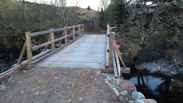
New bridge at Garrygualach (May 2017)
On the downside, the original WalkHighlands directions are far too wordy for practical use on the trail. I had to spend a long time editing them into a concise format suitable for laminating. I’ve raised this with them but they’re unrepentant, and they don’t want me to make my edited version available to you, sorry. Still, they’re a great resource that must have taken a lot of effort to create, they’re actively maintained and are provided free of charge, so ‘thank you WalkHighlands’, I say.

Ice inside tent!
Ideally you want to reach the Highlands in mid-May before the midges, but the SNT is a long hike and spring is cold in Scotland especially at night, so your time window for lightweight backpacking is short. I set out on April 11th and was at Cape Wrath on May 18th just as the first few midges were emerging. I was exceptionally lucky with the weather but still had to trudge through snowstorms and on more than one morning I awoke in a tent full of ice.
To camp in Scotland in April even on a low-level trail like this you need to be equipped for sleeping out at zero Celsius, or in my case as I sleep very cold, somewhat below.
There are also sections of this trail where you need to carry non-trivial amounts of food. Twice my plan showed I needed to carry eleven meals and once eight meals. I allow 250g of dry food per meal, so that was up to 2.75kg extra pack weight.
To hike 450-odd miles in one go you must from the outset commit to walking light and nimble. My base pack weight was 10 kg including waterproofs, tent and a three season synthetic sleeping bag but not water or food. My pack was a 600g vintage GoLite bought for £48 on eBay. Contrary to advice in guidebooks etc. I wouldn’t consider walking this trail in heavy boots, it beats me why anybody does this. Of course you need boots if you’re climbing Munros, but this is long distance trailwalking, a completely different kettle of feet.
Most people I met on the Cape Wrath Trail walking in traditional boots had blister issues – some had shocking open wounds. Some were also deeply fatigued from lugging packs of twenty kilos or even more, with an additional kilo of permanently wet leather dragging on the end of each leg.
Meanwhile, as heavily-booted hikers despaired of their foot rot and in several cases gave up, I skipped along for 450 miles like an irritating pixy in my Salomon X-Ultra Prime mesh shoes, the burn water flowing through them keeping my feet cool and clean. On cold rainy days and on long stretches of boggy ground I wore Sealskinz waterproof socks.
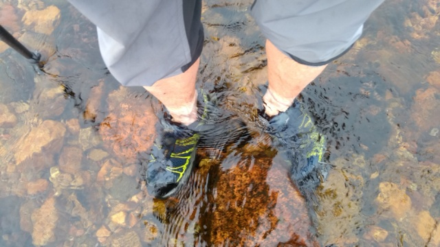
Mesh shoes are what you want for wading rivers. This is the dreaded Garbh Allt at the north end of the Cape Wrath Trail, which on this day was a pussycat, I paddled around in it just for fun. Two days later after heavy rain it was impassable. Scottish rivers are like that, which is why you carry a tent, and have ‘spare day’ in your schedule.
Unsurprisingly, when I got to Cape Wrath these shoes had worn out, but by then they’d done over seven hundred miles of rough trail walking in total and I’ve just bought replacements for seventy quid. Although the shoes were worn in, a full pack changes your gait and I did have minor blisters on my little toes in the first week; I just broke out the Compeed and carried on.
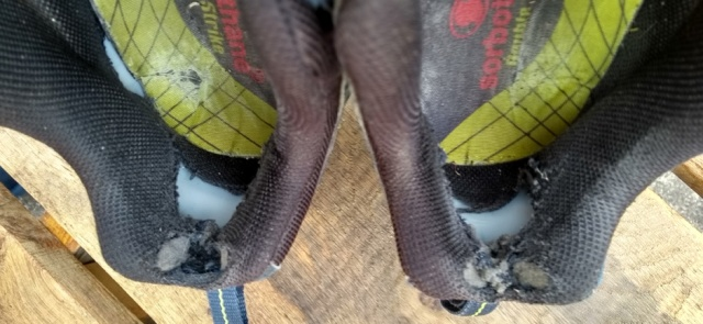
Oh dear, poor things, 700 miles on the clock. Those Sorbothane insoles have had it too, but then they’ve done well over a thousand miles including two Pennine Ways and the SNT.
I followed the same basic pattern as on the Pennine Way, four or five nights of camping then a hostel or BnB to shower, wash clothes and dry out. My income is modest so camping was essential, mostly wild camping not just to save money but because I keep hikers’ hours and sleep better in peace and quiet. The most I paid for a BnB was £50, but that was a more like a country hotel and totally worth it, especially as it snowed heavily that night and the breakfast was vast and delicious. Hostels were around £18-£25.
Generally BnBs were excellent value and the hostels were great too, although a couple were more geared to trendy youths on coaches than to filthy trailwalkers with wet tents. Above all, Scottish people were universally kind and friendly, even in the most unlikely-looking towns I was amazed how they all seemed to have time for a stranger. Short holidays in Scotland have never been enough for this attitude to sink into a dour, suspicious Englishman but now after six weeks up there I think I’m something of a changed man!
Hardly anyone I met in Scotland had heard of the Scottish National Trail and I didn’t meet or hear of anybody else trying the whole thing. As it takes an average walker five weeks (I allowed six) I suppose that’s not surprising. I was surprised how busy the West Highland Way was, even in early spring, and relieved that the SNT only spends a single day on that very popular trail before diverting onto the quieter Rob Roy Way.
Otherwise, it was only once I’d reached the Cape Wrath Trail that I started to meet and mingle with other through-hikers as I’d done on the Pennine Way. Unlike on the PW, though, most were from overseas. Elsewhere, I walked through endless miles of exceedingly remote landscape without encountering another soul.
It was obvious that long sections of the trail would normally be much, much wetter. Apart from some very cold nights, a few dreich days and a spot of bad luck with snowmelt in the Cairngorms, my biggest problem weatherwise was sunburn!
Here’s my full itinerary, both planned and actual.
I walked the Scottish National Trail (most of it) in 37 days, of which four were rest days and the last three an eccentrically slow amble over Cape Wrath. As it turned out I could have come home a week sooner, but other than in the Cairngorms I was exceptionally lucky with the weather. This trail would be harder and slower in normal conditions.
I planned around a rough average of 30 km a day, being less ambitious on what sounded like tougher sections. I’ve left in my original notes on food. The first week’s schedule was constrained by accommodation bookings made long in advance. I’d done this because it was Easter, so I’d figured everywhere would be very busy. In fact I could, and should, have been more flexible.
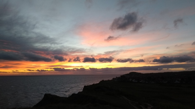
Not Scotland but North Norfolk, dawn on the way to Sheringham station. In order to get to KY in the early afternoon, I pushed through woods and stumbled along clifftops in pitch darkness. Then the train broke down anyway. Always have flexibility in your schedule if trains are involved!
Day 1, April 10th. By train to Berwick on Tweed. PLAN: Bus to Kirk Yetholm via Kelso. Walk 10 km to Morebattle. Supper Templehall Hotel Morebattle. Wild camp somewhere west of Morebattle. ACTUAL: I missed the last bus to KY as my train was three hours late into Berwick, hence I had to stay at Kelso. I’ll never be able to claim I walked the entire Scottish National Trail!
The River Tweed at Kelso. The tall house with the chimneys is the BnB, actually a small and beautiful country hotel aimed at salmon fishing types where having missed the last bus to KY, I got a last minute room online for £40.
Day 2, April 11th. PLAN: Morebattle – St Boswell’s ~ 32 km. Lunch Harestanes Visitor Centre,wild camp by Tweed opposite Dryburgh Abbey. ACTUAL: I got the Hawick bus from Kelso, picked up the trail at Crailing and wild camped in the Eildon Hills, which were blooming breezy.
The River Tweed on the St Cuthberts Way, Eildons behind.
Day 3, April 12th. PLAN: St Boswell’s – Brown Knowe via Melrose 28 km. Breakfast at Melrose and BUY 3 MEALS 0.75 kg. Wild camp on Brown Knowe 55.581, -2.975. ACTUAL: I wild camped in a more sheltered spot on the Southern Upland Way, lower down and somewhat past Brown Knowe which was very exposed in a freezing wind.
The Three Brethren, on the Southern Upland Way, Eildons behind.
Day 4, April 13th. PLAN: Brown Knowe to Peebles via Traquair 26 km. Lunch Cardrona village shop. Camp at Rosetta Holiday Park near Peebles. ACTUAL: a long and lavish breakfast at Cardrona, then as plan.
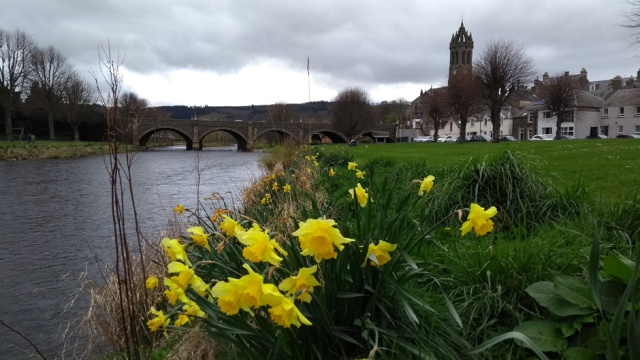
Peebles
Day 5, April 14th. PLAN: Peebles to the Bore Stane 30 km. Via shops at West Linton and supper at Carlops (Allan Ramsay Hotel). Wild camp near the Bore Stane. ACTUAL: as plan, except that the pub was too posh for supper, they charged me eight quid for a ham sandwich! Supernoodles for me.

Wild camped by the Bore Stane, a perfect sheltered site but another cold night.
Day 6, April 15th. PLAN: Bore Stane to Ratho, 27 km. Via Balerno (shops BUY 3 MEALS .75 kg) and Slateford. Camp at Linwater Caravan Park. ACTUAL: as plan, an easy day with two lavish meals.

Union Canal near Ratho
Day 7, April 16th (Easter Sunday). PLAN: Ratho to Falkirk via Linlithgow 34 km. Lunch at Linlithgow. Rosie’s Bed & Breakfast, 115 Oswald St, Falkirk. ACTUAL: as plan and very easy.

Falkirk Tunnel
Day 8: April 17th. PLAN: Falkirk – Twechar 21 km. Camp at Spotty Dog Campsite, Twechar. ACTUAL: as plan. This campsite was minimal, to say the least.

Frosty morning at Twechar
Day 9: April 18th. PLAN: Twechar – Milngavie 18 km then bus or train into Glasgow to stay with friends. ACTUAL: after breakfast at Kirkintillloch McDonalds I just carried on along the towpath right into the centre of Glasgow, which was easy walking and very interesting.

On the way into Glasgow
Day 10: April 19th. Day off in Glasgow, very nice too.

Glasgow School of Art
Day 11: April 20th. PLAN: Glasgow to Muir Park Reservoir via bus/train to Milngavie and supper at Drymen (pub 19 km) 24 km. Wild camp near Muir Park reservoir. ACTUAL: I had lunch at the Beech Tree Inn, bought pies at Drymen and camped in a more sheltered site beyond the reservoir, which is exposed and boggy.

Another totally obscure campsite!
Day 12: April 21st. PLAN: Muir Park Reservoir to Callander via Aberfoyle (lunch and BUY 2 MEALS 0.5 kg) 29 km. Wild camp somewhere outside Callander. ACTUAL: as plan.

Between Aberfoyle and Callander things finally start to look quite Scottish.
Day 13: April 22nd. PLAN: Callander to Comrie 27 km. Chippie at Comrie. BUY 5 MEALS 1.25 kg. Wild camp outside Comrie. ACTUAL: Starting to find these days fairly easy, I camped quite a way past Comrie.
Day 14: April 23rd. PLAN: Comrie to Loch Freuchie 30 km. No facilities. Wild camp at Loch Freuchie. ACTUAL: Loch Freuchie is sheep country with nowhere polite to camp, I camped in a wood further on.
Day 15: April 24th. PLAN: Loch Freuchie to Aberfeldy 20 km. BnB at Aberfeldy, Balnearn House, Crieff Road, PH15 2BJ. ACTUAL: as plan, and very nice too, superb breakfast.
Day 16: April 25th. PLAN: Aberfeldy to Blair Atholl via Pitlochry (lunch). 29 km. Camp at Blair Atholl or Bridge of Tilt. ACTUAL: At Aberfeldy it started to snow and the forecast for the next night was extremely cold, consequently I cut this day short and booked myself into the excellent SYHA Hostel at Pitlochry for the night instead.
Day 17: April 26th. PLAN: Rest day at Blair Atholl. BUY 8 MEALS 2 kg. ACTUAL: Pitlochry to quite a way up Glen Tilt, where I wild camped.
Day 18: April 27th. PLAN: Blair Atholl to Bynack 27 km no facilities. Wild camp near Bynack. ACTUAL: I walked up Glen Tilt in continuous heavy rain to Bynack Lodge where unfortunately due to the rain and snowmelt I couldn’t get across the Bynack Burn. Being alone and lacking experience to judge when the rivers might fall again I turned back towards Blair and ended up wild camping again back in Glen Tilt.

Not a river, this is the path!
Day 19: April 28th. PLAN: Bynack to Glen Feshie, 21 km, no facilities. Wild camp or bothy at Glen Feshie. ACTUAL: I trudged and hitched back down Glen Tilt and got the train to Kingussie where with slight difficulty I found a BnB room.

BnB after two nights in the Cairngorms.
Day 20: April 29th. PLAN: Glen Feshie to Kingussie, 24 km. BUY 7 MEALS 1.75 kg. BnB at Kingussie, Greystones, Acres Road, OH21 1LA. ACTUAL: a nice day off at Kingussie attending the Local History Festival. Greystones BnB is truly remarkable.

BnB after a nice day off at Kingussie!
Day 21: April 30th. PLAN: Kingussie to Laggan 24 km. Wild camp somewhere near Laggan. ACTUAL: Back on plan, in fact I camped quite a bit further up Strathspey.

Estate bothy in Glen Banchor, East Highland Way.
Day 22: May 1st. PLAN: Laggan to Blackburn of Corrieyairack ~ 35 km. Bothy at Blackburn of Corrieyairack NH 3817 0289. ACTUAL: as plan, except that having walked more like 35 km the day before I was at the bothy by 2 pm!

Blackburn of Corrieyairack bothy.
Day 23: May 2nd. PLAN: Bothy- Fort Augustus ~ 5 km. BUY 11 MEALS 2.75 kg. Hostel at Fort Augustus, Morag’s Lodge, Loch Ness, Bunoich Brae, Fort Augustus PH32 4DG. ACTUAL: this planned rest day at Fort Augustus ended up coming rather soon after the unplanned rest on day 20.

Loch Ness at Fort Augustus
Day 24: May 3rd. PLAN: Fort Augustus to Allt Ladaidh via Mandally 28 km. Wild camp in forest near Allt Ladaidh grid reference 230 003. ACTUAL: Glen Garry is hopeless for camping due to the tree felling. I was lucky to find a pitch eventually at Garrygualach, a long day!

A tiny scrap of flat ground among the forestry at Garrygualach. Osprey fishing behind.
Day 25: May 4th. PLAN: Allt Ladaidh to Cluanie 29 km. Possibly Cluanie Inn for dinner. Wild camp past Cluanie. ACTUAL: arriving at the friendly Cluanie Inn well ahead of plan I used their WiFi to book a bed at the amazing Alltbeithe Youth Hostel.

Approaching the remarkable hostel at Alltbeithe (Glen Affric).
Day 26: May 5th. PLAN: Cluanie to Morvich, 26 km. Morvich Caravan Club site, Inverinate. ACTUAL: a nice short day from Alltbeithe along the Affric – Kintail Trail, I was at Morvich by 2 pm.

On the Affric – Kintail Trail west of Camban bothy.
Day 27: May 6th. PLAN: Morvich to Maol-bhuidhe, 23 km. No facilities. Bothy at Maol-bhuidhe. ACTUAL: as plan, surviving the long-dreaded Falls of Glomach.

One of the better bits of the path looking back to the Falls of Glomach. A head for heights is advantageous here, sadly I don’t have one!
Day 28: May 7th. PLAN: Maol-bhuidhe to Craig, 24 km. Gerry’s Hostel, Craig Achnashellach, Strathcarron. ACTUAL: as plan. Gerry’s is great!

The beautiful and isolated Loch Calavie
Day 29: May 8th. PLAN: Craig to Lochan Fada, 29 km. via Kinlochewe (17 km, shop) BUY 6 MEALS 1.5 kg.+ fuel. Wild camp at Lochan Fada. ACTUAL: as plan.

Wild camped at Lochan Fada, Slioch behind.
Day 30: May 9th. PLAN: Lochan Fada to Shenavall, 16 km, no facilities. Bothy at Shenavall. ACTUAL: as plan, the bothy was very busy.

Shenavall Bothy
Day 31: May 10th. PLAN: Shenavall to Clachan, 19 km. Dinner at Clachan. Booked TESCO DELIVERY, 11 MEALS at least 3 kg food total also gas/meths for stove. BnB 2 nights with dinner, Clachan Farmhouse, Clachan, Lochbroom. ACTUAL: as plan. Clachan farmhouse is lovely.

Towards Loch Broom from Clachan Kirk
Day 32: May 11th. PLAN and ACTUAL: Rest day at Clachan Farmhouse.

Looking back to Clachan from Inverlael forest, An Teallach behind.
Day 33: May 12th. PLAN: Clachan to Knockdamph 22 km. Knockdamph bothy (has stove). ACTUAL: I got to Knockdamph pretty early so pushed on to the Old Schoolhouse bothy which turned out to be much nicer.

Old Schoolhouse bothy at Duag Bridge
Day 34: May 13th. PLAN: Knockdamph bothy to Loch Ailsh, 27 km. Bar lunch at Oykel Bridge Hotel, wild camp at Loch Ailsh. ACTUAL: I was at Loch Ailsh by late morning. In a fit of madness, I pushed on all the way to Inchnadamph where having got lost and then jogged through pouring rain to beat competitors, I bagged the last bed in the excellent hostel.
Loch Ailsh
Day 35: May 14th. PLAN:Loch Ailsh to Glencoul bothy, 27 km. Bothy at Glencoul (fire). Push on to Glendhu + 6 km if supplies low, (fire). ACTUAL: I got even madder! A bloke at the hostel claimed heavy rain was forecast for May 15th and hence I’d never get across the Garbh Allt. Trying to beat the forecast rain, I yomped all the way from Inchnadamph to the River Laxford, around 40 km, phew!
Looking back, not without regret, at Glencoul bothy.
Day 36: May 15th. PLAN: Glencoul bothy to Loch a’Garbh, 30 km, very tough, no facilities. STILL MUST HAVE 4 MEALS, at least 1 kg of food. Wild camp at Loch a’Garbh. ACTUAL: Loch Stack to Sandwood Bay, where despite ominous skies the forecast rain still held off until the morning and I had the place to myself, not to mention a massive stock of food.

Sandwood Bay
Day 37: May 16th. PLAN: Loch a’Garbh to Sandwood Bay, 20 km. Via Badcall (shop, 10 km) lunch at shop and BUY 3 MEALS + treats, ~1 kg. Wild camp at Sandwood Bay. ACTUAL: being already at Sandwood Bay, I had a lie in as the forecast rain finally arrived, then strolled to the nearby bothy at Strathchailleach.

Strathchailleach Bothy, or Sandy’s House
Day 38: May 17th. PLAN: Sandwood Bay to Cape Wrath, 13 km. Ozone Cafe at Cape Wrath Lighthouse can provide informal accommodation. ACTUAL: Strathchailleach Bothy to Cape Wrath where I spent the day in warm sunshine and the night camped on the cliff top, supporting the Ozone Cafe by buying lunch, dinner and breakfast.

At Cape Wrath, Britain’s most northwesterly tent!
Day 39: May 18th. PLAN: Spare day. ACTUAL: Minibus and ferry to Durness, camped at Sango Sands campsite and ate in their excellent pub. The minibus and ferry can be unpredictable, allow a whole day to get off Cape Wrath.

An unfeasibly small ferry!
Day 40: May 19th. PLAN: Spare day. ACTUAL: explored around Durness, a nice little place. To see Scottish Primrose I ended up walking at least 15 km.

Just call me a plant twitcher…
Day 41: May 20th. PLAN: Heading towards Inverness. ACTUAL: on Saturdays the minibus from Durness goes all the way through to Inverness, where I bought new clothes (!) and stayed in the excellent SYHA Hostel.

Sightseeing at Inverness
Day 42: May 21st. PLAN: At Inverness. Bazpackers Hostel, 4 Culduthel Road, Inverness, IV2 4AB. ACTUAL: as plan, and very interesting too although one day in Inverness is quite enough to see the sights. Day 43: May 22nd: Home on the first cheap train!
The Hebridean Way
Cycling the length of the Outer Hebrides has been a recognised exploit among our pedalling friends for a while and in 2017, building on success, a complementary walking trail was inaugurated. Officially this runs from the Community Centre on Vatersay to Lews Castle at Stornoway, a modest amble of 247 km (155 miles).
It’s then another 48 km to the Butt of Lewis, but who wouldn’t want to walk to what’s allegedly the UK’s windiest place? Unmissable. When I arrived on Barra it was blowing a wild enough hoolie and lashing down with rain to boot, hence I obviously decided to further extend my Hebridean Way experience to the southernmost point of the inhabited islands at Vatersay South Beach. Who wouldn’t?
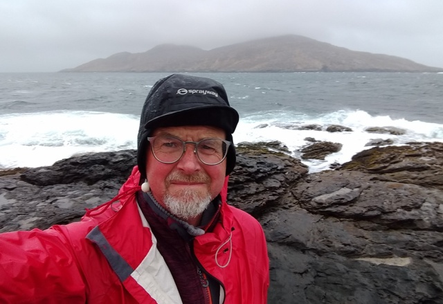
On Vatersay, at the southernmost point of the continuously walkable Outer Hebrides. Sandray behind.
All in all, I walked around 300 km (188 miles). The trail is waymarked, excessively in some places, less impressively in a few other places where you could really do with waymarks. Smart, expensive footbridges have been installed and miles of raised turf path built – a huge effort. A Cicerone guide (Walking the Hebridean Way by Richard Barrett) has been published and LDWA members can download GPX waypoints. There’s very little elevation and because the islands are quite small the trail is rarely far from roads, along which little buses scuttle with surprising frequency. Other than on West Harris, mobile signal and Internet are amazingly good. The people everywhere are pleased to see walkers and completely delightful. What’s not to like? Ahem – the weather?

Leaving Oban harbour, a bit worried about the weather forecast – 40 mph gusts!
Getting to the Outer Hebrides is itself a bit of an adventure. You can fly to Barra if you don’t care about your carbon footprint, or indeed your beach wheelprint. People come from all over the place to experience the world’s only scheduled flight that lands on the sands. Personally I’d get the train from Glasgow to Oban along the West Highland Line, which is famous – of course – for extensive views.

The West Highland Line is famous for extensive views.
At Oban one embarks, rather romantically, upon the Caledonian MacBrayne ferry to Barra, perhaps wondering why, rather than the small ferries that ply around the Inner Hebrides, this one appears to be a large sea-going ship.

Catch the morning train from Glasgow and normally you get a couple of hours at Oban to enjoy the lunchtime catering, which includes several seafood places and reputedly excellent fish and chips.
Don’t rely on the CalMac timetables, things change in the Hebrides. Check the sailing time for your actual day of travel and if possible buy a ticket in advance via their website; it’s very easy. Due to a ship shortage, my sailing had been brought forward two hours. Check-in was due to close seven minutes before the train from Glasgow arrived! A cunning plan indeed, but a nice thing about CalMac is they are very responsive on Twitter. Following @CalMac_Updates enabled a dozen anxious passengers to hear that the ferry would in fact wait for our train, delayed by cyclists failing to stow their bikes in the officially approved manner.
Unfortunately this meant no fish and chips at Oban, but looking at the weather forecast I suspected this might be a good thing. French people in J’m l’Ecosse baseball caps had taken no chances and purchased huge carrier bags of seafood, oysters, mussels, clams and goodness knows what other rubbery-looking delicacies, which they were consuming on deck with gusto, and wine. Scottish people (and me) walked past them sniffing dubiously and going ‘eeuw’. I had tummy-settling Mac’n’Cheese in the nice onboard café.

Sur le bateau ecossais on mange naturellement beaucoup seafood. On dit ‘poof’ a la weather forecast.
The crossing was rough as old boots; once we left the sheltered Sound of Mull the ship was plunging into huge waves like a destroyer. I dread to think what happened to all that seafood. I’m not the best sailor myself and I was approaching my comfort limit as the ship nosed into the sudden and welcome shelter of Castlebay, which does indeed have a castle in its bay.

Castlebay – pouring with rain!
The thing to do on arrival is to scuttle out of the horizontal rain into the lovely community shop, Buth Bharraigh, next to the Castlebay Hotel, which after Easter is often open until 7.15 pm! Here they will sell you a digestion-calming mug of tea and let you charge your phone, depleted by anxious on-train tweeting. Their impressive crafts and gifts are a little early in your trip but they also sell vegetarian and other non-mainstream provisions, thoughtfully complementing the Co-Op which is a little further down the road towards Vatersay. These included the best date slice I’ve ever had anywhere. I also bought some locally-made Buttery Rowies which turned out to be a very useful camping food despite resembling croissants trodden on by an elephant.

Castlebay cottage. Yes, there is a Swan sitting outside the door, don’t ask me why.
Sensible people stay the night in Castlebay and get the bus to Vatersay the next morning. Unfortunately I’d arrived on a Saturday and there are no buses on Sundays, as is universal throughout the Outer Hebrides. I bent my head into the hoolie and trudged southwards, thumb out hopefully.
Getting off the Outer Hebrides at the other end is straightforward, the ferry trip from Stornoway to Ullapool is quite a lot shorter and connecting Citilink coaches then take you to Inverness. I got the early ferry and chose to spend most of a day in Ullapool as it’s an enjoyable place to visit even on a Sunday and more to the point I didn’t trust the connection. In fact, I’m pretty sure the coach had waited for the boat. Having said that, the Sunday morning Citilink bus was very full, so buy a ticket in advance, I would, again that’s easy online.

Leaving Stornoway
As far as the practicalities of the trail go, you can wild camp pretty much anywhere but you’ll need bombproof gear, the wind can be fierce and the rain torrential. A surfer on Harris told me he’d twice seen his local campsite entirely flattened by a 70 mph gale in July! May is normally the best month and I’d say the last two weeks of May into early June the optimum. Sadly this year all the flowers were three weeks late, so I saw hardly any. By mid-June the midges will be out and in summer you’ll need repellent and possibly headnets for walking to be tolerable.
Single nights in BnB’s are very hard to find in May but if you do need a shower the few legitimate campsites with such civilised facilities had plenty of space. Directly on the trail I spotted hostels and/or bunkhouses at Castlebay, Howmore, Carinish, Leverburgh, Drinishader, Tarbert and of course Stornoway but the locals seem to have noticed the development of the trail and are already responding by building additional hostels and bunkhouses, including on Berneray and at West Kilbride (South Uist). The former hostel at Lochmaddy was closed (May 2018). The Gatliff Trust has a hostel 2 km off trail on Berneray and another via a scenic detour adding 7 km overall at Rhenigdale. Curiously, there are no SYHA hostels in the Outer Hebrides.

Wild camp on Vatersay
At first sight this trail doesn’t apppear arduous with only 5300 metres (17500 feet) of ascent, less than half that of the Pennine Way. You’re never far from the sea and in fact for most of the Hebridean Way you’re walking at or near sea level. The few high points are generally around 160 metres asl with just one exceptional 270 m to get you in the mood on the first day. The air temperatures you’ll see forecast in May will look benign, rarely dropping below 5º C at night and in daytime reaching more than twice or even three times that.
Despite all this, a lot of the trail does feel arduous, because it’s boggy and often uneven. I ignored the (in my opinion) silly warning in the official leaflet that you must walk this trail in boots. In line with my policy explained elsewhere, I walked the whole thing happily, if soggily, in permeable mesh trail shoes. However I found my trekking poles were essential on the uneven ground and at times I did feel thoroughly cold.
Neither the guidebook nor the weather forecast really prepare you for the implacable wind, often accompanied by drizzle and enlivened by fierce outbreaks of lashing rain. After a couple of hours walking in Hebridean conditions the wind chill becomes noticeable. After eight or ten hours it becomes quite fatiguing. Even at the low elevation, and despite the winds being almost always southwesterly and so not especially cold, I found I routinely needed an additional layer of clothing compared to what I’d needed on either the Scottish National Trail or the Pennine Way. Although the wind often drops in the evenings, it can then pick up and get strong and cold during the night. I had to close peg my flysheet to exclude it and on two nights in early May I was a bit on the cool side in a three season sleeping bag.
I would personally not even consider walking this trail north to south. The wind is strong but it’s fairly consistent in direction, almost always between south and west. Heading north it’s pushing you along, but after just a couple of days trying to hike southwards with a full pack I think you’d be on all fours, weeping.
Shopping and refreshment opportunities are rather widely spread in the Outer Hebrides and north of Benbecula Sundays are still a problem; you will need to carry some food although it’s actually possible to get a bus to a shop from almost anywhere along the trail. However there are no buses on Sundays and on that day even Stornoway Tesco is closed, a few upmarket hotels are your only sure bet for a meal on the Sabbath (and you’ll probably be a bit grubby). Here’s my itinerary. It started a bit eccentrically, then got more conventional.
Pre-Day. Vatersay South Beach to Vatersay Causeway, about 5 km. This came about because I arrived on a Saturday evening, and there are no buses on Sundays. Consequently I hitched to the southernmost point of Vatersay then started walking back. Wild camped by some stock pens at the roadside.

Vatersay East Beach, the rain has just stopped. Several HW hikers are camped for their first night in those dunes, the official start point of the trail is the Community Centre just to my right which has showers and a daytime cafe.
Day 1. Vatersay Causeway, across Barra, ferry to Eriskay, wild camped at West Kilbride (South Uist), about 27 km. It was a bit daft ticking four islands in one day, but that’s how the oatcake crumbled. Supper in the Am Politician pub on Eriskay. Wild camped at West Kilbride about 300 yards before a legitimate but less sheltered campsite where they’re presently (May 2018) also building a small hostel.

Barra is famous for extensive views.
Day 2. Kilbride to Howmore, a long but completely flat 30-odd km on South Uist. The Hostel at Howmore is wonderful and a compulsory stop. Otherwise no facilities whatsoever on this stage apart from the Co-Op 2 km off trail at Dalabrog.

The lovely Gatliff Trust hostel at Hownore
Day 3, Howmore to Shell Bay (Benbecula), about 25 km. Two supermarkets directly on the trail. The legitimate campsite at Shell Bay is exposed to the wind but the proprietors are very sweet. The adjacent Dark Island Hotel does fabulous, good value, hikers’ grub.

Finally a bit of sunshine on Benbecula
Day 4, Shell Bay to Carinish (North Uist), about 27 km. The weather was appalling and I was soaked and chilled by the time I got to the friendly Moorcroft Holidays. Their bunkhouse was full (I should have booked) but they let me use a Hobbit House at a single occupier discount price of £40. This was the most I paid for accommodation on the entire trail, but it was worth it!

Hurrah for the Hobbit House!
Day 5, Carinish to Beinn Mhor, about 31 km. Breakfast at the lovely Langass Lodge, then lunch at Taigh Chearsabhagh Arts Centre, Lochmaddy, which is a little off the trail (but the shop at Lochmaddy is more or less on it). Then a wild and woolly stretch of North Uist. I’d hoped to hack on to Berneray but it was too far, I wild camped on the north slope of Beinn Mhor, for a bit of shelter from the hoolie.

Hoolie incoming at Lochmaddy
Day 6. Berneray, about 5 km of trail, plus another 2 km each way to the hostel. This was supposed to be a day off, people having told me that Berneray is well worth exploring. Unfortunately the weather was appalling and my additional walk to the famous West Beach was deeply unpleasant. Excellent dinner in the bistro, though.

Gatliff Trust Hostel on Berneray
Day 7, Berneray to Horgabost, about 16 km. An early start for the ferry to Harris, where visible from the trail is the community shop at Leverburgh. Then a short but tiring distance over some of the toughest terrain on the whole trail. At the friendly and beautifully located Horgabost campsite there’s a lifesaving hot food van, but it closes at five and isn’t open on Sunday. Time-consuming access problems through the crofts from the trail to the campsite.
The sun came out on Harris!
Day 8, Horgabost to Tarbert, about 27 km. First section again quite arduous. Tarbert has excellent facilities including the friendly, good value Backpackers Stop Hostel and the Hotel Hebrides for good food even on a Sunday evening (but not late, and I would check by phone).

After ten hours hiking through the hills of Harris, Tarbert is the most magical, miraculous metropolis you’ve ever seen.
Day 9, Tarbert to approaching Baile Aileen, about 27 km. Wild camped west of Baile Aileen. Absolutely no facilities all day, so carry food.

Grimacleit, famous for extensive views.
Day 10, Baile Aileen to Achamore, about 17 km. A slog through bleak terrain, relieved by unexpected breakfast at Island Arts, Baile Aileen. At Achamore I hitched a lift off the trail to Callanish, which is a must-see, and enjoyed a slap-up lunch in the visitor centre before wild camping by the loch.

Callanish
Day 11, Achamore to Stornoway, about 15 km. The first bus leaves Callanish at ten to ten, and gets you back to Achamore in barely fifteen minutes. Then it’s easy road walking into Stornoway, you’ll be there for a late lunch. I stayed at the rightly legendary Heb Hostel.

Stornoway looking positively Mediterranean by Lewis standards.
Day 12, Stornoway to Tolsta, about 23 km plus 2 km onto Tolsta Head. Entirely road walking, but with several shops on the way for provisions. I wild camped in warm sunshine on Tolsta Head, which was amazing and made up for the dull walk.

Uh-oh, Bonxies! On Tolsta Head.
Day 13, Tolsta to the Butt of Lewis, about 25 km. Between two easy sections, some of the most arduous boggy terrain of the entire exploit. Other than a toilet at Traigh Mhor no detectable facilities once past the nice community shop at Tolsta which doesn’t open until ten (although there’s reportedly a small café with limited opening hours somewhere at Port of Ness). However the weather was kind and the Butt of Lewis is perfect for wild camping. Bus back to Stornoway the next morning.

Made it to the Butt!
Outdoor Gear
MAKING A MICRO-TARP
I’ve written elsewhere about my variable experience of bivvybagging; how I always seem to end up lying in water one way or another. How, as Ronald Turnbull says in The Book of the Bivvy, I’m either dry but cold or warm but wet.
The worst problems arise when it rains and you have to put your head inside the bag, not least because it’s impossible to sleep with water pelting onto your eyeballs. The bag promptly fills with condensation and it cannot breathe because, in the rain, there’s no moisture differential across its membrane.
bivy bag bivouac at night
The joy of bivvying
Hiking guru Colin Ibbotson tweeted that he’d made himself a nifty little tarp that covers his head, with hardly any bulk or weight. Further research turned up YouTube videos of so-called Micro-Tarps and eventually the fact that you can buy one, from BackpackingLight.
“My partner has a sewing machine”, I thought, “this looks like a pretty straightforward way to learn to use it”. I resolved to take my first unambitious step into the murky and quite laborious world of MYOG – Making Your Own Gear.
bivouac bivy bag camping
Good morning world. I seem to be lying in a puddle, with a carrier bag for a pillow. If only I had a micro-tarp…
Spoiler – in my opinion the asking price of £44.99 is more than reasonable for the labour involved in making one. If, like me, you’re inexperienced verging on incompetent in needlecraft, it’s an absolute bargain. Not realising this, I perversely persevered.
Here’s a design that’s widely available online:
Silnylon seems to be made in a 1.5 metre width so this would require a piece 2.5 metres long. This is a bit wasteful as it’s sold by the complete metre. Applying just a little thought, and a pair of scissors, it seemed I could cut that shape from a shorter piece of fabric…
Thank goodness for old-school paper and scissors. Here are the final dimensions for maximum economy using a piece of ripstop silnylon 1.5 metres wide and 2 metres long.
I got mine from Pennine Outdoor, it cost about £18 with the postage and a nice big reel of green thread.
On balance I think a slightly bigger tarp, as per the original design, might have given me better protection in really rough weather. And that extra half-metre of silnylon could probably have been used to make other useful things. Ah well.
Having recklessly and irreparably cut the fabric, it only then remains to hem it all round, with nice strong double hems. You need LOTS of pins. At this point I received a stern lecture on the age and fragility of the sewing machine, also speed awareness training.

Initial pinning of the silnylon, just to see the shape. You then need to trim it leaving enough margin for hems, I folded mine double. Poke in lots of pins. They should point inwards and perpendicular to the edges, not parallel to the edges like these do. I was taught that after I took the photo.
Now use your silnylon trimmings to bodge on at each corner some grotty reinforcing patches with lots of random stitching, and some peg loops made from nylon tape salvaged from a useless rucksack that went in the bin. I suppose you could make nice tidy reinforcing patches with pretty stitching if you prefer.

I’m really quite rubbish at sewing!
Now, in a mad delusion of grandeur, I blatantly copied the commercial design by adding a lifter loop that’s supposed to give you a bit more headroom. You’ll need to seal the stitching with Silnet, so it’s quite a bit of extra work for a small enhancement. Especially if, like me, you make a right pig’s ear of it and in fact while trying to bodge it on actually nick a hole in your tarp with your scissors, necessitating the sewing on and sealing of another patch!!

On balance I think this is a worthwhile enhancement, it did give me more space to hide from the rain and seemed to render the whole caboodle more stable.

Use another silnylon trimming to run up a little stuff sack, I would, just because you can and before the owner of the sewing machine comes home. With a couple of random bits of cord for guys (but no pegs) the whole thing weighs 175 g. Don’t commit to fixed guy lengths, flexibility is good.
That’s about it. Now for the great moment when you rig it up in the garden, and even the cat laughs.

It does take a bit of practice. You don’t need your front pole set so high, for a start. It looks alarmingly skimpy if you’re used to a tent. Appearances are in this case are not deceptive.

It isn’t exactly spacious!
Around this point you start to realise that from your first ever effort at Making Your Own Gear you have learnt a few lessons. One is that it probably takes a lot of experiment and evolution to arrive at a silnylon shape that pegs out without creasing. Respect to professional tent makers – did I mention you can buy one of these for £44.99? Another is that silnylon hems ruck up when they’re stretched if they aren’t more or less orthogonal to the weave.

You want the main hems that you’re going to be staring at for entertainment while lying under the thing in pouring rain to be in line with the weave, as near as possible, so they stay flat under tension.

Where you’ve cut and hemmed your silnylon on the bias (wow – technical term!) the hems will ruck up under tension. The way to overcome this is to use a posh zigzag stitch, as seen in the hems of t-shirts. Sadly my GF’s sewing machine is nearly as old and tired as her partner and its zigzagerrator is banjaxed.
So – what’s it like in use? Well it very much depends of course on your bivy bag. Mine is rubbish. Even with my head protected but outside the bag, which I admit was transformational, I still woke up in a puddle after nights of heavy rain, if I got any sleep at all for the general horror of the experience. On several mornings during the hike for which I made this tarp I had to wring out my sleeping bag, but that wasn’t the fault of the tarp, I’d have been far worse off without it. I think I need a better bag!

In sand dunes – an excellent night. It’s very hard to pitch a tent here but a bivy doesn’t need flat ground and the tarp needs less tension so it can just be tied to clumps of marram grass. Also a tent is quite visible and I’m not really supposed to be sleeping here – that mat is annoyingly conspicuous. No actual rain but a heavy dew that would have been tiresome without the tarp. This is when a bivy-tarp combo excels – on a dewy summer night in a dodgy location.
On just showery, breezy nights my tarp was brilliant. It keeps the wind off, as long as the wind doesn’t change. You don’t have to worry about packing up and covering your gear, you can just strew it randomly around your head. Add a bit of Tyvek groundsheet and it’s positively luxurious. You can check your email and social, eat a pie or three or even make a brew in relative comfort, quite well protected from all but heavy windblown rain.

In another sand dune – nice and discreet.

On a sea wall, on a slope and among tall, thick vegetation; I could never have pitched a tent here. It rained, so I spent most of the night in a foetal position with my legs jammed against my trekking pole.

From a micro-tarp you do get to see some pretty funky sunsets. Here I’m in a Lincolnshire roadside swamp, infested with slugs, hidden behind a pile of flytipping. Again it would have been impossible to pitch a tent here, and there was no official camping for miles around.

By the Grantham Canal, a terrible night, I misjudged the wind direction, heavy rain blew under the tarp all night and soaked me.

A much better night in a pub garden, with permission and after an excellent dinner.
As you can see, my micro-tarp experience has been mixed. However there’s one more top tarp tip – you can pitch it in different configurations. In particular the triangular-ish shape is perfect for adding a roof to a summit wind shelter.
Here I am (below) on the summit of Carnedd Llewelyn (1064 m). The micro-tarp kept the hail off brilliantly – this hail was falling in the middle of June, by the way, I wouldn’t just stroll up there for a random kip if I were you. In fact I had such a great night that my tarp is now officially known as the Carnedd Llewelyn Sheraton and just for that one experience it was well worth the small cost and moderate trouble of making.

Keeping the hail off nicely. It was pretty breezy up there too.
I just wish I had a better bivy bag. Mine is a Snugpak ‘Special Forces’, I haven’t got on with it at all. Any recommendations would be gratefully received, thanks.
FREEZE-DRIED CAMP FOOD BY ‘SUMMIT TO EAT’
On my recent Hebridean Way jaunt I was lucky enough to have, in a small but not unappreciated way, a kind sponsor. I’ve several times on Twitter expressed scepticism as to the cost-effectiveness and palatability of freeze-dried camp meals, and wondered aloud (well, atweet,) why anyone bothers with them. Noticing one of my intemperate Tweets on this subject, the kind and good-humoured folk at Summit To Eat sent me a few samples, hoping to convert me.
Curry night on Tolsta Head, Isle of Lewis.
StE is a brand of European Freeze Dry Ltd, Preston, Lancashire, my ancestral county, which probably explains their twinkle-eyed generosity. I’d like to declare immediately and unequivocally that I’m a perpetually peckish oldie and anyone who gives me free food is my friend for life. Also that other ancestral counties are available.
Conscientiously, I lugged these things all the way to the Outer Hebrides where, contrary to rumour, there are in fact perfectly normal shops so I could have managed the trail without them. Nonetheless they were, for me, an intriguing new departure in camp cuisine, so I was looking forward to trying them. Spoiler – with one exception I enjoyed them very much.
Let’s consider whether these things represent good value, in terms of calories, carry weight and cost compared to my default camp meal. These calculations will apply to pretty much any freeze-dried meal, they’re mostly pretty similar in weight and nutritional value. Further down I’ll reveal what I thought of the actual meals I tried, thoughts which will obviously be specific to this brand.
Here’s my default camp meal. Obviously I don’t eat exactly the same food every single night, but this is the meal I eat more than any other so I’ll use it as a benchmark. I’ve actually been known to eat this for breakfast.

Super Noodles, half a packet of instant mashed potato and a pic’n’mix cheese. Weight about 165 g.
By the way, I strongly prefer the Vindaloo Super Noodles but these aren’t widely available. The cheese is normally a BabyBel as that’s all you can find in remote village shops. These weigh a couple of grams more than a 20g cheddar and deliver 20 fewer calories, would you believe. So, working on an average pack weight of 165 g this meal delivers about 730 calories, 18 g of protein and 30 g of fat (numbers are rounded). Even with a slightly less calorific BabyBel that’s per 100 g of pack weight around 440 calories, 11 g protein, 18 g fat. The cost of this meal last week in a supermarket was £1.25 (80p noodles, 20p spud, 25p cheese). Expect to pay £1.50 – £2 in a remote village shop.
Notice it’s the pack weight (gross weight) I’m interested in, not the net weight of food product. I’m a backpacker, I want to know what I’ve got to carry. As a rule of thumb I never carry anything of less than 400 calories per 100 g for any distance, unless it’s a really good pie I’m going to eat fairly soon. As advised by Ronald Turnbull in The Book of the Bivvy, I do my healthy eating in shop doorways. I also carry vitamin C tablets which I’m convinced help blisters and other small wounds to heal more quickly, although I’ve no factual knowledge of these matters.
In case you’re wondering, here’s the recipe: in the feeble glow of a miniature headtorch, heat 2/3 of a titanium mug of swamp water until visible active life-forms are discouraged, add noodles and curry gubbins. It should be pretty wet, like noodle soup. When noodles have softened, add instant mash and crumbled cheese. Stir with a grubby stick until gluey. Eat like a wild animal, with appropriate noises. Listen, we have to have some kind of fun when we’re dossing all alone in a benighted swamp in the middle of nowhere.
Talking of fun, consider a grown-up freeze-dried meal instead:

As you can see the claimed weight of this Beef and Potato Stew is 118 g, but this is the net weight of actual food. The pack weight is about 145 g – one thing that’s always put me off these meals is the strong, substantial and hence heavy packaging necessary for their long shelf life, an extraordinary seven years in this case. The whole caboodle, though, is still 20 g less to carry than my standard meal. However it delivers over 100 fewer calories – about 620 as opposed to about 730.
The other per meal figures you can read on the pack, per 100 g of pack weight they equate to 428 calories, 16 g protein, 25 g fat. Quite a lot more protein and fat as you can see. The big difference is the price which although you’ll sometimes find discounts is normally £5.50, i.e. as much as £4 more for 108 fewer calories and only 20 g less pack weight compared to my benchmark camp meal.
For their Chicken Fried Rice the figures are per 100 g pack weight 419 calories, 18 g protein, 19 g fat. Pack weight 147 g, calories 617, 18 g less pack weight and £4 more money for 113 fewer calories. For the Chicken Tikka Masala per 100 g pack weight 441 calories, 13 g protein, 24 g fat. Pack weight 156 g, calories 688, 9 g less pack weight and £4 more money for 42 fewer calories. Phew!
OK, let’s think about pudding. Yay! One of the best things about backpacking is that you can live entirely on puddings for an entire trip and no one’s any the wiser. Generally I follow my cheesy noodle glue with curry-flavoured cocoa, if I have enough water and can be bothered with further reducing my karma by boiling more life-forms (think Mexican, or masala choco-chai). This washes down a couple of nutty sweetie bars, as below:Well that sure looks like pudding to me, and it delivers an impressive 351 calories for only 71 g pack weight. Plus about 8 g of protein and 22 g fat (rounded). The cost this week in a supermarket was 77p. £1 – £1.20 in a village shop, probably.
So, by the way, my benchmark camp meal delivers about 1080 calories and 26 g protein for just over two quid and a total pack weight of no more than 240 g, even including a zip-lok bag to prevent the instant spuds from mysteriously turning into wallpaper paste in my rucksack.
In comparison, we present (drum roll) – chocolate mousse! Yes, by some implausible pixy miracle of freeze drying, chocolate mousse!! What on Earth can it be like? Either way, it weighs 121 g for 416 calories, other data on packet below. The cost is a slightly alarming £4.50.
So – per 100g pack weight that’s 344 calories, 9 g protein, 6 g fat. In comparison my benchmark candy bars give per 100 g pack weight 494 calories, 11 g protein, 30 g fat. Peanuts are things of power, if not beauty, and of course let’s not think about the food miles. A better alternative from that point of view is Lidl’s Fin Carré whole hazelnut milk chocolate at an impressive 584 calories per 100g, as opposed to 510 for Snickers. That’s more even than the peanut brittle at 578. Chocolate bars are less bombproof in your pack though.
So the chocolate mousse costs around £3.50 more than my (completely arbitrary) benchmark and weighs 50 g more, but delivers 65 more calories. Notice though that it’s below my (completely arbitrary) threshold of 400 calories per 100g pack weight for long distance carrying. Another slight issue with these puds is that they are cold, so you need clean drinking water to make them up. Obviously you don’t encounter this limitation with candy bars.
‘But enough of your cockamamie figures’, I hear you cry, ‘tell us what freaky freeze-dried chocolate mousse can possibly be like!’
I kid you not, it’s gorgeous. Absolutely delicious. Here it is made up, in a hobbit house somewhere on North Uist, slightly out of focus due to a Hebridean hoolie shaking the tenuous foundations of my compact and bijou abode.
Seriously, I can hardly tell you how much I enjoyed this chocolate mousse. Not only is it super-chocolatey it has detectable bits of granola that have by some miracle stayed crunchy, and detectable cherries that are seriously cherry-flavoured. This may be a personal oddity but very often on a long trail I do find myself craving something cool, creamy and chocolatey. This was just right. I was alarmed by the whole concept of dried mousse, fearing the sodium bicarbonate that makes the bubbles when you add water would give an off-flavour. They must have put in just the right amount, as you can’t detect this at all. A total hit, I would buy this to keep in the cupboard at home and eat as a cheeky TV snack.
I’m sorry, nice Summit to Eat people, I wish I could say the same about the Custard Apple Crunch (121 g pack weight, 447 calories). It was a struggle to finish this, even after a long hike. I’m afraid it put me in mind of some apple crumble and custard that somebody else had already eaten, several days ago. I’m sure this is just a personal preference. I hear there are folk who don’t like chocolate but do instead very much like cold custard with chewy but quite fruity bits of dried apple and crunchy nubbins lurking in it. I’m afraid they don’t live in this house. What I will say is that, like all StE meals, this contained no weird unrecognisable ingredients, only familiar home larder stuff. Praise indeed is due for that.
The Chicken Fried Rice was OK, despite containing garlic, ginger and ‘teriyaki sauce’ the flavour was unassuming. Although I followed the instructions carefully I may not have rehydrated it for long enough as the texture of the chicken was dry and papery. What did impress me was that I could detect the slightly caramelised flavour of something having been actually fried. Overall, this was pretty much how I expected a freeze-dried meal to taste, so no disappointment.
The Beef Stew with Potato I hugely enjoyed. It had a clean, home-made flavour with clearly detectable white pepper, as per the very short ingredients list which again comprised only familiar domestic foods. Freeze-dried potato is always a bit odd, the texture is if anything more like fried tofu, but I happen to like fried tofu so no complaints. There was a generous quantity of beef which rehydrated beautifully and what struck me was that each small piece of meat had been very carefully trimmed, there wasn’t a single dodgy bit. A hit, I’d buy this.
The Chicken Tikka with Rice was amazingly soupy even though I’m sure I put the right amount of water in it. Nonetheless it was absolutely delicious, I enjoyed it enormously. The chicken pieces rehydrated perfectly (which made the oddness of the meat in the Chicken Fried Rice more surprising) and the curry flavour was sparkling and true with a nice refreshing acidity from lemon and yoghurt. All the ingredients were recognisable. Again, I’d happily buy this to keep in the cupboard at home as an emergency late night snack, let alone for camping.

South Uist serving suggestion…
One final, if trivial, thing I would like to say about these meals is that the picture on the main meal packets is more likely to put me off than entice me. That guy (?) looks to me like he’s having no fun at all. I do NOT aspire to be him, or like him. Whatever he chooses to suffer, possibly including his food, I want no part of. Other freeze-dried food packs have reassuring pictures of delicious-looking food, a strategy I commend to Summit to Eat when they next re-design. The picture on the puds is much more comforting.
Am I converted to freeze-dried camp food? Hmm… Part of the fun of backpacking, for me, is to eat weird food I wouldn’t eat at home, not to mention sampling as many local pies as possible. And these meals are much more expensive than my normal fare. Suppose, though, you camp on a notable summit, on a Saturday night, say, and you feel something a bit better than noodles would be appropriate, maybe with a tin of beer. Or two.
Suppose, too, you compare the prices with eating in a pub. I think we can start to see how these meals might offer an interesting ‘third way’ in trail nutrition. In the UK one is rarely far from a bacon butty or chips and so I certainly wouldn’t carry a full roster of these meals for something like the Pennine Way. However I’d definitely consider them for single night or for weekend hilltop wild camps and I’d buy and carry the Beef & Potato Stew, the Chicken Tikka Masala and the Chocolate Mousse even for a long trail. That’s if I don’t eat them at home first.
MONTANE ULTRA TOUR 40 BACKPACK – FRAMELESS, NOT BLAMELESS.
As everyone knows, Montane is a decent company conscientiously making innovative, functional gear. Nonetheless I personally found their Ultra Tour 40 backpack uncomfortable. Explaining why enables me to explore some general issues with frameless packs, as well as to relate how, for me, this particular pack seemed to make those issues worse than they need to be.
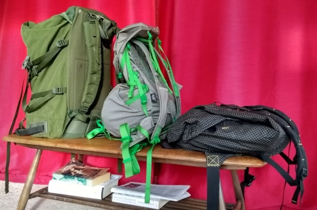
Consider (above) this line-up of suspects, arrayed left to right in increasing order of floppiness. In this photo each has an identical small cushion stuffed into its bottom, as if prepared for a spanking.
On the left my Berghaus Roc, a dear old friend, ca. 1999 and still going strong, veteran of two Pennine Ways and many other adventures. No frou-frou pockets or dangly dongles, tough as old boots, made from gnarly mil-spec nylon. This is the backpack to fling onto the roof of an Indian bus. I love it and still find it very comfortable. In this fully framed pack, internal metal struts make the back panel completely rigid. Hence, as you can see, it stands up by itself even when mostly empty. The elephant in the tent is that it’s heavy, by modern standards, and my knees aren’t what they used to be.
On the right, my new best friend, a vintage GoLite bought for £48 on eBay. Absurdly simple, literally just a sack with straps. Veteran of the Scottish National Trail and several other adventures. I love this pack too, I’ve walked over 800 miles with it carrying full camping gear and find it very comfortable. It’s utterly minimal and has no frame whatsoever, its only structural element is a skinny and completely flexible foam layer inside the back panel. I wish you could still buy these elemental, reliable and frankly rather stylish packs.
In the middle is the Montane Ultra Tour 40. As you can see it’s a third way pack, neither fish nor fowl. It’s called ‘frameless’ but they’ve hedged their bets by inserting a sheet of semi-rigid plastic, like glorified styrofoam, into the back panel. I bought the medium/large size, by the way, as despite being only 175 cm tall I have a torso length of 51 cm (I blame short legs for my inability to run).
Consider a fully-framed backpack (below). The length of the back panel, distance D, is fixed. It’s determined by the frame and cannot change, however you adjust the straps or load lifters.
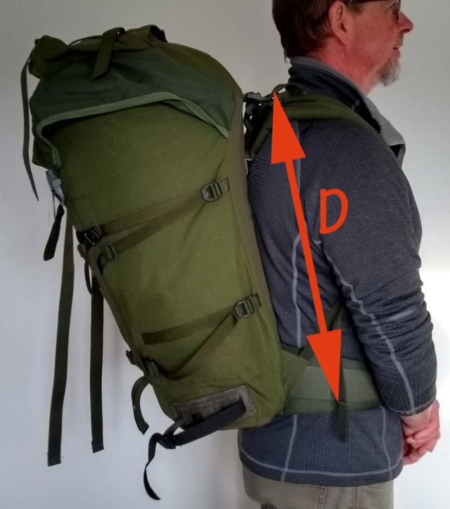
Consider the Montane Ultra Tour 40 (below). Lacking a rigid frame, its equivalent distance D is variable. For the pack to ride comfortably and behave predictably over long distances we must try to constrain distance D to a fixed length. The only way to do this with a frameless pack is by strategically packing then firmly compressing the contents. This compressing is what those green side straps are for.

Yes, I need to go on another hike, I’m having to hold my tummy in.
In the photo above, the contents are insufficiently compressed and both the shoulder straps and load lifters are too tight. You can see some of the problems that arise. When you tighten the shoulder straps, trying to stop your load from flopping about, distance D shortens. The back of the hipbelt is pulled up so it’s no longer effectively sharing load. Creases form at A, and an annoying fold at B. In passing, the load lifters are nowhere near as effective as on a framed pack. All they did when the pack was full was to pull the top of it forward into the back of my neck at C. I found this annoying rather than helpful.
So you can’t just sling your kit into a frameless pack willy-nilly and wander off hoping for the best. You’re supposed to pack intelligently and firmly, and impose structure on the thing. One popular suggestion is the ‘burrito method’, using a CCF sleeping mat to create a rigid internal cylinder. I found this method pretty hopeless.

10 mm CCF mat ‘burrito’ – hardly any room left for anything else!

5 mm CCF mat ‘burrito’.
Ten millimetre foam gave some structure but it’s far more hassle than you need on a wet, cold morning in the hills to get such a stiff mat to expand fully into the sack, and it also takes up far too much room in a 40 litre pack. It also ‘burrito’d’ my pack into such a curved cylinder that the pads were forced away from my shoulders, pressing the centre of the pack directly onto my vertebrae which soon became very uncomfortable.
A five millimetre mat leaves more room but isn’t rigid enough to impose worthwhile structure and anyway isn’t warm enough for three season camping in the British hills. In both cases it becomes impossible to pack optimally. Furthermore the bottom of the Ultra Tour 40 is not flat. Even when you force the CCF cylinder down as far as it will go against the outer panel, there is still a floppy section of the inner panel creasing against your lower back. And I don’t even like CCF mats.
Abandoning the burrito, you end up having to optimise two parameters simultaneously, which frankly is more mental effort than I need on a multi-week hike. One is the way your pack hangs. Rather than getting the hipbelt sitting just right, then adjusting the straps and lifters to match, as I was used to doing with a framed pack, I found you need to first allow the pack to hang freely from your shoulders, so its weight stretches the back panel fully. Only then do you tie the hipbelt at the level to which it has naturally fallen.
This is all very well but I found that to stretch the back panel of the Ultra Tour 40 fully, my hip belt was descending uncomfortably low. It ended up strapped around my pelvis, constraining my walking, rather than resting correctly just on top of it. This was despite my torso length being well within the design range for this size of pack, as confirmed by the outdoor shop I bought it from with a back measuring gauge. I might have been better off with the small/medium size instead of the medium/large, but if that’s actually the case then Montane’s size guide for these packs is unhelpful in a frameless context.
The other parameter is how your contents are stowed. You’re supposed to place long, stiff items against the back panel before compressing the whole caboodle very firmly. Again this is all very well, but I didn’t have any long stiff items (my tent uses my trekking poles). I tried putting my Thermarest in the water bladder pocket (I don’t use water bladders) but it made no difference. I stuffed and compressed the pack as hard as I could, but after three miles or so of walking it was always uncomfortable due to a sharp crease forming in the back panel.
After several miles this would start to draw blood from my back unless I sorted it out rapidly. On short trial hikes I’d improvised fixes, but fifteen miles from Kirk Yetholm on a southbound Pennine Way I was already looking in despair at outdoor websites that might possibly despatch a replacement pack to Alston hostel.
Luckily, I did find a way of improving matters. By ramming my rigid plastic first aid box hard down behind my other stuff, I found I could jam it within the pack at precisely the point of fold, easing the crease incompletely but adequately. Once I discovered this trick, the pack was tolerable, but never really comfortable, for the next 250 miles.

Two orange arrows show where the painful crease forms and, as you can see, remains. It gets much worse after a few miles. Blue dots are where the pack presses against my spine if ‘burrito’d’ into a cylinder with a 10 mm foam mat. Orange dots show a flexible joint in the back panel which compromises the function of the load lifters.
One might reasonably wonder whether this would equally be a problem with any frameless pack. I wondered that too and was very relieved when I subsequently had no such issues with my GoLite.
I found I could chuck my stuff into that completely unstructured backpack pretty much randomly. I hardly needed to pay any attention to packing distribution or compression, it was always comfortable. Somehow the clever design of the GoLite enables the weight of its contents, however incompetently stowed, to stretch the back panel nice and smooth, free from uncomfortable creases.
Unfortunately the same cannot be said of the Ultra Tour 40 and ultimately it seemed to me that the well-known disadvantages of completely frameless packs are actually made worse by the semi-rigid back panel fitted inside this one. Small creases do sometimes form in the GoLite but, as its back panel is completely flexible and memory-free, they soon release if you shuffle your stuff around. Montane’s back panel has memory and its crease quickly becomes permanent.
The creasing seems to me exacerbated by the orientation of the hipbelt. As you can see from the three photos below, in the Bergaus Roc and the GoLite the hipbelt is attached at only a little more than ninety degrees to the back panel. In the Ultra Tour 40 however the hipbelt hangs down at a much more obtuse angle, in fact it’s almost pointing at your knees when undone. When you pull the hipbelt up into a horizontal position to fasten it, this obviously forces the back panel of the rucksack to cinch and fold, making the crease at B worse.
It may be that I was using my Ultra Tour 40 wrongly, in which case I’d appreciate advice. Like most outdoor gear, it came with no meaningful instructions or indeed meaningful information of any kind. As usual, the swing tags were purely decorative, their wording just marketing hype equally useless in any of its several languages.
I must say this pack is a generous forty litres, I walked the Pennine Way with it carrying three season camping gear and was never limited for capacity. This was partly thanks to the three large external mesh pockets which are stretchy and cleverly designed to retain a lot of stuff. However they’re not hard-wearing; they quickly snag and tear on fences and their hem stitching soon frayed.
The Ultra Tour 40 may initially have a slight water sensitivity and perhaps need to choose from the water-free menu, but waterproof it is not, certainly not after ten days on the trail. Like all backpacks of my experience it’s incorrigibly hydrophilic; drybags are a must.
I couldn’t really work out what to keep in the floppy little shoulder pockets, they’re the wrong shape for a phone and too small for meaningful hydration. In the end my Sprayway hat lived in one of them. Mind you, I never really know what to do with hipbelt pockets either. These examples are not the slightest bit weatherproof and once they were filled with random bits and bobs which I then had no idea where to find, they jammed annoyingly in narrow kissing gates.
People say they like all these fancy pockets so they can access mission-critical accoutrements without taking their pack off. Personally I cannot understand this aversion to taking a rucksack off. If your backpack is difficult to put on and take off, it’s too heavy. I like nothing better than taking my rucksack off, in fact I fling mine off with glad abandon at any opportunity.
You’d think other reviews of the Montane Ultra Tour 40 might be available, but in fact they’re distinctly scarce.
Here an enthusiastic young man who works for some outdoor shop recites the exciting features you can see for yourself on the maker’s website. Don’t you love ‘reviews’ like that?
On UK Climbing somebody says “the back system does have the propensity to ‘ruck’ above the waist belt if not fully loaded; this doesn’t appear to cause my partner problems (though might for others).” Fair enough. Live for the Outdoors while trying to make an honest living selling you the thing does admit that “the level of comfort is below that of other packs, if you pack this badly or carry a heavy load, as there is no stiffening in the back, and the load does not transfer easily to the hips” Reasonable, although perhaps not explaining the problem.
I did manage an entire Pennine Way with the Ultra Tour 40, so I suppose I got value for money as it’s not expensive. But rather than a life-enhancing companion and helpmate, as a rucksack should be, it was an annoying extra worry.
The real point is that I’ve subsequently learnt how a well designed frameless pack carrying exactly the same gear over equally long distances can be no trouble at all. My older, simpler GoLite is, in comparison, a joy to carry and I won’t be using the Montane pack again.
WATERPROOF HIKING BOOTS – WHY I JUST SAY ‘NO’.
I’m no outdoors expert but I do have a few miles under my feet in the British hills. Over those miles I’ve acquired a buzzy and eccentric-sounding bee in my bonnet about ‘waterproof’ hiking footwear, and a strong preference for trail shoes over boots. For a multi-week hike over more or less continuously wet terrain, counter-intuitively, I’ve come to regard heavy, ‘waterproof’ footwear as a waste of money and even counterproductive.
If your outdoor activity is more in the way of scuttling up dryish, rocky, high hills at the weekend, or running, or scrambling or winter mountaineering you won’t find these reflections useful. If you’re a fellow long-haul bog-plodder I’ll be interested to know whether you share my damply and stinkily acquired prejudice.
Observation one: on a long distance trail, your problems come more from inside your footwear than from outside.
In my opinion ventilation, hygiene and freedom from blisters are more important than either waterproofing or ankle support. By the way I walk with poles, if you don’t use these ankle support may be more important.
I’ve personally found that on a multi-week hike, my footwear can be astonishingly minimal as long as the insoles give enough arch support and shock absorption and I carry waterproof socks for cold conditions.
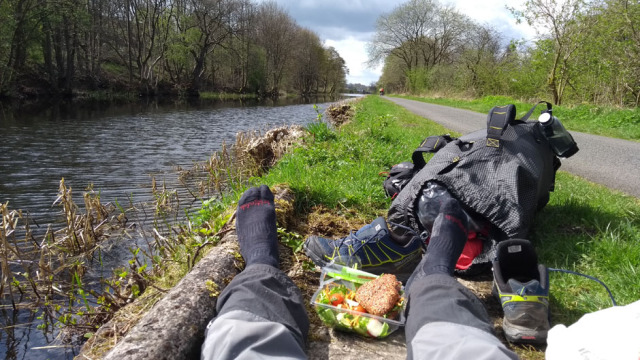
Note the emphasis on ‘multi-week’ and ‘long distance’. In my experience the different needs of trail walkers compared to weekend walkers only start to really become apparent in the second week of continuous hiking. Not to mention the second half-century of age.
Observation two: on a multi-week hike, ‘waterproof’ footwear doesn’t stay ‘waterproof’.
I’m the first to admit that this is a small sample, but I’ve now walked three Pennine Ways in mid-price Gore-tex lined footwear: Karrimor KSB hybrid boots, Scarpa Ranger leather boots and Salomon X-Ultra* trail shoes. On all three of these hikes my footwear started to leak at around day nine, and all three times in exactly the same place – at the flex zone between the toe and the laces.
One thing this tells us is that most people who buy ‘waterproof’ hiking footwear will get four weekends of perfectly happy use out of it, and let’s face it that’s probably as much total use as many hiking boots get. A weekend hike with dry feet must be quite a pleasant experience, I really must try it sometime.
I found, by the way, that no amount of externally applied ‘waterproofer’ could subsequently fix this leakage once the membrane had broken down, certainly not under the pressure of further continuous hiking in soaking wet conditions.
You’ll have twigged by now that I’ve taken to wearing non-waterproof shoes in which – gulp – my feet can potentially get wet all the time, actually wet and from day one. Surely, you might reasonably ask, eight days of dry feet at the start of a trail is better than zero days of dry feet? I asked that too.
Observation three: once it gets wet, ‘waterproof’ footwear doesn’t ‘breathe’.
Even in those initial eight days your feet are not dry. They are stewing, rubbing, wrinkling and festering in their own sweat, because whatever membrane manufacturers may claim, I’ve concluded that in the British hills ‘breathable’ waterproof footwear is a myth.
By day 15 on the Pennine Way these Scarpa Ranger boots were completely, permanently soaked. If you pressed a finger into the leather, water oozed out. Their membrane can’t ‘breathe’ through their permanently soaked leather as there’s no moisture differential across it. Inside them trench foot was developing nicely, and itching maddeningly
A membrane will breathe if there’s a moisture differential across it, preferably also a temperature difference across it, and a flow of air over the outside. Clearly, breathable shell jackets and overtrousers often (though not always) comply with at least one of these conditions, hence they’re not a myth, they’re awesomely brilliant and have certainly transformed my hillwalking.
If you’re plodding through bogs all day and for multiple weeks, the outside of your footwear quite soon becomes permanently soaking wet. The airflow across your feet is negligible as they’re down in the boggy vegetation.
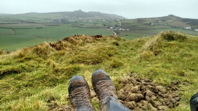
Even the most technical membrane cannot breathe when it’s completely covered in wet poo…
The above laws of breathability tell us that in such conditions ‘breathing’ of said footwear cannot occur. All the membrane is then doing is keeping your feet confined in their own stinky old sweat, rather than allowing them to interact dynamically with the wet environment.
The situation gets worse once the leaks start, at around day nine on the trail. Bog water enters the boot from small points of membrane failure, wicks throughout your sock and can’t get out.
Your feet are now sitting all day wrinkly-stinkly in a static cocktail of sweat and bog gunk. Nice fresh water from puddles and streams can’t flush this horridness out, because apart from the points of failure at the flex zone, most of your boot is still waterproof.
In the first few days the net effect of all this is to make the small blisters you inevitably pick up at the start of a hike bigger and squidgier, more prone to infection and slower to heal. Subsequently the skin of your feet starts to rot, the itching driving you crazy.
Even if you encounter a dry stretch of the trail and/or a sunny day, your feet will take ages to dry because even the most ‘breathable’ waterproof membrane sheds water vapour much more slowly than simple permeable mesh or fabric, especially if it’s encased in soaking wet leather.
Whereas, give my non-waterproof mesh shoes a couple of hours of skipping along in sunshine and a nice breeze and they’re virtually dry. In contrast, once my membrane-lined leather boots are wet, that’s it, they stay wet for the rest of the trail. Unless, that is, I’m lucky enough to be able to shrink and crack them overnight in a drying room, and that’s another can of worms.

Thirty-five days’ hiking in permeable mesh shoes, and my feet are completely free from either blisters or trench foot. They didn’t even smell! When I walked the Pennine Way in ‘waterproof’ footwear they stank.
South of the British Isles and ironically in generally drier conditions breathable ‘waterproof’ hiking footwear could make more sense. If trails are mostly dry underfoot and your feet are getting wet only intermittently, say from morning vegetation or sudden rainstorms, their materials might well work as intended, until their ninth day on the trail anyway. However, if trails are mostly dry, why bother? What’s the big deal about intermittently wet feet?
Well, the deal gets big if and when wet feet are accompanied by low temperatures. If your feet are wet while hiking through slush or snow or in a hard morning frost, you potentially have a problem. Walking the Pennine Way in early April and in leaky ‘waterproof’ boots, I did experience a teeny weeny touch of frostbite (although my ears copped it worse).
For this reason I now carry Sealskinz waterproof socks in case my wet feet get too cold in my non-waterproof trail shoes. On the Scottish National Trail in April/May I needed these only about one day in six, even though I was on occasions walking through snowstorms and several nights had ice in my tent.
There’s another way to look at this issue. Suppose you really can’t get used to nasty old fresh water entering your footwear from outside and despite my wittering on here you still prefer your tootsies to stew all day in nothing but their nice, warm, claggy sweat. Here’s a simple calculation comparing costs of going ‘waterproof’, simple being the only kind I can manage.
Say a pair of mid-price Gore-tex lined boots costs £160 and they stay reliably waterproof for eight days of rough, boggy hill walking, as per my real world experience on the Pennine Way. That’s twenty quid a day for stinky, sweaty feet and no say in the matter. Probably blisters too.
My Salomon X-Ultra Prime non-waterproof shoes cost seventy quid and lasted me seven hundred miles of rough hill walking. Say 17.5 miles a day, 40 days, that’s £1.75 a day. Sealskinz cost £20 – £25, so even if they only lasted eight days like the boots that’s about three quid a day. Call it a fiver a day in total for continuously waterproof footwear, as opposed to twenty.
In fact I’ve carried my present Sealskinz in my pack, only intermittently needing to wear them, for about eight weeks of hiking and they’re still fine. So in reality I’ve had the ability flexibly to waterproof my feet as and when needed on the trail for about 50p a trail day, hence arguably a real cost to date of £2.25 a day and still decreasing.
I’ve only really discussed the ‘waterproofing’ issue, because my take on this seems to surprise people. Lots of other people more knowledgeable than me have discussed boots versus shoes. All I can really add is that I’ve personally come to like minimal footwear and to consider ankle support something of a myth. I would stick to boots if you’ve a tendency to turn your ankles, especially if you don’t like walking with poles. If in shoes, take care on the first few days of your hike as it takes a while for ankles to strengthen.
I’ve never had any trouble with my ankles, touch wood, apart from badly turning one near the top of Snowdon on Boxing Day 1977 (I limped back down to the car park but then couldn’t drive and had to sleep in the back of my Triumph Herald, it was perishing). This happened while I was wearing extremely stiff old school Hawkins leather boots, with steel shanks in the soles. The Great Stone Chute in the Cuillins wore all the stitching off the back – Hawkins just re-stitched them, those were the days. They were stolen from my allotment twenty-five years later and for all I know could still be going strong.
Getting on a bit, I have had problems with knees, metatarsals and shin splints. Hence I’m personally more interested in shock absorption than ankle support and in fact I routinely replace all insoles, however fancy, with Sorbothane Double Strikes. I also find that having less weight on the ends of my feet transforms my oldie stamina. I’m convinced by the oldie adage that a pound on your foot equals multiple pounds in your pack.
One thing I have noticed with shoes as opposed to boots is poorer grip. Obviously this could be a very serious problem if your hike involves exposed scrambling. Transitioning from Scarpa boots to Salomon shoes I had to modify my gait on rocky descents to adapt to their different distribution of grip.
Salomon shoes have virtually no grip at the back of the heel, and what they do have wears quickly. *Update 2019 – this looks to be vastly improved on their latest model.
Incidentally, if you are wearing shoes rather than boots paying extra for the shoes to be ‘waterproof’ is even more nonsensical, because as soon as you step into a bog the water pours into them over their tops.

I find gaiters fiddly and noisy, and I’ve never come across any that prevented water rising into them from below, although for all I know they may be available at a crazy price. I was a big fan of gaiters when I used to hike in polycotton trousers that were quite chilly when wet. Now I have Haglöfs synthetic trousers that dry in a wink in the slightest breeze and on my last Pennine Way my gaiters were just redundant pack weight.
Still, your body and your needs may be different from mine and many readers’ experience will also be more extensive. Otherwise I hope you find my limited, personal experience interesting.
*these are ‘waterproof’, as opposed to the permeable Salomon X-Ultra Primes I use now. The Salomon website is an impenetrable labyrinth of despair, so there may be other options I haven’t had a spare lifetime to find out about.
POLES APART – ALPKIT CARBONLITE TREKKING POLES.
If you’re a day hiker put off poles because they seem heavy and awkward, give these skinny things a try. I found them insufficiently robust for multi-week trekking with a full pack on rough trails but, considering their weight (136g each) and price (£49 a pair, February 2017) that shouldn’t really have been a surprise. If you’re hiking 10-15 days annually with a light pack these poles should last you at least a year and I think you’d enjoy using them, as I did before I destroyed them.
The main things I look for in trekking poles are light weight, minimal simplicity, reliable locking and a feeling of robustness. Buying online, the only option with Alpkit, I could judge the first two but not the last. I couldn’t find reviews that gave me a sense of the durability of these elegantly conceived, attractive and very light poles. I hope the following helps.
I’ve never been a great one for rubber tips, but when these poles arrived with optional push-on silencers I thought I’d give them a try. They split and fell off. As soon as I pushed any weight down onto the pole the rubber opened out axially along obvious fault lines in the material. Not a promising start. I emailed Alpkit a photo of the split tips and with no quibbling they sent free replacements. These split too. Great. Alpkit say “there was a batch last year which had issues with the rubber feet so we sent out replacements to anyone that was affected – including yourself. I am very sorry that the replacement feet also failed”. To be fair I wasn’t ever going to use the silly rubber feet anyway, I just lose them. Into the bin they went, originals and replacements.
I’ve never been a great one for silly baskets, but at least these poles come with sensible small ‘trekking baskets’, as opposed to the vast snow baskets other manufacturers supply by default to walkers whose poles lean safely in the cupboard between November and March. I duly gave these baskets a try along The Way and found they caught constantly and infuriatingly in vegetation. Not only that, when my legs got tired I started to trip over them, risking pole breakage.
People say ‘ but if I don’t have baskets my poles will sink into bogs’ Erm, actually that’s a major benefit of poles in bogs, to be able to probe the depth of the mud immediately ahead. How can you probe the depth of the bog if you’ve got a basket on your pole that stops the pole going into the bog? Ridiculous. Cunningly though, with these poles you’re supposed to be able to screw the baskets on and off according to when you need them.
Unfortunately after a couple of weeks on the Pennine Way the threads were so worn that screwing the baskets on became impossible. And of course everyone loves having filthy muddy baskets and filthy muddy rubber tips knocking around in the depths of their pack, or the pocket of their soaking wet shell jacket. Yeah, right. Pish and fie to the silly baskets, I say. If you’re a desperate basket case mine went into the bin at Alston petrol station, although admittedly that was last October.
The next problem I found with these poles was that the stitching on the straps had been hot-melted to prevent fraying. This is a good idea in principle and showed attention to detail. Unfortunately heat-sealing the fabric edges had created rough and quite sharp ridges of solid plastic at the tops of the padding where the straps narrowed. These pressed into my hands. I had to abrade the straps on rocks to smooth off the sharp ridges of melted fabric.

I’ve smoothed these strap edges by rubbing them on rocks but as supplied they were surprisingly sharp.
On morning four of my second Pennine Way I felt a stinging sensation in the palm of my right hand when I picked up the newer of my two poles, whose strap I’d forgotten thus to abrade, distracted by other pains. The sharp edge of the strap had actually cut a small but open and quite sore wound into my soft little hand – ouch! I should have anticipated this earlier and it was easily fixed, but really…
So, after initial niggles, what were the Alpkit Carbonlite Ultra poles like to walk with? They were a total delight. Featherlight at just 140-odd grams each they were nicely balanced, swung freely and could be placed with fingertips. For their weight and within reason they felt secure and rugged. I’m a clumsy walker and over six weeks of trekking I arrested numerous minor balance issues on steep gradients with these poles. At no time did I feel vulnerable, although I certainly wouldn’t want to take a direct horizontal fall onto one of these skinny things, carbon poles being strong in compression but less so, I suspect, in shear.
The straps adjusted freely but locked off securely. The handles were comfortable and didn’t seem to gather dirt, get slippery or acquire an odd smell, unlike me. Like me, though, their tops wore a little bald; you could feel and even start to see the tubing after a couple of weeks. I know you’re not supposed to press down on the tops, but when you’re tired on a long descent sometimes you need that change of hand position.I routinely adjust pole lengths according to whether I’m ascending or descending; I found the twist-lock system was easy, reliable and didn’t jam.
The ‘tungsten carbide’ tips wore down with astonishing speed and are not replaceable. Either a Chinese factory database has translated ‘tungsten’ as ‘dung-strength’, or Alpkit inadvertently specified their tungsten from the periodic table of some parallel, squidgier universe.I did my first Pennine Way in 1999 with Italian alloy poles that were each heavy enough to club a sheep; at Kirk Yetholm their tips had looked virtually identical to their initial appearance at Edale. Ah well, tips apart, things were all good on planet Carbonlite. For about two weeks…
Suddenly and apropos nothing, on Day 16 in the middle of Wark Forest, the bottom section dropped out of one of my poles. ‘Goodness me’, I said, or words to that effect. The internal metal shaft had sheared clean off, leaving the pole broken beyond repair other than with circlip pliers and spare parts which, oddly enough, I didn’t seem to have about my person. ‘Bless my soul’, I said, or words to that effect. Squatting disconsolately in a bog, I dashed off a stern e-mail to Alpkit HQ with this very picture attached (below).How did they feel, I enquired, about the fact that thanks to their duff kit I was now faced with traversing The Cheviot massif on a bad knee with only one pole?
A sweet young lady whose only experience of ‘outdoors’ is probably the kerb between cab and club, bless her, replied that they’d be pleased to invoke their warranty procedure, to initiate which would I please print out a free return label and mail them the allegedly defective pole for inspection. I received this instruction late at night in a Northumberland bunk barn, once I’d retrieved the WiFi code from where Swiss Gianni had playfully hidden it under his sleeping bag. You had to be there.
Suppose, I enquired acidly and via one bar of battery in reply, I was pedalling across Patagonia, say, on one of their bikes and the frame cracked beyond repair? I’d have to yomp hundreds of miles with a busted bike on my shoulders, then ship it back to Nottingham so they could look at it and say ‘oh dear, what a pity, how sad’. ‘I’ve cut the handle off my toothbrush to save pack weight’, I pointed out, realising as I did so the eccentricity, albeit truthfulness, of this claim, ‘and you want me to lug 136 grams of irreparably broken trekking pole pointlessly over The Cheviot?’ This exchange was not completed until I arrived at Byrness, the last point to which a replacement could have been sent.
Fair play to Alpkit, it subsequently turned out that they would in fact have been prepared to courier free of charge a replacement pole to Byrness hostel, had I been more forceful initially and not stupidly assumed, submerged in my own adventure, that their young support operative would have heard of the Pennine Way and hence have some idea of my situation. This kind offer was made too late but that was no fault of theirs; the offer was made and I appreciate it. In my experience Alpkit do care about people who are stuck outdoors with dodgy gear and will help you out if you’ve got the sense to communicate clearly that help is needed.

When I got home I found that on the strength of my photo they’d in fact kindly sent me a free replacement pole without my returning the bust one. So a few months later I set off once again along the Pennine Way, armed with one new and one slightly used pole. I was not untroubled about their reliability but apart from the cut hand, noted above, all went well. I’d cautiously conclude that the internal failure was a one-off.
However after a couple of weeks the lower section of one of the poles became very wobbly, due to wear of the carbon shaft. Presumably the older one, although I’d no way of telling as they both looked equally tired by this point. Then, not long after my return to Norfolk, on a routine stroll the lower section of the other pole started to slip, the classic failure mode for internal twist-lock poles.
Finally, I sent all three of the Carbonlite Ultra Trekking Poles I’d managed to ruin in just a few weeks’ use back to Alpkit. There was no charge for this, you just have to print out a returns form and a free postage label from their website. Having examined the sad specimens returned to them, Alpkit kindly offered either yet another free replacement set or a full refund of my original purchase price and with a commendable lack of quibbling. Shamelessly, I took the money, so I’d unintentionally but effectively walked most of two Pennine Ways on free poles. Sorry Alpkit, and thanks for being so decent.
What can we conclude from this tale of woe?
Perhaps surprisingly, I recommend Alpkit Carbonlite Ultra Trekking Poles if bought with open eyes and realistic expectations. Until they fall apart, they’re just so nice to use. I’d recommend them without hesitation for weekend hillwalks on non-technical trails. Even more so if you’re blessed with sufficient income for the reasonable price to mean you can afford to replace them routinely (although that’s not a very green approach to gear buying). I recommend them because Alpkit is run by nice people who stand by their stuff, and their ‘Alpine Bond’ is for real. These poles are supremely light, perfectly designed, elegant in appearance and optimal in feature set. They’re only let down by a slight durability deficit and for the weight and the price perhaps that shouldn’t be such an enormous surprise.
I hope Alpkit consider this a fair review as they’ve been more than fair with me and I’d buy gear from them again with confidence. If you’re hiking for anything up to a couple of weeks these super-skinny trekking poles will quickly become companions as beloved as a pair of whippets. Just bear in mind you’ll be saying goodbye to them sooner than you would to Great Danes.
My own requirement is more demanding and I’m a bit of a hair-shirter when it comes to consumerism; I’d rather buy more durable gear even if it’s slightly less pleasant to use. I’ve upgraded to Black Diamond Trails. These are heavier, more expensive alloy poles with field-adjustable external cam-locks and replaceable carbide tips; so far they’re giving me a bit more confidence. We’ll see. Given my history of gear buying they could be another disaster. Watch this space…
Contact
Call the Oldiephone…
It would be great to hear from you. I don’t think anything weird will happen if you get in touch, and I’ve no idea how to use your contact details for anything else, even if I wanted to. You can find me on Twitter @OldieOutdoors and I occasionally even Instagram as, unsurprisingly, @oldieoutdoors